Suttontown, North Carolina | |
|---|---|
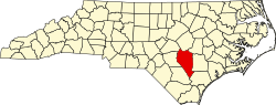
 Suttontown Location of Suttontown in North Carolina  Suttontown Suttontown (the United States) | |
| Coordinates: 35°12′13″N78°14′26″W / 35.20361°N 78.24056°W | |
| Country | |
| State | North Carolina |
| County | Sampson |
| Elevation | 52 m (171 ft) |
| Time zone | UTC-5 (Eastern (EST)) |
| • Summer (DST) | UTC-4 (EDT) |
| ZIP code | 28341 |
| Area codes | 910, 472 |
| GNIS feature ID | 995733 [1] |
Suttontown is an unincorporated community in Sampson County, North Carolina, United States.
The Marshall Kornegay House and Cemetery was added to the National Register of Historic Places in 1986. [2]