This article needs additional citations for verification .(June 2025) |
Taliparamba West | |
|---|---|
suburb | |
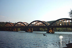 The historic Kuppam Bridge | |
 | |
| Coordinates: 12°02′59″N75°20′51″E / 12.049687°N 75.347414°E | |
| Country | |
| State | Kerala |
| District | Kannur |
| Languages | |
| • Official | Malayalam, English |
| Time zone | UTC+5:30 (IST) |
| ISO 3166 code | IN-KL |
| Vehicle registration | KL-59 |
| Nearest city | Taliparamba |
| Lok Sabha constituency | Kasargode |
Taliparamba West is a group of suburbs and villages on the north and west of Taliparamba town, Kerala state, India. [1]
Contents
The locality is divided into two parts, south and north; South Kuppam is a part of Taliparamba municipality while North Kuppam, near Mukkunnu, is a part of Pariyaram village Panchayath.
During the 1960s and 1970s this village was a commercial center of spices. The National Highway-17 passes through Kuppam.
A Gothic style St. Mary's Forane Church is located at Taliparamba within 22 kilometers off Kannur district. The artistic church, along with the 25-feet long Mother Mary painting, is one of the tourist attractions in the area. [2]


