Related Research Articles

Clump Mountain is a national park in Queensland, Australia, 1287 km northwest of Brisbane. It is part of the Coastal Wet Tropics Important Bird Area, identified as such by BirdLife International because of its importance for the conservation of lowland tropical rainforest birds. Here is an important habitat of the endangered southern cassowary, a large flightless bird, which has been recorded only in the tropical rainforests of Queensland and New Guinea.
Edmund Kennedy is a national park in Queensland, Australia, 1269 km northwest of Brisbane. The national park is part of the Wet Tropics World Heritage Area. It was named after Edmund Kennedy, a mid-nineteenth century explorer.

Ella Bay is a national park beside Ella Bay and spans the localities of Wanjuru in the Cassowary Coast Region and Eubenangee in the Cairns Region, Queensland, Australia.

Eubenangee Swamp is a national park in Eubenangee in the Cairns Region, Queensland, Australia, 1332 km northwest of Brisbane. It is part of the Coastal Wet Tropics Important Bird Area, identified as such by BirdLife International because of its importance for the conservation of lowland tropical rainforest birds. It plays home to over 190 species of birds.
Grey Peaks is a national park in Far North Queensland, Australia, 1,374 km northwest of Brisbane. It is part of the Coastal Wet Tropics Important Bird Area, identified as such by BirdLife International because of its importance for the conservation of lowland tropical rainforest birds.
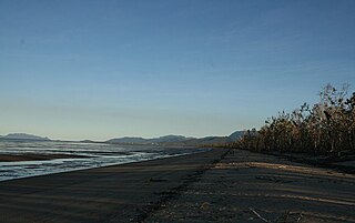
Hull River is a national park in Queensland (Australia), 1275 km northwest of Brisbane. GIS mapping data from Queensland Department of Natural Resources (2002) showed an area of 3,240 hectares, of which about 2,100 hectares are estuarine mangroves, with the remainder being swamp forests dominated by Melaleuca and specialist Eucalypt species. Rainfall averages 3,600 mm per year. The park is part of the Coastal Wet Tropics Important Bird Area, identified as such by BirdLife International because of its importance for the conservation of lowland tropical rainforest birds.

Kurrimine Beach is a national park in Queensland, Australia, which lies 1,295 km northwest of Brisbane. It is part of the Coastal Wet Tropics Important Bird Area, identified as such by BirdLife International because of its importance for the conservation of lowland tropical rainforest birds.

Girringun National Park is a national park in Queensland, Australia, approximately 50 kilometres (31 mi) southwest of Ingham, 110 kilometres (68 mi) north of Townsville and 1,290 kilometres (800 mi) northwest of Brisbane. The park is one of the Wet Tropics World Heritage Area series of national parks, and is a gazetted World Heritage Site.
Maria Creek is a national park in Far North Queensland, Australia, 1292 km northwest of Brisbane. It is part of the Coastal Wet Tropics Important Bird Area, identified as such by BirdLife International because of its importance for the conservation of lowland tropical rainforest birds.
Moresby Range is a national park in Far North Queensland, Australia, 1,314 km northwest of Brisbane. It is part of the Coastal Wet Tropics Important Bird Area, identified as such by BirdLife International because of its importance for the conservation of lowland tropical rainforest birds.

Mowbray is a national park in Queensland, Australia, 1441 km northwest of Brisbane. The park forms part of the Wooroonooran Important Bird Area, identified as such by BirdLife International because it supports populations of a range of bird species endemic to Queensland's Wet Tropics.
Russell River is a national park in North Queensland, Australia, 1352 km northwest of Brisbane. The park protects a coastal strip between the sea and the Russell River. It is part of the Coastal Wet Tropics Important Bird Area, identified as such by BirdLife International because of its importance for the conservation of lowland tropical rainforest birds.
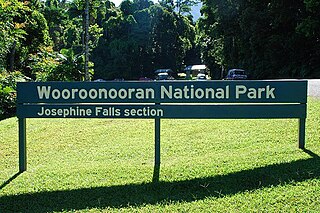
Wooroonooran National Park is a national park in Queensland, Australia, 1,367 km northwest of Brisbane, between Innisfail and Cairns.

Mission Beach is a coastal town and locality in the Cassowary Coast Region, Queensland, Australia. In the 2016 census, the locality of Mission Beach had a population of 815 people.

The Daintree Rainforest is a region on the northeast coast of Queensland, Australia, north of Mossman and Cairns. At around 1,200 square kilometres (460 sq mi), the Daintree is a part of the largest continuous area of tropical rainforest on the Australian continent. The Daintree Rainforest is a part of the Wet Tropics of Queensland Rainforest, that spans across the Cairns Region. The Wet Tropics Rainforest is the oldest continually surviving tropical rainforest in the world. Along the coastline north of the Daintree River, tropical forest grows right down to the edge of the sea.

The Bellenden Ker Range, also known as the Wooroonooran Range is a coastal mountain range in Far North Queensland, Australia. Part of the Great Dividing Range it is located between Gordonvale and Babinda.

The Paluma Important Bird Area consists of the southernmost section of the Wet Tropics World Heritage Site of north Queensland, Australia.

The Coastal Wet Tropics Important Bird Area comprises a disjunct 521 km2 stretch of coastal and subcoastal land in tropical Far North Queensland, Australia. It extends from just south of Cairns in the north for about 150 km to Cardwell in the south. It is important for the conservation of lowland rainforest birds, especially southern cassowaries.

South Mission Beach is a coastal town and locality in the Cassowary Coast Region, Queensland, Australia. In the 2016 census, South Mission Beach had a population of 932 people.
Tam O'Shanter is a locality in the Cassowary Coast Region, Queensland, Australia. In the 2016 census, Tam O'Shanter had a population of 0 people.
References
- 1 2 "Tam O'Shanter Point (entry 33218)". Queensland Place Names. Queensland Government . Retrieved 28 August 2015.
- ↑ BirdLife International. (2011). Important Bird Areas factsheet: Coastal Wet Tropics. Downloaded from "BirdLife International - conserving the world's birds". Archived from the original on 10 July 2007. Retrieved 10 July 2007. on 2011-12-16.
- ↑ Lloyd's Register (1848), Seq.№T13.
Coordinates: 17°58′S146°6′E / 17.967°S 146.100°E
| | This Queensland location article is a stub. You can help Wikipedia by expanding it. |