
Captain James Cook was a British explorer, cartographer and naval officer famous for his three voyages between 1768 and 1779 in the Pacific Ocean and to New Zealand and Australia in particular. He made detailed maps of Newfoundland prior to making three voyages to the Pacific, during which he achieved the first recorded European contact with the eastern coastline of Australia and the Hawaiian Islands and the first recorded circumnavigation of New Zealand.

HMS Endeavour was a British Royal Navy research vessel that Lieutenant James Cook commanded to Tahiti, New Zealand and Australia on his first voyage of discovery from 1768 to 1771.

The Torres Strait, also known as Zenadh Kes, is a strait between Australia and the Melanesian island of New Guinea. It is 150 km (93 mi) wide at its narrowest extent. To the south is Cape York Peninsula, the northernmost extremity of the Australian mainland. To the north is the Western Province of Papua New Guinea. It is named after the Spanish navigator Luís Vaz de Torres, who sailed through the strait in 1606.

The Guugu Yimithirr, also spelt Gugu Yimithirr and also known as Kokoimudji, are an Aboriginal Australian people of Far North Queensland, many of whom today live at Hopevale, which is the administrative centre of Hopevale Shire. At the 2011 census, Hopevale had a population of 1,005 people. It is about 46 kilometres (29 mi) from Cooktown by road. It is also the name of their language. They were both a coastal and inland people, the former clans referring to themselves as a "saltwater people".

Hinchinbrook Island is an island in the Cassowary Coast Region, Queensland, Australia. It lies east of Cardwell and north of Lucinda, separated from the north-eastern coast of Queensland by the narrow Hinchinbrook Channel. Hinchinbrook Island is part of the Great Barrier Reef Marine Park and wholly protected within the Hinchinbrook Island National Park, except for a small and abandoned resort. It is the largest island on the Great Barrier Reef. It is also the largest island national park in Australia.
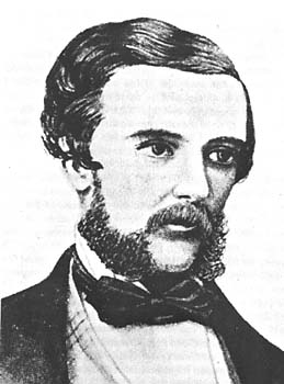
Edmund Besley Court Kennedy J. P. was an explorer in Australia in the mid nineteenth century. He was the Assistant-Surveyor of New South Wales, working with Sir Thomas Mitchell. Kennedy explored the interior of Queensland and northern New South Wales, including the Thomson River, the Barcoo River, Cooper Creek, and Cape York Peninsula. He died in December 1848 after being speared by Aboriginal Australians in far north Queensland near Cape York.

Botany Bay is an open oceanic embayment, located in Sydney, New South Wales, Australia, 13 km (8 mi) south of the Sydney central business district. Its source is the confluence of the Georges River at Taren Point and San Souci as well as the Cooks River at Kyeemagh, which flows 10 km (6 mi) to the east before meeting its mouth at the Tasman Sea, midpoint between the suburbs of La Perouse and Kurnell. The northern headland of the entrance to the bay from the Tasman Sea is Cape Banks, and, on the southern side, the outer headland is Cape Solander, and the inner headland is Sutherland Point.

Point Danger is a headland, located at Coolangatta on the southern end of the Gold Coast on the east coast of Australia. Separated by Snapper Rocks and Rainbow Bay to the west, with Duranbah Beach and the Tweed River mouth to the south, present-day Point Danger has also indicated the border between New South Wales and Queensland, Australia, since 1863.

Lockhart River is a town in the Aboriginal Shire of Lockhart River and a coastal locality split between the Aboriginal Shire of Lockhart River and the Shire of Cook, on the Cape York Peninsula in Queensland, Australia. The town is an Aboriginal community. From 1924 to 1967, the Lockhart River Mission was run by the Anglican Church. In the 2021 census, the locality of Lockhart River had a population of 640 people.

The first voyage of James Cook was a combined Royal Navy and Royal Society expedition to the south Pacific Ocean aboard HMS Endeavour, from 1768 to 1771. It was the first of three Pacific voyages of which James Cook was the commander. The aims of this first expedition were to observe the 1769 transit of Venus across the Sun, and to seek evidence of the postulated Terra Australis Incognita or "undiscovered southern land".

Broughton Island is an island 14 km north-east of Port Stephens on the Mid North Coast of New South Wales, Australia. It is part of the Myall Lakes National Park.(map)
Cape Grafton is a cape located to the north-east of Cairns in Queensland, Australia. The cape was named by Lieutenant James Cook during his first voyage of discovery in 1770. It was named after Augustus FitzRoy, 3rd Duke of Grafton, the British prime minister when Cook sailed. Cook set anchor two miles from the shore and briefly inspected the cape with botanists Joseph Banks and Daniel Solander.

Jackey Jackey, Aboriginal name Galmahra, was the Aboriginal Australian guide and companion to surveyor Edmund Kennedy. He survived Kennedy's fatal 1848 expedition into Cape York Peninsula and was subsequently formally recognized for heroic deeds by the Colony of New South Wales in words engraved on a solid silver breastplate or gorget, which read as follows:
Presented by His Excellency Sir Charles Augustus FitzRoy K.D. Governor of New South Wales, to Jackey Jackey, an Aboriginal native of that colony. In testimony of the fidelity with which he followed the late Assistant Surveyor E.B.C. Kennedy, throughout the exploration of York Peninsula in the year 1848; the noble daring with which he supported that lamented gentleman, when mortally wounded by the Natives of Escape River, the courage with which after having affectionately tended the last moments of his Master, he made his way through hostile Tribes and an unknown Country, to Cape York; and finally the unexampled sagacity with which he conducted the succour that there awaited the Expedition to the rescue of the other survivors of it, who had been left at Shelbourne Bay.

Sandy Cape is the most northern point on Fraser Island off the coast of Queensland, Australia. The place was named Sandy Cape for its appearance by James Cook during his 1770 voyage up the eastern coast of Australia aboard the Endeavour.

The second voyage of James Cook, from 1772 to 1775, commissioned by the British government with advice from the Royal Society, was designed to circumnavigate the globe as far south as possible to finally determine whether there was any great southern landmass, or Terra Australis. On his first voyage, Cook had demonstrated by circumnavigating New Zealand that it was not attached to a larger landmass to the south, and he charted almost the entire eastern coastline of Australia, yet Terra Australis was believed to lie further south. Alexander Dalrymple and others of the Royal Society still believed that this massive southern continent should exist. After a delay brought about by the botanist Joseph Banks' unreasonable demands, the ships Resolution and Adventure were fitted for the voyage and set sail for the Antarctic in July 1772.

George Augustus Frederick Elphinstone Dalrymple was a colonist, explorer, public servant and politician, member of the Legislative Assembly of Queensland. He founded the towns of Bowen and Cardwell, and pioneered the opening up of the Herbert, Burdekin, Johnstone and Daintree River regions to British colonisation. During this time he was responsible for many killings of Aboriginal people who lived in the area.
Weymouth Bay is a bay in North Queensland, Australia.

The European exploration of Australia first began in February 1606, when Dutch navigator Willem Janszoon landed in Cape York Peninsula and on October that year when Spanish explorer Luís Vaz de Torres sailed through, and navigated, Torres Strait islands. Twenty-nine other Dutch navigators explored the western and southern coasts in the 17th century, and dubbed the continent New Holland. Most of the explorers of this period concluded that the apparent lack of water and fertile soil made the region unsuitable for colonisation.
Rockingham is a rural town and coastal locality in the Cassowary Coast Region, Queensland, Australia. In the 2021 census, the locality of Rockingham had a population of 104 people.
Tully Heads is a coastal town and locality in the Cassowary Coast Region, Queensland, Australia. In the 2021 census, the locality of Tully Heads had a population of 354 people.


