
Cairns is a city in Queensland, Australia, on the tropical north east coast of Far North Queensland. In the 2021 census, Cairns had a population of 153,181 people.

Cape York Peninsula is a peninsula located in Far North Queensland, Australia. It is the largest wilderness in northern Australia. The land is mostly flat and about half of the area is used for grazing cattle. The relatively undisturbed eucalyptus-wooded savannahs, tropical rainforests and other types of habitat are now recognised and preserved for their global environmental significance. Although much of the peninsula remains pristine, with a diverse repertoire of endemic flora and fauna, some of its wildlife may be threatened by industry and overgrazing as well as introduced species and weeds.

Weipa is a coastal mining town in the local government area of Weipa Town in Queensland. It is one of the largest towns on the Cape York Peninsula. It exists because of the enormous bauxite deposits along the coast. The Port of Weipa is mainly involved in exports of bauxite. There are also shipments of live cattle from the port.
Hope Vale is a town within the Aboriginal Shire of Hope Vale and a coastal locality split between the Aboriginal Shire of Hope Vale and the Shire of Cook, both in Queensland, Australia. It is an Aboriginal community. In the 2016 census, the locality of Hope Vale had a population of 1,015 people.

Coen is a rural town and coastal locality in the Shire of Cook, Queensland, Australia. The town of Coen is inland on the Peninsula Developmental Road, the main road on the Cape York Peninsula in far northern Queensland. In the 2021 census, the locality of Coen had a population of 320.
Yarrabah is a coastal town and locality in the Aboriginal Shire of Yarrabah, Queensland, Australia. It is an Aboriginal community. In the 2021 census, the locality of Yarrabah had a population of 2,505 people.

Cape Tribulation is a headland and coastal locality in the Shire of Douglas in northern Queensland, Australia. In the 2021 census, Cape Tribulation had a population of 123 people.

Far North Queensland (FNQ) is the northernmost part of the Australian state of Queensland. Its largest city is Cairns and it is dominated geographically by Cape York Peninsula, which stretches north to the Torres Strait, and west to the Gulf Country. The waters of Torres Strait include the only international border in the area contiguous with the Australian mainland, between Australia and Papua New Guinea.

Green Island is a marine island and locality in the Cairns Region, Queensland, Australia. In the 2021 census, Green Island had a population of 20 people.

Lockhart River is a town in the Aboriginal Shire of Lockhart River and a coastal locality split between the Aboriginal Shire of Lockhart River and the Shire of Cook, on the Cape York Peninsula in Queensland, Australia. The town is an Aboriginal community. In the 2016 census, Lockhart River had a population of 724 people.
North Queensland or the Northern Region is the northern part of the Australian state of Queensland that lies just south of Far North Queensland. Queensland is a massive state, larger than many countries, and its tropical northern part has been historically remote and undeveloped, resulting in a distinctive regional character and identity.

Kowanyama is a town and coastal locality in the Aboriginal Shire of Kowanyama, Queensland, Australia.

The Shire of Cook is a local government area in Far North Queensland, Australia. The Shire covers most of the eastern and central parts of Cape York Peninsula, the most northerly section of the Australian mainland.
The history of Cairns in Queensland, Australia, is a transition of a port from a shanty town to a modern city, following an uncertain start because of competition from the newly created neighbouring community of Port Douglas. A succession of major work projects, institution establishments and direct involvement in world enterprise accelerated the settlement's development.

The Bloomfield River is a river in the Wet Tropics of Far North Queensland, Australia, noted for its Bloomfield River cod fish species, found only in the river.

The Mulgrave River, incorporating the East Mulgrave River and the West Mulgrave River, is a river system in Far North Queensland, Australia. The 70-kilometre (43 mi)-long river flows towards the Coral Sea and is located approximately 50 kilometres (31 mi) south of Cairns.

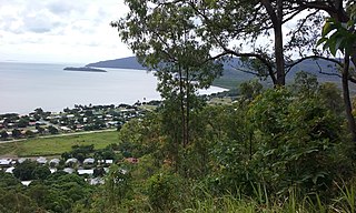
The Aboriginal Shire of Yarrabah is a special local government area in Far North Queensland, Queensland, Australia, east and southeast of Cairns on Cape Grafton. It is managed under a Deed of Grant in Trust under the Local Government Act 2004.

Cooktown is a coastal town and locality in the Shire of Cook, Queensland, Australia. Cooktown is at the mouth of the Endeavour River, on Cape York Peninsula in Far North Queensland where James Cook beached his ship, the Endeavour, for repairs in 1770. Both the town and Mount Cook which rises up behind the town were named after James Cook.
The Yidiny, are an Aboriginal Australian people in Far North Queensland. Their language is the Yidiny language.

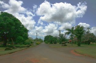
East Trinity is a coastal rural locality in the Cairns Region, Queensland, Australia. It was formerly known as Trinity East. In the 2016 census, East Trinity had a population of 212 people.

