Tandil

Last updated
Tandil
Tandil desde La Movediza 2.JPG
Panoramic view of the city
Argentina location map.svg
Red pog.svg
Tandil
Location in Argentina
Argentina Buenos Aires location map.svg
Red pog.svg
Tandil
Tandil (Buenos Aires Province)
Coordinates: 37°19′S59°08′W / 37.317°S 59.133°W / -37.317; -59.133
CountryArgentina
Province Buenos Aires
Partido Tandil
FoundedApril 4, 1823
Area
  Total52.34 km2 (20.21 sq mi)
Elevation
188 m (617 ft)
Population
 (2010 census)
  Total116,916
  Density2,200/km2 (5,800/sq mi)
CPA Base
B 7000
Area code +54 249
Website www.tandil.gov.ar
City Hall Municipalidad Tandil.jpg
City Hall

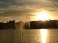
Tandil is the main city of the homonymous partido (department), located in Argentina, in the southeast of Buenos Aires Province, just north-northwest of Tandilia hills. The city was founded in 1823 and its name originates from the Piedra Movediza ("Moving Stone") which fell in 1912. The city is the birthplace of many notable sports personalities, as well as former president of Argentina Mauricio Macri.

Contents

Geography

Tandil is located 180 metres (590 ft) above sea level and its coordinates are 37°19′08″S59°08′05″W / 37.31889°S 59.13472°W / -37.31889; -59.13472 . The city borders Rauch and Azul (to the north), Ayacucho and Balcarce (to the east), Lobería, Necochea and Benito Juárez (to the south) and Azul and Benito Juárez (to the west).

Tandil is situated approximately midway between La Plata (the provincial capital), 330 km (210 mi) to its NE, and Bahía Blanca, lying the same distance to its SW; it is also 160 kilometres (99 mi) NW of Mar del Plata, and 360 kilometres (220 mi) SSW of Buenos Aires. Tandil is in a zone within the Pampas known as the Humid Pampas.

According to the 2010 census (INDEC), Tandil had a population of 116,916. The total area of the Tandil partido is 4,935 km2 (1,905 sq mi).

Climate

Tandil's climate is mild and humid (classified as Cfb or an oceanic climate under the Köppen climate classification), [1] with an average temperature of 13.8 °C (56.8 °F) and 888.6 millimetres (34.98 in) of precipitation annually. Mornings are often cold in autumn, winter and spring, and generally fresh in the summer. Fog is very common in autumn and winter, when frosts are also common. Minimum temperatures below −5 °C (23 °F) have been recorded in the winter months. Rainfall occurs throughout the year but more frequently in summer. Snow are not very common.

The climatological data in the table below is from the period 1991–2020:

Climate data for Tandil, Argentina (1991–2020, extremes 1961–present)
MonthJanFebMarAprMayJunJulAugSepOctNovDecYear
Record high °C (°F)40.7
(105.3)
37.8
(100.0)
37.2
(99.0)
32.5
(90.5)
28.0
(82.4)
23.3
(73.9)
25.4
(77.7)
31.2
(88.2)
30.0
(86.0)
33.6
(92.5)
35.4
(95.7)
39.9
(103.8)
40.7
(105.3)
Mean daily maximum °C (°F)28.4
(83.1)
26.9
(80.4)
24.5
(76.1)
20.5
(68.9)
16.5
(61.7)
13.3
(55.9)
12.5
(54.5)
15.0
(59.0)
16.9
(62.4)
19.9
(67.8)
23.4
(74.1)
27.0
(80.6)
20.4
(68.7)
Daily mean °C (°F)20.8
(69.4)
19.6
(67.3)
17.4
(63.3)
13.5
(56.3)
10.2
(50.4)
7.2
(45.0)
6.2
(43.2)
8.2
(46.8)
10.2
(50.4)
13.3
(55.9)
16.4
(61.5)
19.5
(67.1)
13.5
(56.3)
Mean daily minimum °C (°F)13.3
(55.9)
12.7
(54.9)
11.0
(51.8)
7.4
(45.3)
4.8
(40.6)
2.0
(35.6)
1.1
(34.0)
2.4
(36.3)
3.9
(39.0)
6.8
(44.2)
9.3
(48.7)
11.6
(52.9)
7.2
(45.0)
Record low °C (°F)1.8
(35.2)
0.8
(33.4)
0.0
(32.0)
−4.6
(23.7)
−5.8
(21.6)
−11.0
(12.2)
−11.6
(11.1)
−8.5
(16.7)
−7.1
(19.2)
−4.8
(23.4)
−4.0
(24.8)
−0.3
(31.5)
−11.6
(11.1)
Average precipitation mm (inches)108.8
(4.28)
98.5
(3.88)
91.6
(3.61)
93.5
(3.68)
56.0
(2.20)
48.6
(1.91)
41.1
(1.62)
57.5
(2.26)
58.7
(2.31)
85.9
(3.38)
98.4
(3.87)
74.0
(2.91)
912.6
(35.93)
Average precipitation days (≥ 0.1 mm)7.97.17.67.36.05.46.35.46.98.78.87.284.6
Average snowy days0.00.00.00.00.10.10.10.10.00.00.00.00.2
Average relative humidity (%)67.072.876.978.381.680.580.275.974.473.869.764.674.6
Mean monthly sunshine hours 254.2240.1220.1186.0142.6114.0127.1164.3159.0213.9231.0232.52,284.8
Mean daily sunshine hours 8.28.57.16.24.63.84.15.35.36.97.77.56.3
Percent possible sunshine 59.163.758.449.146.237.242.452.246.753.753.649.951.0
Source: Servicio Meteorológico Nacional (percent sun 1991–2000) [2] [3] [4] [5]

Place name

Piedra Movediza ("Moving Stone"), c. 1890 Tandil moving stone 1890.jpg
Piedra Movediza ("Moving Stone"), c. 1890
Replica of the Piedra Movediza installed in 2007 Piedra movediza Tandil, Prov. Buenos Aires, Argentina..JPG
Replica of the Piedra Movediza installed in 2007

It is widely believed that the name of the city comes from the Mapuche words tan ("falling"), and lil ("rock"). It is probably a reference to the Piedra Movediza ("Moving Stone"), a large boulder which stood seemingly miraculously balanced on the edge of a rocky foothill. [6] In order to demonstrate the slight movements of the boulder, it was common practice to place bottles under its base to watch them shatter. [7] The "Moving Stone" toppled on February 29, 1912, and split into two pieces at the bottom of the hill.

In May 2007, a fix replica was set up in the same place where the original stood. The replica, made by engineering students, is actually cemented in place and does not teeter the way the original did. [7]

History

The town was founded by Martín Rodríguez on April 4, 1823, named Fuerte Independencia (Fort Independence). In time the original natives became assimilated and mingled with the increasing European population.[ citation needed ] The vast majority of immigrants came from Spain and Italy, but also Danish people settled mainly guided by the Danish College of Missions, the latter constituting a very active community. Tandil was designated a city (although by modern standards it was a large town) in 1895 and became a popular tourist destination attracting people from Buenos Aires and other parts of Argentina.

The Piedra Movediza fell in 1912 and split in two below. Although it is impossible after the fact to ascertain the reason it fell, it is very possible that the delicately balanced rock was thrown off balance by the common practice of placing glass bottles under it and watching them explode. This was the way the locals would prove to visitors that the rock, in fact, moved, since the movement was too subtle to be detected by the naked eye. There have been projects to restore the rock, and a replica stone was placed where the original used to be. Other similar stones like El Centinela are also attractions, but none has the truly astonishing quality of teetering ever so slowly like the "moving rock" once did.

National University of Central Buenos Aires Province

The National University of Central Buenos Aires Province (Universidad Nacional del Centro de la Provincia Buenos Aires) is a public university located in Tandil. It was founded in 1974 as part of University of Buenos Aires Professor Alberto Taquini's plan to geographically diversify Argentina's National University system.

Established with the unification of a private school and a campus of the National University of the South, with more than 11,000 students, the university includes 10 schools offering 21 undergraduate, 58 graduate, and 19 post-graduate degrees. It maintains secondary campuses in Azul and Olavarría.

Notable people

Argentina's president Mauricio Macri was born in Tandil Macri recibio el baston y la banda presidencial.jpg
Argentina's president Mauricio Macri was born in Tandil
Juan Martin del Potro is a well known sport personality from the city Del Potro WM16 (13) (28340179731).jpg
Juan Martín del Potro is a well known sport personality from the city

Arts

Politics

Sports

Related Research Articles

<span class="mw-page-title-main">San Fernando del Valle de Catamarca</span> City in Catamarca, Argentina

San Fernando del Valle de Catamarca is the capital and largest city in Catamarca Province in northwestern Argentina, on the Río Valle River, at the feet of the Cerro Ambato. The city name is normally shortened as Catamarca.

<span class="mw-page-title-main">Rawson, Chubut</span> City in Chubut, Argentina

Rawson is the capital of the Argentine province of Chubut, in Patagonia. It has 24,616 inhabitants in 2010, and it is the chief town of the Rawson Department.

<span class="mw-page-title-main">Azul, Buenos Aires</span> Town in Buenos Aires, Argentina

Azul is the head city of the Azul Partido, located at the center of the Buenos Aires Province in Argentina, 300 km south of Buenos Aires. It has 63,000 inhabitants as per the 2001 census [INDEC].

<span class="mw-page-title-main">Ezeiza, Buenos Aires</span> City in Buenos Aires Province, Argentina

Ezeiza is the capital city of the Ezeiza Partido within the Greater Buenos Aires area in Argentina. The city had a population of 160,219 in 2010. Ezeiza is one of the fastest-growing cities in Argentina; the city and its surroundings are known for the many gated communities there, as well as for the Ministro Pistarini International Airport and the Ezeiza Federal Prison Complex. Ezeiza and its surrounds are known as affluent areas.

<span class="mw-page-title-main">San Luis, Argentina</span> City in San Luis, Argentina

San Luis is the capital city of San Luis Province in the Cuyo region of Argentina. It is also the seat of the Juan Martín de Pueyrredón Department.

<span class="mw-page-title-main">Posadas, Misiones</span> City in Misiones, Argentina

Posadas is the capital city of the Argentine province of Misiones, in its south, at the far north-west of the country on the left bank of the Paraná River, opposite Encarnación, Paraguay. The city has an area of 965 square kilometres (373 sq mi) and a population of 324,756, and the Greater Posadas area has a population of over 359,609 according to a 2017 estimate.

<span class="mw-page-title-main">Junín, Buenos Aires</span> City in Buenos Aires Province, Argentina

Junín is a city in the province of Buenos Aires, Argentina, and administrative seat of the partido of Junín. It has a population of 85,420 and is located 260 km (162 mi) west of the city of Buenos Aires. It is mostly known for being the hometown of former first lady of Argentina Eva Perón.

<span class="mw-page-title-main">Pehuajó</span> City in Buenos Aires Province, Argentina

Pehuajó is a city in the Pehuajó Partido in the province of Buenos Aires, Argentina. The partido has about 38,400 inhabitants as per the 2001 census [INDEC]. The name of this relatively small city is well known in Argentina because of María Elena Walsh's song Manuelita, about an adventurous turtle (tortoise); a dilapidated concrete statue of María Elena Walsh's Manuelita lies just outside the city, beside Ruta Nacional 5.

<span class="mw-page-title-main">Las Flores, Buenos Aires</span> City in Buenos Aires Province, Argentina

Las Flores is a city in the province of Buenos Aires, Argentina, and the only city in Las Flores Partido. It had a population of about 26,000 at the 2022 census [INDEC]. It is located 187 km from Buenos Aires City. The main economic activities in the area are agriculture and cattle breeding.

Monte Caseros is a city in the south-east of the province of Corrientes in the Argentine Mesopotamia. It has about 37,000 inhabitants as of the 2010 census [INDEC]. It is the head town of the department of the same name, which comprises also the municipalities of Colonia Libertad, Juan Pujol and Mocoretá.

<span class="mw-page-title-main">Tres Arroyos</span> Place in Buenos Aires, Argentina

Tres Arroyos is a city in Buenos Aires Province, Argentina. It is the administrative seat of Tres Arroyos Partido.

El Palomar is a town in the urban agglomeration of Greater Buenos Aires in Argentina. It is located 20 km (12 mi) west of Buenos Aires.

<span class="mw-page-title-main">Nueve de Julio, Buenos Aires</span> City in Buenos Aires, Argentina

Nueve de Julio is a city in Buenos Aires Province. It is named for the date of Argentina's Independence Day. It also gives its name to the administrative division of Nueve de Julio Partido. Its UN/LOCODE is AREJO.

Laboulaye is a city in the southeast of the province of Córdoba, Argentina. It has 20,534 inhabitants as per the 2010 census [INDEC]. It lies on National Route 7, near the provincial borders of Santa Fe and Buenos Aires, about 315 km south from Córdoba City and 285 km west from Rosario.

<span class="mw-page-title-main">San Miguel, Buenos Aires</span> City in Buenos Aires Province, Argentina

San Miguel is a city in the northwest region of Greater Buenos Aires, 30 km from the City of Buenos Aires. San Miguel is the county seat of San Miguel Partido, and has been a part of Greater Buenos Aires since the early 2000s. The number of inhabitants was 157,532 according to the 2001 census.

<span class="mw-page-title-main">San Martín, Mendoza</span> City in Mendoza, Argentina

San Martín is a city in the north-center part of the Mendoza Province in Argentina. It is the capital of the San Martín Department and constitutes, with Palmira and La Colonia, the third-largest metropolitan area in the province.

<span class="mw-page-title-main">Villa Dolores</span> City in Córdoba, Argentina

Villa Dolores is a city in the province of Córdoba, Argentina, located in the southwestern side of the province. It has a population of 29,854 inhabitants.

Coronel Suárez is a city in Buenos Aires Province, Argentina. It is the administrative centre for Coronel Suárez Partido. Its population is largely made up of Argentines of Volga German descent.

San Carlos de Bolívar is a town in Buenos Aires Province, Argentina. It is the administrative centre for Bolívar Partido.

<span class="mw-page-title-main">Dolores, Buenos Aires</span> Town in Buenos Aires Province, Argentina

Dolores is a town in Buenos Aires Province, Argentina. It is the administrative centre for Dolores Partido. The town settlement was officially founded by Ramón Lara on 21 August 1817.

References

  1. Peel, M. C. and Finlayson, B. L. and McMahon, T. A. (2007). "Updated world map of the Köppen–Geiger climate classification" (PDF). Hydrol. Earth Syst. Sci. 11 (5): 1633–1644. Bibcode:2007HESS...11.1633P. doi: 10.5194/hess-11-1633-2007 . ISSN   1027-5606.{{cite journal}}: CS1 maint: multiple names: authors list (link)
  2. "Estadísticas Climatológicas Normales - período 1991-2020" (in Spanish). Servicio Meteorológico Nacional. Retrieved 29 April 2023.
  3. "Estadísticas Climatológicas Normales – período 1991–2020" (PDF) (in Spanish). Servicio Meteorológico Nacional. 2023. Archived from the original on 8 July 2023. Retrieved 31 July 2023.
  4. "Estadística climatológica de la República Argentina Período 1991-2000" (in Spanish). Servicio Meteorológico Nacional. Archived from the original on 9 May 2023. Retrieved 23 May 2023.
  5. "Clima en la Argentina: Guia Climática por Tandil". Caracterización: Estadísticas de largo plazo (in Spanish). Servicio Meteorológico Nacional. Retrieved 29 April 2023.
  6. Scheffel, Richard L.; Wernet, Susan J., eds. (1980). Natural Wonders of the World. United States of America: Reader's Digest Association, Inc. p. 366. ISBN   0-89577-087-3.
  7. 1 2 noticias.universia.com.ar. "Cómo será la réplica de la movediza de Tandil". Noticias Universia Argentina (in Spanish). Archived from the original on 2018-10-07. Retrieved 2018-10-07.
  8. "Maria Cristina Kiehr (Soprano) - Short Biography". bach-cantatas.com. Retrieved 2018-10-07.
  9. Morando, Andrés (3 August 2013). "Referí bombero". Olé (in Spanish). Retrieved 6 October 2016.