Tangbe

Last updated
Tangbe
ताङबे
Village
Tangbe, Upper Mustang.jpg
Tangbe from above
Nepal Gandaki adm location map.svg
Red pog.svg
Tangbe
Location in Nepal
Nepal adm location map.svg
Red pog.svg
Tangbe
Tangbe (Nepal)
Coordinates: 28°53′20″N83°48′13″E / 28.88889°N 83.80361°E / 28.88889; 83.80361 Coordinates: 28°53′20″N83°48′13″E / 28.88889°N 83.80361°E / 28.88889; 83.80361
CountryFlag of Nepal.svg    Nepal
Zone Dhawalagiri Zone
District Mustang District
Time zone UTC+5:45 (Nepal Time)

Tangbe (Taye in Tibetan [1] ) is a small village in the village development committee of Chhusang in the Mustang District of Nepal. It is located on a promontory with a good view over the Kali Gandaki Gorge on the Upper Mustang trekking route, between Kagbeni and Chhusang.

Contents

Demography

Ruins of an ancient fortress in Tangbe Ruins Fortress Tangbe.jpg
Ruins of an ancient fortress in Tangbe

The people of Tangbe village call themselves "Tangbetani". Most Tangbetanis are using the surname "Gurung", which is a very well known surname in Nepal. Whereas some of the Tangbetanis use the surname "Tangbetani" or "Tangbe".

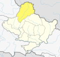
Tangbetanis come from the village of Tangbe, which is a part of the Bahra Gaunle (12 villages) confederation in Mustang district. According to oral history, they have come to Tangbe from Bhurcho of Manang District.

Most of the Tangbetanis have already migrated from Tangbe. A majority of the Tangbrtanis are living in Pokhara, some are living in Kathmandu and some of the Tangbetanis are living in the United States as well as in Australia. There are only 32 households in the Tangbe village. Some 85 families are found in Pokhara, around 25 families in Jomsom, around 20 families in Kathmandu and around 50 individuals in the United States and Australia.

They were traditionally salt traders. The ruins of an ancient fortress have become a silent witness of history, when Tangbe was on a major salt trade route between Tibet and India. After the decline in this trade many years ago, most Tangbetanis stated to be engaged in farming and other vocations. Nowadays a majority of Tangbetanis are owners of Fashion Wear Shops at Pokhara.

The Tangbetanis have been described as an indigenous people of Nepal, residing in the Barha gaun area of Mustang. They resemble Lhoba in physical appearance and are influenced by Tibetan Culture. They have their own unique language called the "Serke", meaning the golden language. They have their own unique dress and ornaments. They also have their own traditional cultural songs, which are sung during the festivals. They also dance along with the melody of the songs they sing.

Religion and Culture

Buddhist chortens in Tangbe Chortens, Tangbe.jpg
Buddhist chortens in Tangbe

All the Tangbetanis are Buddhist. They celebrate several festivals such as Chhau/ Losar (Lhochhar: New Year), Yartong (The festival of riding on a horse and going to the Muktinath) and Dhachyang (The festival for playing Bow and Arrow). According to their tradition, second son should become Dhawa (Lama: Religious Devotee, Buddhist) and second daughter a Jhuma (a Buddhist nun). Their marriage system is polyandrous by tradition, but such marriages are not practiced anymore.

Community

A social association of Tangbetanis have been established in Pokhara. This association is called "Tangbe Samaj Sewa Sanjh". The office and conference hall of this association is located at Parsyang, Pokhara.

See also

Related Research Articles

Upper Mustang Northern area of Mustang District, Nepal

Upper Mustang is an upper part of Mustang District, which is located in Nepal. The Upper Mustang was a restricted kingdom and demilitarized area until 1992 which makes it one of the most preserved regions in the world, with a majority of the population still speaking traditional Tibetic languages. Tibetan culture has been preserved by the relative isolation of the region from the outside world. Life in Mustang revolves around tourism, animal husbandry and trade.

Thakali people

Thakali people are an ethnolinguistic group originating from the Thak Khola region of Mustang District in the Dhaulagiri zone of Nepal. Thak-sat-se is the traditional area of the Thakali community, which lies over Mustang District, the valley of the Kali Gandaki river in western Nepal. According to the 2001 census, Thakali population of around 12,973 constituted only 0.06% of Nepal's population. As per the 2011 Nepal census, there are 13,215 Thakali people in Nepal.

Pokhara Metropolitan city in Gandaki Province, Nepal

Pokhara is a metropolitan city in Nepal, which serves as the capital of Gandaki Province. It is the country's largest metropolitan city in terms of area and second-largest in terms of population. The city also serves as the headquarters of Kaski District. Pokhara is located 200 kilometres west of the capital, Kathmandu. The city is on the shore of Phewa Lake, and sits at an elevation of approximately 822m. The Annapurna Range, with three out of the ten highest peaks in the world—Dhaulagiri, Annapurna I and Manaslu—is within 15–35 mi (24–56 km) of the valley.

Kali Gandaki Gorge Himalayan gorge in Nepal

The Kali Gandaki Gorge or Andha Galchi is the gorge of the Kali Gandaki in the Himalayas in Nepal. By some definitions, it may be one of the deepest gorges in the world.

Gandaki Zone Zone in Nepal

Gandaki zone (Nepali: गण्डकी अञ्चलListen  was one of the fourteen zones of Nepal, located in the Western Development Region. It was named as Sapta Gandaki after the seven tributaries that makes up the Gandaki River. Pokhara served as its regional and zonal headquarter. It was also the birthplace of Bhanubhakta Acharya, first poet of Nepal.

Gandaki River River in Nepal and India

The Gandaki River, also known as the Narayani and the Gandak, is one of the major rivers in Nepal and a left bank tributary of the Ganges in India. Its total catchment area amounts to 46,300 km2 (17,900 sq mi), most of it in Nepal. In the Nepal Himalayas, it is notable for its deep canyon. The basin also contains three mountains over 8,000 m (26,000 ft), namely Dhaulagiri, Manaslu and Annapurna I. Dhaulagiri is the highest point of the Gandaki basin.

Mustang District District in Gandaki Province, Nepal

Mustang District is one of the eleven districts of Gandaki Province and one of seventy-seven districts of Nepal. It covers an area of 3,573 km2 (1,380 sq mi) and has a population (2011) of 13,452. The headquarters is located at Jomsom. Mustang is the 5th largest district of Nepal.

Baglung Place in Dhaulagiri Zone, Nepal

Baglung is a municipality in western Nepal, 275 km (171 mi) west of Kathmandu. It is the administrative headquarters of Baglung District and Dhaulagiri Zone. Baglung serves as the major center for business, finance, education, service and healthcare for the people of mid-Kali Gandaki valley that encompass Beni, Jaljala, Baglung, Kushma, Kathekhola, Galkot, Phalewas and Jaimuni local bodies. The city is located at the cross-section of Kaligandaki corridor highway and midhill highway that transverse Nepal in north–south and east–west directions respectively.

Jomsom Airport Domestic airport serving Jomsom, Gandaki Province, Nepal

Jomsom Airport is a domestic airport located in Jomsom serving Mustang District, a district in Gandaki Province in Nepal. It serves as the gateway to Mustang District that includes Jomsom, Kagbeni, Tangbe, and Lo Manthang, and Muktinath temple, which is a popular pilgrimage for Nepalis and Indian pilgrims.

Lomanthang Rural Municipality Rural municipality in Gandaki Province, Nepal

Lomanthang is a rural municipality in Mustang district in Gandaki Province of western Nepal. It is located at the northern end of the district, bordering the Tibet Autonomous Region of China to the north and Dalome rural municipality of Mustang in the south.

Jomsom HQ/Ward in Gandaki Province, Nepal

Jomsom, also known as Dzongsam is the centre of Gharapjhong rural municipality in Mustang district and a former independent village development committee situated at an altitude of about 2,700 metres (8,900 ft) in Gandaki Province of western Nepal. The soaring peaks of Dhaulagiri and Nilgiri form a backdrop to the town straddling the Kali Gandaki River, which flows right through the centre of Jomsom. Along the banks of the Kali Gandaki, black fossilised stones called shaligram, considered as an iconic symbol and reminder of the god Vishnu in the Hindu culture, can be found. Such stones are believed to be found only in the Kali Gandaki, and are holy to the Hindus.

Kagbeni, Mustang Incorporated village in Mustang, Nepal

Kagbeni is a village in the Baragubg Muktikshetra rural municipality of Mustang District of the Himalayas, in Nepal, located in the valley of the Kali Gandaki River. At the time of the 2011 Nepal census it had a population of 555 people. It lies on the trail from Jomsom to the royal capital Lo Manthang, near the junction with the trail to Muktinath. Kagbeni is also regarded as one of the oldest villages in the Himalayas.

Chhusang Village development committee in Dhawalagiri Zone, Nepal

Chhusang is a village development committee in Mustang District in the Dhawalagiri Zone of northern Nepal. It is located on the Upper Mustang trekking route, between Tangbe and Chele, about an hour's walk north of Tangbe. It lies at the junction of the Narshing river and the Kali Gandaki.

Tukuche Village development committee in Dhawalagiri Zone, Nepal

Tukuche , sometimes spelt Tukche, is a village development committee in Mustang District in the Dhawalagiri Zone of northern Nepal. At the time of the 1991 Nepal census it had a population of 652 people living in 166 individual households.

Annapurna Circuit

The Annapurna Circuit is a trek within the mountain ranges of central Nepal. The total length of the route varies between 160–230 km (100-145 mi), depending on where motor transportation is used and where the trek is ended. This trek crosses two different river valleys and encircles the Annapurna Massif. The path reaches its highest point at Thorung La pass (5416m/17769 ft), reaching the edge of the Tibetan plateau. Most trekkers hike the route anticlockwise, as this way the daily altitude gain is slower, and crossing the high Thorong La pass is easier and safer.

Thakali is a Sino-Tibetan language of Nepal spoken by the Thakali people, mainly in the Myagdi and Mustang Districts. Its dialects have limited mutual intelligibility.

Chhairo gompa Tibetan Buddhist monastery in Mustang, Nepal

Chhairo Monastery was the first monastery of the Nyingma school of Tibetan Buddhism founded in Upper Mustang. It was established in the 16th century and is part of present-day Mustang District, Nepal.

Shashi Dhoj Tulachan

Shashi Dhoj Tulachan, called Guru Nawang Chhogyall Tenzin, is the spiritual leader of the Chhairo gompa, of Nyingma Tibetan Buddhism, having been given responsibility for the Gompa by the current incarnation who is not a practising lama. He is also responsible for three gompas in Tukuche, his home village on the right bank of the Kali Gandaki, and in the Annapurna trail:

Rupse Falls

Rupse Falls is a waterfall in central Nepal. It is located in Dana VDC of Myagdi District in Dhawalagiri Zone of western Nepal. It is 300 meters tall. The falls are a popular tourist destination.

Tibet–Nepal salt trade route Ancient salt trading route

The Tibet–Nepal salt trade route is an ancient salt trading route running between the Tibetan Plateau and the Middle Hills of Nepal, and further on to India. After the annexation of Tibet by China in 1950 and the Sino-Indian War in 1962, patterns of trade changed, and the use of the old trading route between India and Tibet dwindled and the salt-carrying caravans became redundant.

References

  1. Dead and living settlements in the Shöyul of Mustang (PDF)