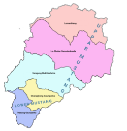
Upper Mustang

Last updated
Kingdom of Lo / Mustangགློ་ཡུལ། གློ་སྨན་ཐང་། (Tibetan) मुस्ताङ राज्य (Nepali)
1380–2008
Flag of Mustang.svg
Flag
Upper & lower Mustang.png
Upper & lower Mustang with local level bodies
StatusIndependent sovereign state (1380-1795)
Dependency of Nepal (1795-2008)
Capital Lo Manthang
Official languages
Religion
GovernmentMonarchy
Raja/Gyelpo (King) 
 1380-1400s (first)
Ame Pal
 1964-2008 (last)
Jigme Dorje Palbar Bista
History 
 Established
1380
 Abolished by the Federal government
7 October 2008
Area
 Total
2,020 [1]  km2 (780 sq mi)
Population
 Estimate
7,000 [1]
 Density
3.47/km2 (9.0/sq mi)
Succeeded by
Mustang District Blank.png
Today part ofFlag of Nepal.svg    Nepal
Lo Manthang LoManthang 1.JPG
Lo Manthang

Upper Mustang (formerly Kingdom of Lo) is an upper part (Northern area) of Mustang District, which is located in Nepal. The Upper Mustang was a restricted kingdom until 1992 which makes it one of the most preserved regions in the world, with a majority of the population still speaking traditional Tibetic languages. Tibetan culture has been preserved by the relative isolation of the region from the outside world. Life in Mustang revolves around tourism, animal husbandry and trade.

Contents

The Upper Mustang comprises the northern two-thirds of the Mustang District of Gandaki Province, Nepal. It consists of three rural municipalities namely Lo Manthang, Dalome and Baragung Muktichhetra.

The southern third (lower Mustang) of the district is called Thak and is the homeland of the Thakali community, who speak the Thakali language and whose culture combines Tibetan and Nepalese elements.

Mustang's status as a kingdom ended in 2008 when its suzerain Kingdom of Nepal became a republic. The influence of the outside world, especially China, is growing and contributing to rapid change in the lives of Mustang's people. [2] Development work has increased in recent years.

History

Raja Jigme Dorje Palbar Bista. Jigme Palbar Bista.jpg
Raja Jigme Dorje Palbar Bista.

Mustang was once an independent kingdom, although closely tied by language and culture to Tibet. From the 15th to the 17th century, its strategic location granted Mustang control over the trade between the Himalayas and India. At the end of the 18th century, the kingdom was annexed by Nepal and became a dependency of the Kingdom of Nepal in 1795. [3]

The Kingdom of Lo Manthang supported Tibet and the Qing Empire during the Sino-Nepalese War.

Though still recognized by many Mustang residents, the monarchy ceased to exist on October 7, 2008, by order of the Government of Nepal. [4] The last official and later unofficial king (raja or gyelpo) was Jigme Dorje Palbar Bista (1930–2016), [5] who traced his lineage directly back to Ame Pal, the warrior who founded this Buddhist kingdom in 1380. [6] Ame Pal oversaw the founding and building of much of the Lo and Mustang capital of Lo Manthang, a walled city that has changed little in appearance since that time period. [7]

In 2007, a shepherd in Mustang discovered a collection of 55 cave paintings depicting the life of the Buddha. [8]

Climate

Upper Mustang has a trans-Himalayan climate which is cool and semi-arid with precipitation in the range of 250–400 mm (9.8–15.7 in). It is in the rain shadow of the Annapurna and Dhaulagiri ranges.

The Day and Night Temperature in Upper Mustang according to the months is shown below:

MonthDay TemperatureNight Temperature
December, January, February0 to 5 °C

32 to 41 °F

-25 to -20°C

-13 to -4 °F

March, April, May, June16 to 22 °C

61 to 72 °F

-6 to -2°C

21 to 28°F

July, August, September20 to 33 °C

68 to 73 °F

-3 to 0 °C

27 to 32 °F

October, November12 to 20 °C

54 to 68 °F

-8 to -4 °C

18 to 25 °F

Demographics

The population of the whole Mustang District in 2001 was 14,981, spread between three towns and approximately thirty smaller settlements. The inhabitants are either Thakalis, Gurung or, in traditional Mustang, primarily Tibetan.

Most of the population of Mustang lives near the Kali Gandaki River, 2,800 to 3,900 m (9,200 to 12,800 ft) above sea level. The tough conditions cause a large winter migration into lower regions of Nepal. The administrative center of Mustang District is at Jomsom (eight kilometres (5.0 mi) south of Kagbeni) which has had an airport since 1962 and has become the main tourist entry point since Mustang was opened to western tourism in 1992.

Geography

The main hydrographic feature of Mustang is the Gandaki River. The river runs southward towards Nepal Terai, bisecting Mustang. Routes paralleling the river once served as a major trade route between Tibet and India, especially for salt. Part of the river valley in the southern Mustang District forms the Kali Gandaki Gorge, by some measures the deepest gorge in the world.

Traditional Mustang (the Lo Kingdom) is 53 km (33 mi) northsouth at its longest, 60 km (37 mi) eastwest at its widest and ranges from a low point of 2,750 m (9,020 ft) above sea level on the Kali Gandaki River just north of Kagbeni to 6,700 m (22,000 ft) at Khamjung Himal, a peak in southeast Mustang.

Transport

Upper Mustang is on an ancient trade route between Nepal and Tibet exploiting the lowest 4,660-metre (15,300 ft) pass Kora La through the Himalaya west of Sikkim. Kora La currently serves as one of the active border crossings between China and Nepal. [9]

Mechanized access inside Nepal began with the opening of an airstrip at Jomsom at the approximate boundary between the southern Thak and northern Lo sections of the valley, which was in operation by the 1960s.

China eventually decided to revitalize trade and in 2001 completed a 20-kilometre (12 mi) road from the international border to Lo Manthang. [10] Across the TAR border is Zhongba County of Shigatse Prefecture. China National Highway 219 follows the valley of the Yarlung Tsangpo River some 50 kilometres (31 mi) north of the border.

Meanwhile, road-building from the south was inhibited by difficulties along the Kali Gandaki Gorge to the south, but proceeded incrementally. In 2010, a nine-kilometre (6 mi) gap remained but the road was completed before 2015 and is suitable for high clearance and four wheel drive vehicles.

Currently, the easiest and only widely used road corridor, from Kathmandu to Lhasa—named Arniko Highway in Nepal and China National Highway 318 in the TAR—traverses a 5,125-metre (16,810 ft) pass. This is some 465 metres (1,530 ft) higher than Kora La.

Tourism

Rigsum Gonpo and Buddhist prayer flags at the entrance of Samar Rigsum Gonpo and prayer flags at the entrance of Samar (15842094652).jpg
Rigsum Gönpo and Buddhist prayer flags at the entrance of Samar

Foreign visitors have been allowed to the region since 1992, but tourism to Upper Mustang is regulated. Foreigners need to obtain a special permit to enter, costing $500 for ten days, followed by $50 per day. [11] Most tourists visit for the region's trekking trails, which largely follow the same trade route used in the 15th century, although road construction is beginning to impact the areas trekking routes. [12] Over a thousand western trekkers now visit each year, with over 7,000 between (mid-July 2018 to mid-July 2019). August and October are the peak visiting months. On August 27, 2010, local youth leaders in Mustang threatened to bar tourists beginning October 1, 2010 due to the refusal of the Nepalese government to provide any of the $50 per day fee to the local economy. Visitation, however, continued uninterrupted beyond that date. [13]

Mustang is rich in Buddhist culture, similar to the area of the Tibet Autonomous Region of the People's Republic of China. It is an alternate way to experience the Tibetan culture and landscape to the tours provided by the Chinese government. The Tiji festival in Lo-Manthang is another popular destination for tourists in the area seeking to experience the native culture.

The first westerner in Mustang was Toni Hagen, Swiss explorer and geologist, who visited the Kingdom in 1952 during one of his travels across the Himalayas. French Michel Peissel is considered the first westerner to stay in Lo Manthang, during the first authorised exploration of Mustang in 1964. [14]

See also

Related Research Articles

<span class="mw-page-title-main">Thakali people</span> Ethnolinguistic group

The Thakali are an ethnolinguistic Tibeto-Burman ethnic group of Nepal. The traditional area of the Thakali community is called Thak-sat-se or the Thak Khola region and lies in the Kali Gandaki River valley in the Mustang District, Gandaki Province in western Nepal. According to the 2001 census, the Thakali population of around 12,973 constituted only 0.06% of Nepal's population. By the 2011 Nepal census, there were 13,215 Thakali people in Nepal.

<span class="mw-page-title-main">Kali Gandaki Gorge</span> Himalayan gorge in Nepal

The Kali Gandaki Gorge or Andha Galchi is the gorge of the Kali Gandaki in the Himalayas in Nepal. By some sources, it may be one of the deepest gorges in the world.

<span class="mw-page-title-main">Gandaki Zone</span> Zone in Nepal

Gandaki zone was one of the fourteen zones of Nepal, located in the Western Development Region. It was named as Sapta Gandaki after the seven tributaries that makes up the Gandaki River. Pokhara served as its regional and zonal headquarter. It was also the birthplace of Bhanubhakta Acharya, first poet of Nepal.

<span class="mw-page-title-main">Gandaki River</span> River in Nepal and India

The Gandaki River, also known as the Narayani and Gandak, is one of the major rivers in Nepal and a left-bank tributary of the Ganges in India. Its total catchment area is 46,300 km2 (17,900 sq mi), most of it in Nepal. In the Nepal Himalayas, the Gandaki is notable for its deep canyon. The basin also contains three mountains over 8,000 m (26,000 ft), namely Dhaulagiri, Manaslu and Annapurna Massif. Dhaulagiri is the highest point of the Gandaki basin.

<span class="mw-page-title-main">Dolpo</span> Place in Karnali Province, Nepal

Dolpo is a high-altitude culturally Tibetan region in the upper part of the Dolpa District of western Nepal, bordered in the north by China. Part of the region lies in Shey Phoksundo National Park. The sparse, agro-pastoral population, known as Dolpo in standard Tibetan and Dhol-wa in the local dialect, is connected to the rest of Nepal via Jufal airport, which can be reached in three days by horse. There are no precise population numbers for the region, with estimates including less than 5,000 and 18,000

<span class="mw-page-title-main">Mustang District</span> District in Gandaki Province, Nepal

Mustang District is one of the eleven districts of Gandaki Province and one of seventy-seven districts of Nepal which was a Kingdom of Lo-Manthang that joined the Federation of Nepal in 2008 after abolition of the Shah dynasty. The district covers an area of 3,573 km2 (1,380 sq mi) and in 2011 had a population of 13,452. The headquarters is located at Jomsom. Mustang is the fifth largest district of Nepal in terms of area.

<span class="mw-page-title-main">Jomsom Airport</span> Domestic airport serving Jomsom, Gandaki Province, Nepal

Jomsom Airport is a domestic airport located in Jomsom serving Mustang District, a district in Gandaki Province in Nepal. It serves as the gateway to Mustang District that includes Jomsom, Kagbeni, Tangbe, and Lo Manthang, and Muktinath temple, which is a popular pilgrimage for Nepalis and Indian pilgrims.

<span class="mw-page-title-main">Lomanthang Rural Municipality</span> Rural municipality in Gandaki Province, Nepal

Lomanthang is a rural municipality in Mustang district in Gandaki Province of western Nepal. It is located at the northern end of the district, bordering the Tibet Autonomous Region of China to the north and Dalome rural municipality of Mustang in the south.

<span class="mw-page-title-main">Jomsom</span> Town in Mustang, Nepal

Jomsom, also known as Dzongsam, is the centre of Gharapjhong rural municipality in Mustang district and a former independent village development committee situated at an altitude of about 2,700 metres (8,900 ft) in Gandaki Province of western Nepal. The soaring peaks of Dhaulagiri and Nilgiri form a backdrop to the town straddling the Kali Gandaki River, which flows right through the centre of Jomsom. Along the banks of the Kali Gandaki, black fossilised stones called shaligram, considered as an iconic symbol and reminder of the god Vishnu in the Hindu culture, can be found. Such stones are believed to be found only in the Kali Gandaki, and are considered holy by Hindus.

<span class="mw-page-title-main">Kagbeni, Mustang</span> Incorporated village in Mustang, Nepal

Kagbeni is a village in the Baragubg Muktikshetra rural municipality of Mustang District of the Himalayas, in Nepal, located in the valley of the Kali Gandaki River. At the time of the 2011 Nepal census, it had a population of 555 people. The village lies on the trail from Jomsom to the royal capital Lo Manthang, near the junction with the trail to Muktinath. Kagbeni is also regarded as one of the oldest villages in the Himalayas.

<span class="mw-page-title-main">Chhusang</span> Village development committee in Dhawalagiri Zone, Nepal

Chhusang is a village development committee in Mustang District in the Dhawalagiri Zone of northern Nepal. It is located on the Upper Mustang trekking route, between Tangbe and Chele, about an hour's walk north of Tangbe. It lies at the junction of the Narshing river and the Kali Gandaki.

<span class="mw-page-title-main">Tukuche</span> Village development committee in Dhawalagiri Zone, Nepal

Tukuche, sometimes spelt Tukche, is a village development committee in Mustang District in the Dhawalagiri Zone of northern Nepal. At the time of the 1991 Nepal census it had a population of 652 people living in 166 individual households.

<span class="mw-page-title-main">Tangbe</span> Village in Dhawalagiri Zone, Nepal

Tangbe is a small village in the village development committee of Chhusang in the Mustang District of Nepal. It is located on a promontory with a good view over the Kali Gandaki Gorge on the Upper Mustang trekking route, between Kagbeni and Chhusang.

<span class="mw-page-title-main">Annapurna Circuit</span> Mountain trail in central Nepal

The Annapurna Circuit is a trek within the mountain ranges of central Nepal. The total length of the route varies between 160–230 km, depending on where motor transportation is used and where the trek is ended. This trek crosses two different river valleys and encircles the Annapurna Massif. The path reaches its highest point at Thorung La pass, reaching the edge of the Tibetan plateau. Most trekkers hike the route anticlockwise, as this way the daily altitude gain is slower, and crossing the high Thorong La pass is easier and safer.

Thakali is a Sino-Tibetan language of Nepal spoken by the Thakali people, mainly in the Myagdi and Mustang Districts. Its dialects have limited mutual intelligibility.

<span class="mw-page-title-main">Chhairo gompa</span> Tibetan Buddhist monastery in Mustang, Nepal

Chhairo Monastery was the first monastery of the Nyingma school of Tibetan Buddhism founded in Upper Mustang. It was established in the 16th century and is part of present-day Mustang District, Nepal.

<span class="mw-page-title-main">Mustang Caves</span> Place

Mustang Caves or Sky Caves of Nepal are a collection of some 10,000 man-made caves dug into the sides of valleys in the Mustang District of Nepal. Several groups of archaeologists and researchers have explored these stacked caves and found partially mummified human bodies and skeletons that are at least 2,000–3,000 years old. Explorations of these caves by conservators and archaeologists have also led to the discovery of valuable Buddhist paintings, sculptures, manuscripts and numerous artifacts belonging to the 12th to 14th century. The caves lie on the steep valley walls near the Kali Gandaki River in Upper Mustang. Research groups have continued to investigate these caves, but no one has yet understood who built the caves and why they were built. The site has been listed as a UNESCO tentative site since 1996.

<span class="mw-page-title-main">Korala</span> Pass between Tibet and Nepal

Korala or Kora La or Koro La is a mountain pass between Tibet and Upper Mustang. At only 4,660 metres (15,290 ft) in elevation, it has been considered the lowest drivable path between Tibetan Plateau and the Indian subcontinent. It currently serves as a vehicle border crossing between China and Nepal.

<span class="mw-page-title-main">Tibet–Nepal salt trade route</span> Ancient salt trading route

The Tibet–Nepal salt trade route is an ancient salt trading route running between the Tibetan Plateau and the Middle Hills of Nepal and further on to India. After the annexation of Tibet by China in 1950 and the Sino-Indian War in 1962, patterns of trade changed and the use of the old trading route between India and Tibet dwindled and the salt-carrying caravans became redundant.

References

  1. 1 2 Raffaele, Paul (April 1998). "Into the Forbidden Kingdom of Mustang". Reader's Digest. 421. 71.
  2. Mustang: A Kingdom on the Edge Al Jazeera Correspondent Archived 2020-06-12 at the Wayback Machine
  3. "Principality of Mustang, Nepal".
  4. China View news
  5. "Nepal remembers Bista, last king of Upper Mustang". bbc.co.uk. Retrieved December 18, 2016.
  6. Wild, windy and harsh, yet stunningly beautiful; The Sunday Tribune; April 21, 2002
  7. Peissel, Michel (1992) [1967]. Mustang - A Lost Tibetan Kingdom (2nd ed.). Pilgrims Book House. pp. 227–31.
  8. Shepherd leads experts to ancient Buddha cave paintings; Guardian Unlimited; May 4, 2007.
  9. "Beijing to reopen fourth border point with Nepal". Kathmandu Post. 12 November 2023. Retrieved 7 February 2024.
  10. "New highway divides isolated Buddhist kingdom of Mustang". Taipei Times. Taipei, Taiwan. AFP. May 19, 2007. Retrieved Dec 14, 2013.
  11. "The Best Upper Mustang Treks: An Expert Guide - Horizon Guides". horizonguides.com. Retrieved 2024-01-22.
  12. "The Best Upper Mustang Treks: An Expert Guide - Horizon Guides". horizonguides.com. Retrieved 2024-01-22.
  13. Mustang to Bar Tourists
  14. Peissel, Michel [1967]. Mustang, a Lost Tibetan Kingdom, Books Faith, 2002

Bibliography

Documentaries

29°05′N83°55′E / 29.083°N 83.917°E / 29.083; 83.917