Tarangnan

Last updated
Tarangnan
Municipality of Tarangnan
Tarangnan mountaintop view.jpg
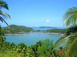
Mountain-top view of Tarangnan
Flag of Tarangnan, Samar.png
Tarangnan Samar.png
Ph locator samar tarangnan.png
Map of Samar with Tarangnan highlighted
OpenStreetMap
Tarangnan
Philippines location map (square).svg
Red pog.svg
Tarangnan
Location within the Philippines
Coordinates: 11°54′N124°45′E / 11.9°N 124.75°E / 11.9; 124.75
Country Philippines
Region Eastern Visayas
Province Samar
District 1st district
Founded April 1, 1884
Barangays 41 (see Barangays)
Government
[1]
  Type Sangguniang Bayan
   Mayor Danilo V. Tan
   Vice Mayor Arnel R. Tan
   Representative Stephen James Tan
   Electorate 19,761 voters (2022)
Area
[2]
  Total132.49 km2 (51.15 sq mi)
Elevation
16 m (52 ft)
Highest elevation
335 m (1,099 ft)
Lowest elevation
0 m (0 ft)
Population
 (2020 census) [3]
  Total25,713
  Density190/km2 (500/sq mi)
   Households
5,936
Economy
   Income class 4th municipal income class
   Poverty incidence
29.87
% (2018) [4]
   Revenue 132.2 million (2020)
   Assets 294.2 million (2020)
   Expenditure 118 million (2020)
   Liabilities 61.43 million (2020)
Service provider
  ElectricitySamar 1 Electric Cooperative (SAMELCO 1)
Time zone UTC+8 (PST)
ZIP code
6704
PSGC
IDD : area code +63(0)55
Native languages Waray
Tagalog

Tarangnan, officially the Municipality of Tarangnan (Waray : Bungto han Tarangnan; Tagalog : Bayan ng Tarangnan), is a 4th class municipality in the province of Samar, Philippines. According to the 2020 census, it has a population of 25,713 people. [3]

Contents

Tarangnan is situated on the western coast of Samar Island, to the south-east of the ancient town of Bangahon (now Gandara) and to the north of Samar's capital Catbalogan. Tarangnan is found near the former ancient puebloTinago, the first town to be Christianized and was made a center or cabecera. [5]

Tarangnan has its own municipal hospital which was inaugurated in 1982, with a 10-bed capacity. It is augmented by Rural Health Unit extension workers. It has daycare centers which also cater the needs of pre-schoolers.

History

During the earlier part of the 17th century, Tarangnan or Tinago was the first settlement of Jesuit missionaries on the island of Samar. Tinago was the first cabecera on Samar where the first Jesuits have arrived, that is October 15, 1596. When Tinago was devastated by the Moro attack in 1616, the Jesuits decided to transfer the cabecera to Catbalogan. Since that time Tinago had not came back to life as pueblo until 1725. [6] The poblacion was established at Dapdap but for access and sanitation it was moved to tarangnan in 1883–1884. [7]

The attempted transfer of the pueblo from Dapdap to Tarangnan in 1882 became highly celebrated case. It was a struggle or a fight between the parish priest of Dapdap, fr. Angel Pulido, OFM and the governadorcillo of Dapdap. [8]

Tarangnan Church Tarangnan Church.jpg
Tarangnan Church

The town of Dapdap was transferred in 1884 to a barrio called Tarangnan, from which it derived its name today. At first the church and convento were constructed of light materials which means bamboo and nipa. The new church was constructed in 1894 by P. Venancio Palencia, OFM and completed in 1897. [9]

In the second half of the nineteenth century, the island of Samar experienced a commercial boom, especially in abaca, with imports and exports of abaca products. Moro raids in the island declined due to the presence of Spaniards. As the Spaniards settled in Samar, they saw the need of all-weather seaports and easy communications for their commercial activities and political administration. This development paved the way for the convergence of the inhabitants into the old town site of Tarangnan, where transport was relatively accessible. The settlement of Tarangnan was growing at a much faster pace than the pueblo of Dapdap.

Taking into consideration the island's commercial boom, with prospects of Tarangnan as a trading center and its religious vigilance over Dapdap, on June 21, 1881, Gov. Enrique Chacon wrote to his superiors. He recommended the transfer of the Poblacion from Dapdap to Tarangnan due to the former's poor accessibility, unavailability of land area for expansion, and its unsanitary environment.

On April 1, 1884, Tarangnan was declared as one of the municipalities of the Province of Samar by means of Royal Decree by the King of Spain, King Alfonso I.[ citation needed ]

In 1957, the following sitios were declared barrios: Cabunga-an, [10] Tigdaranao, [11] and Binalayan. [12]

In 1979, by virtue of Batas Pambansa Blg. 16, nine barangays were separated to create the municipality of Pagsanghan. [13]

Geography

The municipality of Tarangnan is geographically situated in the west portion of the island of Samar, bounded on the north by the municipality of Pagsanghan, in the south by the capital city of Catbalogan and on the west by the Samar Sea or Maqueda Bay. The distance of the poblacion to Catbalogan is about 36 kilometres (22 mi) and 60 kilometres (37 mi) away from Calbayog. It can be reached via an 11 kilometres (6.8 mi) road from the Maharlika Highway crossing Barangay Balugo by a provincial road.

Barangays

Tarangnan is politically subdivided into 41 barangays. Each barangay consists of puroks and some have sitios.

  • Alcazar
  • Awang
  • Bahay
  • Balonga-as
  • Balugo
  • Bangon Gote
  • Baras
  • Binalayan
  • Bisitahan
  • Bonga
  • Cabunga-an
  • Cagtutulo
  • Cambatutay Nuevo
  • Cambatutay Viejo
  • Canunghan
  • Catan-agan
  • Dapdap
  • Gallego
  • Imelda Pob. (Posgo)
  • Lucerdoni (Irong-irong)
  • Lahong
  • Libucan Dacu
  • Libucan Gote
  • Majacob
  • Mancares
  • Marabut
  • Oeste - A
  • Oeste - B
  • Pajo
  • Palencia
  • Poblacion A
  • Poblacion B
  • Poblacion C
  • Poblacion D
  • Poblacion E
  • San Vicente
  • Santa Cruz
  • Sugod
  • Talinga
  • Tigdaranao
  • Tizon

Climate

Climate data for Tarangnan, Samar
MonthJanFebMarAprMayJunJulAugSepOctNovDecYear
Mean daily maximum °C (°F)28
(82)
29
(84)
29
(84)
31
(88)
31
(88)
30
(86)
29
(84)
29
(84)
29
(84)
29
(84)
29
(84)
28
(82)
29
(85)
Mean daily minimum °C (°F)21
(70)
21
(70)
21
(70)
22
(72)
24
(75)
24
(75)
24
(75)
25
(77)
24
(75)
24
(75)
23
(73)
22
(72)
23
(73)
Average precipitation mm (inches)72
(2.8)
52
(2.0)
65
(2.6)
62
(2.4)
87
(3.4)
129
(5.1)
153
(6.0)
124
(4.9)
147
(5.8)
157
(6.2)
139
(5.5)
117
(4.6)
1,304
(51.3)
Average rainy days17.413.416.818.022.025.326.224.224.926.023.320.8258.3
Source: Meteoblue [14]

Demographics

Population census of Tarangnan
YearPop.±% p.a.
1903 6,184    
1918 7,286+1.10%
1939 11,605+2.24%
1948 12,271+0.62%
1960 15,984+2.23%
1970 17,551+0.94%
1975 19,489+2.12%
1980 15,558−4.40%
1990 15,894+0.21%
1995 18,791+3.19%
2000 20,538+1.92%
2007 22,767+1.43%
2010 24,146+2.16%
2015 24,992+0.66%
2020 25,713+0.56%
Source: Philippine Statistics Authority [15] [16] [17] [18]

Economy

Education

Some years back, Tarangnan was estimated to have a low literacy rate. But, with the opening of primary education in some barangays and expansion of secondary education (Tarangnan National High School) in Barangay Oeste, its literacy rose dramatically to 89.95%, as recorded in the NSO 1995 survey.

Notes

  1. Municipality of Tarangnan | (DILG)
  2. "2015 Census of Population, Report No. 3 – Population, Land Area, and Population Density" (PDF). Philippine Statistics Authority. Quezon City, Philippines. August 2016. ISSN   0117-1453. Archived (PDF) from the original on May 25, 2021. Retrieved July 16, 2021.
  3. 1 2 Census of Population (2020). "Region VIII (Eastern Visayas)". Total Population by Province, City, Municipality and Barangay. Philippine Statistics Authority . Retrieved 8 July 2021.
  4. "PSA Releases the 2018 Municipal and City Level Poverty Estimates". Philippine Statistics Authority. 15 December 2021. Retrieved 22 January 2022.
  5. Kobak, Cantius (2002). Historical Sketches of the Pueblos of Samar and Leyte: 1580-1900. Milwaukee, Wisconsin: Unpublished. p. 721 - 723.
  6. ARSI, Catalogi, Phil. 4. fol. 127, Central Archives of Rome
  7. Cruikshank, Robert Bruce (1975). A History of Samar Island, 1768 - 1898. pp. 271.
  8. Cruikshank: pp. 169 - 186
  9. Martin y Morales, Ensayo de una sintesis de los trabajos realizados por las corporaciones religiosas espanolas de Filipinas 1901 p. 493,
  10. "An Act to Convert the Sitio of Cabunga-an in the Municipality of Tarangnan, Province of Samar, into a Regular Barrio". LawPH.com. Retrieved 2011-04-12.
  11. "An Act to Convert the Sitio of Tigdaranao in the Municipality of Tarangnan, Province of Samar, into a Regular Barrio". LawPH.com. Retrieved 2011-04-13.
  12. "An Act to Convert the Sitio of Binalayan in the Municipality of Tarangnan, Province of Samar, into a Regular Barrio". LawPH.com. Retrieved 2011-04-13.
  13. "Batas Pambansa Blg. 16". The LawPhil Project. Arellano Law Foundation. February 9, 1979. Retrieved March 22, 2023.
  14. "Tarangnan: Average Temperatures and Rainfall". Meteoblue. Retrieved 29 February 2020.
  15. Census of Population (2015). "Region VIII (Eastern Visayas)". Total Population by Province, City, Municipality and Barangay. Philippine Statistics Authority . Retrieved 20 June 2016.
  16. Census of Population and Housing (2010). "Region VIII (Eastern Visayas)" (PDF). Total Population by Province, City, Municipality and Barangay. National Statistics Office . Retrieved 29 June 2016.
  17. Censuses of Population (1903–2007). "Region VIII (Eastern Visayas)". Table 1. Population Enumerated in Various Censuses by Province/Highly Urbanized City: 1903 to 2007. National Statistics Office.{{cite encyclopedia}}: CS1 maint: numeric names: authors list (link)
  18. "Province of Samar (Western Samar)". Municipality Population Data. Local Water Utilities Administration Research Division. Retrieved 17 December 2016.
  19. "Poverty incidence (PI):". Philippine Statistics Authority. Retrieved December 28, 2020.
  20. "Estimation of Local Poverty in the Philippines" (PDF). Philippine Statistics Authority. 29 November 2005.
  21. "2003 City and Municipal Level Poverty Estimates" (PDF). Philippine Statistics Authority. 23 March 2009.
  22. "City and Municipal Level Poverty Estimates; 2006 and 2009" (PDF). Philippine Statistics Authority. 3 August 2012.
  23. "2012 Municipal and City Level Poverty Estimates" (PDF). Philippine Statistics Authority. 31 May 2016.
  24. "Municipal and City Level Small Area Poverty Estimates; 2009, 2012 and 2015". Philippine Statistics Authority. 10 July 2019.
  25. "PSA Releases the 2018 Municipal and City Level Poverty Estimates". Philippine Statistics Authority. 15 December 2021. Retrieved 22 January 2022.

Related Research Articles

<span class="mw-page-title-main">Basey</span> Municipality in Samar, Philippines

Basey, officially the Municipality of Basey, is a 1st class municipality in the province of Samar, Philippines. According to the 2020 census, it has a population of 56,685 people.

<span class="mw-page-title-main">Calbiga</span> Municipality in Samar, Philippines

Calbiga, officially the Municipality of Calbiga, is a 4th class municipality in the province of Samar, Philippines. According to the 2020 census, it has a population of 23,310 people. The town is famous for the Langun-Gobingob Caves which is the largest cave system in the Philippines, reputed to be the second largest in Asia and the world's third largest karst formation.

<span class="mw-page-title-main">Jiabong</span> Municipality in Samar, Philippines

Jiabong, officially the Municipality of Jiabong, is a 5th class municipality in the province of Samar, Philippines. According to the 2020 census, it has a population of 19,205 people.

<span class="mw-page-title-main">Marabut, Samar</span> Municipality in Samar, Philippines

Marabut, officially the Municipality of Marabut, is a 5th class municipality in the province of Samar, Philippines. According to the 2020 census, it has a population of 17,842 people.

<span class="mw-page-title-main">Pagsanghan</span> Municipality in Samar, Philippines

Pagsanghan, officially the Municipality of Pagsanghan, is a 5th class municipality in the province of Samar, Philippines. According to the 2020 census, it has a population of 7,959 people.

<span class="mw-page-title-main">San Sebastian, Samar</span> Municipality in Samar, Philippines

San Sebastian, officially the Municipality of San Sebastian, is a 6th class municipality in the province of Samar, Philippines. According to the 2020 census, it has a population of 8,704 people.

<span class="mw-page-title-main">Santa Margarita, Samar</span> Municipality in Samar, Philippines

Santa Margarita, officially the Municipality of Santa Margarita, is a 4th class municipality in the province of Samar, Philippines. According to the 2020 census, it has a population of 26,816 people.

<span class="mw-page-title-main">Laoang</span> Municipality in Northern Samar, Philippines

Laoang, officially the Municipality of Laoang, is a 2nd class municipality in the province of Northern Samar, Philippines. According to the 2020 census, it has a population of 61,607 people.

<span class="mw-page-title-main">Lavezares</span> Municipality in Northern Samar, Philippines

Lavezares, officially the Municipality of Lavezares, is a 4th class municipality in the province of Northern Samar, Philippines. According to the 2020 census, it has a population of 29,390 people.

<span class="mw-page-title-main">Palapag</span> Municipality in Northern Samar, Philippines

Palapag, officially the Municipality of Palapag, is a 3rd class municipality in the province of Northern Samar, Philippines. According to the 2020 census, it has a population of 34,034 people.

<span class="mw-page-title-main">Pambujan</span> Municipality in Northern Samar, Philippines

Pambujan, officially the Municipality of Pambujan, is a 4th class municipality in the province of Northern Samar, Philippines. According to the 2020 census, it has a population of 35,532 people.

<span class="mw-page-title-main">San Roque, Northern Samar</span> Municipality in Northern Samar, Philippines

San Roque, officially the Municipality of San Roque, is a 4th class municipality in the province of Northern Samar, Philippines. According to the 2020 census, it has a population of 29,882 people.

<span class="mw-page-title-main">Silvino Lobos</span> Municipality in Northern Samar, Philippines

Silvino Lobos, officially the Municipality of Silvino Lobos, is a 4th class municipality in the province of Northern Samar, Philippines. According to the 2020 census, it has a population of 15,100 people.

<span class="mw-page-title-main">Arteche</span> Municipality in Eastern Samar, Philippines

Arteche, officially the Municipality of Arteche, is a 3rd class municipality in the province of Eastern Samar, Philippines. According to the 2020 census, it has a population of 16,360 people.

<span class="mw-page-title-main">Can-avid</span> Municipality in Eastern Samar, Philippines

Can-avid, officially the Municipality of Can-avid, is a 4th class municipality in the province of Eastern Samar, Philippines. According to the 2020 census, it has a population of 21,682 people.

<span class="mw-page-title-main">Dolores, Eastern Samar</span> Municipality in Eastern Samar, Philippines

Dolores, officially the Municipality of Dolores, is a 3rd class municipality in the province of Eastern Samar, Philippines. According to the 2020 census, it has a population of 44,626 people.

<span class="mw-page-title-main">Oras, Eastern Samar</span> Municipality in Eastern Visayas, Philippines

Oras, officially the Municipality of Oras, is a 3rd class municipality in the province of Eastern Samar, Philippines. According to the 2020 census, it has a population of 37,451 people.

<span class="mw-page-title-main">Salcedo, Eastern Samar</span> Municipality in Eastern Samar, Philippines

Salcedo, officially the Municipality of Salcedo, is a 5th class municipality in the province of Eastern Samar, Philippines. According to the 2020 census, it has a population of 22,136 people.

<span class="mw-page-title-main">San Policarpo, Eastern Samar</span> Municipality in Eastern Samar, Philippines

San Policarpo, officially the Municipality of San Policarpo, is a 5th class municipality in the province of Eastern Samar, Philippines. According to the 2020 census, it has a population of 15,365 people.

<span class="mw-page-title-main">Catbalogan</span> Capital of Samar, Philippines

Catbalogan, officially the City of Catbalogan, is a 5th class component city and capital city of the province of Samar, Philippines. According to the 2020 census, it has a population of 106,440 people.