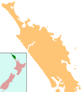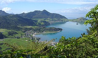
Whangārei is the northernmost city in New Zealand and the regional capital of Northland Region. It is part of the Whangarei District, a local body created in 1989 from the former Whangarei City, Whangarei County and Hikurangi Town councils, to administer both the city proper and its hinterland. The city population was estimated to be 54,400 in June 2020, an increase from 47,000 in 2001.

The Northland Region is the northernmost of New Zealand's 16 local government regions. New Zealanders sometimes refer to it as the Winterless North because of its mild climate. The main population centre is the city of Whangārei, and the largest town is Kerikeri. At the 2018 New Zealand census Northland recorded a surprising population growth spurt of 18.1% since the previous 2013 census, placing it as the fastest growing region of New Zealand, ahead of other strong growth regions such as the Bay of Plenty and Waikato.

Bream Head is a promontory on the east coast of Northland in the North Island of New Zealand. Located at the end of a 30 kilometre-long peninsula, the head juts into the Pacific Ocean to the southeast of Whangārei. The Hen and Chicken Islands are located off the headland at a distance of 12 kilometres.
Arakaninihi Island is a small island in the Northland Region of New Zealand. It lies off Taiharuru Head, directly east of Whangarei.

Ruakākā is a small town in the north of New Zealand approximately 30 kilometres south of Whangārei in the Bream Bay area. Originally a small beachside community, Ruakākā has seen development due to its proximity to the expansion of the country's only oil refinery at Marsden Point during the 1980s. A recently established timber processing plant at Marsden Point has further stimulated growth.
Whangarei Observatory is associated with the Northland Astronomical Society (NAS), and situated in the Heritage Park grounds, off State Highway 14 in Maunu, Whangarei, New Zealand.
Raumanga is a suburb of Whangārei in the Northland Region of New Zealand. The main campus of Northland Polytechnic is situated in Raumanga.

Marsden Point lies 30 kilometres (19 mi) southeast of Whangarei and around 140 kilometres (87 mi) from Auckland's CBD. It forms the south-eastern tip of the entrance to the Whangarei Harbour on the east coast of Northland, New Zealand.

Mount Manaia is a dominant landmark approximately 30 kilometres southeast of Whangarei city on the Whangarei Heads peninsula.

Whangarei District is a territorial authority district in the Northland Region of New Zealand that is governed by the Whangarei District Council. The district is made up in area largely by rural land, and includes a fifth of the Northland Region. It extends southwards to the southern end of Bream Bay, northwards to Whangaruru and almost to the Bay of Islands, and westwards up the Mangakahia River valley past Pakotai and almost to Waipoua Forest. It includes the Hen and Chicken Islands and the Poor Knights Islands.
Horahora is a suburb on the southwestern side of Whangarei, in Northland, New Zealand.

Ngātiwai or Ngāti Wai is a Māori iwi of the east coast of the Northland Region of New Zealand. Its historical tribal area or rohe stretched from Cape Brett in the north to Takatū Point on Tawharanui Peninsula in the south and out to Great Barrier Island, the Poor Knights Islands and other offshore islands.
Otangarei is a suburb of Whangarei, in Northland Region, New Zealand.

Whangārei Heads is a locality and promontory on the northern side of the Whangārei Harbour in Northland, New Zealand. Whangārei is 29 km (18 mi) to the north-west, and Ocean Beach is 8 km (5.0 mi) to the south-east, with Taurikura between the two. Mount Manaia rises to 420 metres to the east.

Otiria is a rural locality in the Northland Region of New Zealand's North Island. It neighbours Moerewa to the east, with the nearest major town, Kawakawa a few kilometres further eastwards. Other nearby localities include Pokapu to the south, Orauta to the west, and Hupara to the north.
The Mangapai River is a river of the Northland Region of New Zealand's North Island. It is perhaps better described as a silty arm of Whangarei Harbour, located 10 kilometres (6 mi) due south of Whangarei. Its average width is some 4 metres (13 ft), but the silty nature of its course means that the stream itself is far narrower.

Whangārei Central is the central suburb and business district of Whangārei, in the Northland Region of New Zealand's North Island.

The Northland District Health Board is a district health board with the focus on providing healthcare to an area in the upper North Island of New Zealand.
Kensington is a suburb of Whangārei, in Northland Region, New Zealand. It is about 2 kilometres north of the city centre. State Highway 1 runs through Kensington, The Western Hills form a boundary on the west, and Hātea River on the east.


