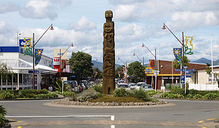
Whangaruru is a rural community and harbour on the east coast of Northland, New Zealand. Mokau, Helena Bay, Whakapara, Hikurangi and Whangarei are to the south and the Bay of Islands is to the northwest.[3][4]
The Whangaruru area includes the villages of Punaruku west of the harbour, Whangaruru north of the harbour, and Whangaruru North east of the harbour.
The area was reputedly named by Puhimoanariki who was sailing up the coast. After searching for a long time he found shelter from bad weather there.[5] The name "Whangaruru" is a Māori-language word meaning "sheltered harbour",[6] and is a direct linguistic cognate with "Honolulu" in the related Hawaiian language.
The hapū has several traditional meeting grounds in the Whangaruru and Panaruku area, including the Ngātiwai Marae and Ngāti Wai Soldiers' Memorial Hall, the Ōtetao Reti Marae and Hoori Reti meeting house, and the Tuparehuia Marae.[7][8]
In October 2020, the Government committed $444,239 from the Provincial Growth Fund to upgrade Ōtetao Reti Marae, creating 33 jobs. It also committed $295,095 to upgrade Ngātiwai Marae, creating 5 jobs.[9]
Demographics
Statistics New Zealand describes Ōakura-Whangaruru South as a rural settlement. The settlement covers 2.03km2 (0.78sqmi)[1] and had an estimated population of 200 as of June 2023,[2] with a population density of 99 people per km2. The settlement is part of the larger Whangaruru statistical area.
Hhistorical population for Ōakura-Whangaruru South
Ōakura-Whangaruru South had a population of 150 at the 2018 New Zealand census, an increase of 39 people (35.1%) since the 2013 census, and a decrease of 9 people (−5.7%) since the 2006 census. There were 66 households, comprising 81 males and 69 females, giving a sex ratio of 1.17 males per female. The median age was 60.4 years (compared with 37.4 years nationally), with 15 people (10.0%) aged under 15 years, 18 (12.0%) aged 15 to 29, 60 (40.0%) aged 30 to 64, and 57 (38.0%) aged 65 or older.
Ethnicities were 76.0% European/Pākehā, 30.0% Māori, 8.0% Pacific peoples, and 2.0% Asian. People may identify with more than one ethnicity.
Although some people chose not to answer the census's question about religious affiliation, 34.0% had no religion, 44.0% were Christian and 4.0% had other religions.
Of those at least 15 years old, 27 (20.0%) people had a bachelor's or higher degree, and 33 (24.4%) people had no formal qualifications. The median income was $21,100, compared with $31,800 nationally. 9 people (6.7%) earned over $70,000 compared to 17.2% nationally. The employment status of those at least 15 was that 33 (24.4%) people were employed full-time, 12 (8.9%) were part-time, and 3 (2.2%) were unemployed.[10]
Whangaruru statistical area
The statistical area of Whangaruru covers 469.26km2 (181.18sqmi)[1] and had an estimated population of 2,880 as of June 2023,[11] with a population density of 6.1 people per km2.
Historical population for the Whangaruru statistical area
Whangaruru statistical area had a population of 2,520 at the 2018 New Zealand census, an increase of 420 people (20.0%) since the 2013 census, and an increase of 453 people (21.9%) since the 2006 census. There were 858 households, comprising 1,323 males and 1,197 females, giving a sex ratio of 1.11 males per female. The median age was 44.1 years (compared with 37.4 years nationally), with 525 people (20.8%) aged under 15 years, 396 (15.7%) aged 15 to 29, 1,170 (46.4%) aged 30 to 64, and 432 (17.1%) aged 65 or older.
Ethnicities were 77.1% European/Pākehā, 35.7% Māori, 3.2% Pacific peoples, 1.1% Asian, and 1.5% other ethnicities. People may identify with more than one ethnicity.
The percentage of people born overseas was 10.5, compared with 27.1% nationally.
Although some people chose not to answer the census's question about religious affiliation, 54.6% had no religion, 33.6% were Christian, 1.3% had Māori religious beliefs, 0.1% were Hindu, 0.1% were Muslim, 0.1% were Buddhist and 1.7% had other religions.
Of those at least 15 years old, 267 (13.4%) people had a bachelor's or higher degree, and 426 (21.4%) people had no formal qualifications. The median income was $24,300, compared with $31,800 nationally. 210 people (10.5%) earned over $70,000 compared to 17.2% nationally. The employment status of those at least 15 was that 867 (43.5%) people were employed full-time, 306 (15.3%) were part-time, and 132 (6.6%) were unemployed.[12]
Education
Whangaruru School is a coeducational full primary (years 1-8) school with a roll of 28 students as of February 2024.[13][14] The school was founded in 2005 to replace Punaruku, Ngaiotonga Valley and Helena Bay Schools. It is on the site of the old Punaruku School.[15]
Te Kura Hourua ki Whangaruru was a secondary (years 9-13) partnership school opened in 2014,[16] and closed in 2016.[17]
Coromandel, also called Coromandel Town to distinguish it from the wider district, is a town on the Coromandel Harbour, on the western side of the Coromandel Peninsula, which is in the North Island of New Zealand. It is 75 kilometres east of the city of Auckland, although the road between them, which winds around the Firth of Thames and Hauraki Gulf coasts, is 190 km long. The population was 1,930 as of June 2023.
Ōpōtiki is a town in the eastern Bay of Plenty in the North Island of New Zealand. It houses the headquarters of the Ōpōtiki District Council, the mayor of Ōpōtiki and comes under the Bay of Plenty Regional Council.
Ōpunake is a small town on the southwest coast of Taranaki in New Zealand's North Island. It is located 45 kilometres southwest of New Plymouth. Rahotu is 16 km to the northwest. Manaia is 29 km to the southeast. State Highway 45 passes through the town. The town has a population of 1,440.
Kawakawa is a small town in the Bay of Islands area of the Northland Region of New Zealand. Kawakawa developed as a service town when coal was found there in the 1860s, but coal mining ceased in the early 20th century. The economy is now based on farming. The town is named after the kawakawa shrub.
Moerewa is a small town in the Northland Region of the North Island of New Zealand. It is located close to the Bay of Islands five kilometres to the west of Kawakawa.
Matauri Bay is a bay in New Zealand, situated 30 km north of Kerikeri, in Whangaroa county, just north of the Bay of Islands. It has over a kilometre of white sand and crystal clear water, making it a popular summer destinations for surfers, divers, fishers and holidaymakers.
Taharoa is a small village on the west coast of the North Island of New Zealand, to the southwest of Kawhia Harbour and overlooking Lake Taharoa.
Kaeo is a township in the Far North District of New Zealand, located some 22 km (14 mi) northwest of Kerikeri. The town's name comes from the Māori-language name of the New Zealand freshwater mussel, which is found in nearby rivers.
Nūhaka is a small settlement in the northern Hawke's Bay Region of New Zealand's eastern North Island, lying on State Highway 2 between Wairoa and Gisborne. The road to Mahia turns off the highway at Nūhaka.
Te Araroa is a town in the Gisborne Region of the North Island of New Zealand. It is situated 175 km north of Gisborne city, along State Highway 35 between Tokata and Awatere. Te Araroa is the birthplace of noted Māori politician Sir Āpirana Ngata. Māori in the area are generally associated with the Ngāti Porou iwi. It is 100 metres from its local beach.
Panguru is a community in the northern Hokianga harbour, in Northland, New Zealand. The Whakarapa Stream flows from the Panguru Range in the Warawara Forest to the west, through Panguru and into the Hokianga.
Kaiwaka, known as "the little town of lights", is a settlement in Northland, New Zealand. The Kaiwaka River runs from the east through the area and joins with the Wairau River to form the Otamatea River, which drains into the Kaipara Harbour. State Highway 1 passes through Kaiwaka. Wellsford is 20 kilometres (12 mi) south, Brynderwyn is 8 kilometres (5.0 mi) north, and Whangārei, the closest city, is 60 kilometres (37 mi) to the north. The Mangawhai Heads are 18 kilometres (11 mi) northeast of Kaiwaka.
Whangarei District is a territorial authority district in the Northland Region of New Zealand that is governed by the Whangarei District Council. The district is made up in area largely by rural land, and includes a fifth of the Northland Region. It extends southwards to the southern end of Bream Bay, northwards to Whangaruru and almost to the Bay of Islands, and westwards up the Mangakahia River valley past Pakotai and almost to Waipoua Forest. It includes the Hen and Chicken Islands and the Poor Knights Islands.
Otangarei is a suburb of Whangārei, in Northland Region, New Zealand.
Waitōtara is a town in South Taranaki, New Zealand. Waverley is 10 km to the north-west, and Whanganui is 34 km to the south-east. State Highway 3 passes through it. The Waitōtara River flows past the east side of the town.
Te Karaka is a small settlement inland from Gisborne, in the northeast of New Zealand's North Island. It is located in the valley of the Waipaoa River close to its junction with its tributary, the Waihora River. Te Karaka is located on State Highway 2, and is the largest settlement between Gisborne and Ōpōtiki in the Bay of Plenty.
Matapouri is a coastal settlement in the Whangarei District of Northland, New Zealand. It is 7 km north of Tutukaka and 35 km north-east of Whangārei, in an area known as the Tutukaka Coast. Matapouri was described by Whangarei District Council in 2010 as "an archetypal Kiwi bach settlement". Holiday homes make up 90 per cent of the houses and at holiday times the number of residents swells to seven times its permanent population.
Tutukaka is a locality on the east coast of Northland, New Zealand, in an area commonly referred to as the Tutukaka Coast which includes Ngunguru and Matapouri. The city of Whangārei is to the southwest. The residential areas of Tutukaka fringe the hills surrounding Tutukaka Harbour, which has a history as a local fishing port and hosts Tutukaka's marina. The Māori name comes from the term tūtū kākā, which means a parrot (kākā) snaring tree (tūtū).
Rotoiti is a settlement on the shore of Lake Rotoiti, in Rotorua Lakes within the Bay of Plenty Region of New Zealand's North Island.
Waitahanui is a village in the Taupō District, Waikato region, New Zealand. The village is on the eastern shore of Lake Taupō, 14 km (9 mi) south of the district seat of Taupō.
This page is based on this Wikipedia article Text is available under the CC BY-SA 4.0 license; additional terms may apply. Images, videos and audio are available under their respective licenses.