Tedieville, Missouri

Last updated

Tedieville, Missouri
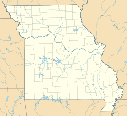
USA Missouri location map.svg
Red pog.svg
Tedieville, Missouri
Coordinates: 38°55′12″N93°16′20″W / 38.92000°N 93.27222°W / 38.92000; -93.27222
Country Flag of the United States (23px).png  United States
State Flag of Missouri.svg Missouri
County Pettis County
Township Longwood Township
Elevation
[1]
245 m (804 ft)
Time zone UTC-6 (Central (CST))
 • Summer (DST) UTC-5 (CDT)
ZIP code
65333
GNIS feature ID737947 [1]

Tedieville was an unincorporated community in northern Pettis County, Missouri, United States. [1]

The community was located on Missouri Route CC approximately 4.5 miles northeast of Houstonia and one mile south of the Pettis-Saline county line. [2]

History

A post office called Tedieville was established in 1887, and remained in operation until 1903. [3] It is unknown why the name "Tedieville" was applied to this community. [4]

References

  1. 1 2 3 U.S. Geological Survey Geographic Names Information System: Tedieville, Missouri
  2. ↑ Sweet Springs, MO 15 Minute Topographic Quadrangle, USGS, 1945
  3. ↑ "Post Offices". Jim Forte Postal History. Retrieved November 27, 2016.
  4. ↑ "Pettis County Place Names, 1928–1945". The State Historical Society of Missouri. Archived from the original on June 24, 2016. Retrieved November 27, 2016.