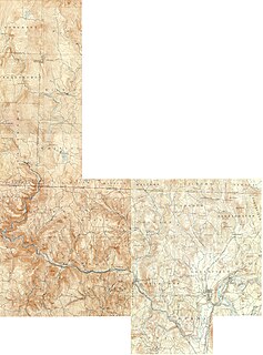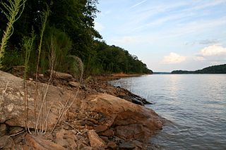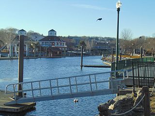
The Housatonic River is a river, approximately 149 miles (240 km) long, in western Massachusetts and western Connecticut in the United States. It flows south to southeast, and drains about 1,950 square miles (5,100 km2) of southwestern Connecticut into Long Island Sound. Its watershed is just to the west of the watershed of the lower Connecticut River. Birds and fish who live in and around the river contain significant levels of PCBs and present health risks.

The Ottawa River, also known as Ottawa Creek, is a short river, approximately 20 miles (32 km) long, in northwest Ohio and southeast Michigan in the United States. It drains an area on the Ohio-Michigan border along the eastern and northern fringes of the city of Toledo, goes through Ottawa Hills, and empties directly into Lake Erie. It is one of two rivers in northwestern Ohio that share the same name, along with the Ottawa River that is a tributary of the Auglaize River. The upper 4 miles (6 km) of the river in Michigan north of Sylvania, Ohio is called North Tenmile Creek on federal maps, while another branch rising in Fulton County, Ohio, is called Tenmile Creek.

Deerfield River is a river that runs for 76 miles (122 km) from southern Vermont through northwestern Massachusetts to the Connecticut River. The Deerfield was historically influential in the settlement of western Franklin County, Massachusetts, and its namesake town. The Deerfield River is the Connecticut River's second longest tributary in Massachusetts, 2.1 miles (3.4 km) shorter than the Metropolitan Springfield's Westfield River.

The Tugaloo River is a 45.9-mile-long (73.9 km) river bordering the U.S. states of Georgia and South Carolina. It was named for the Cherokee town of Tugaloo at the mouth of Toccoa Creek, near present-day Toccoa, Georgia and Travelers Rest in Stephens County, Georgia. It is fed by the Tallulah River and the Chattooga River, which each form an arm of Lake Tugalo, on the edge of Georgia's Tallulah Gorge State Park. The Tugaloo then flows out of the lake via Tugaloo Dam, passing into Lake Yonah and through Yonah Dam. The river then ends as an arm of Lake Hartwell, as does South Carolina's Seneca River. After flowing out of Lake Hartwell, it is called the Savannah River.

The Hockanum River is a river in Connecticut. Hockanum is derived from the Native American Podunk people Algonquin language word meaning "hook-shaped", so named because of the course of the river. The Hockanum neighborhood in East Hartford is named after it.

The Rio Chama, a major tributary river of the Rio Grande, is located in the U.S. states of Colorado and New Mexico. The river is about 130 miles (210 km) long altogether. From its source to El Vado Dam its length is about 50 miles (80 km), from El Vado Dam to Abiquiu Dam is about 51 miles (82 km), and from Abiquiu Dam to its confluence with the Rio Grande is about 34 miles (55 km).

The Dead River, sometimes called the West Branch, is a 42.6-mile-long (68.6 km) river in central Maine in the United States. Its source is Flagstaff Lake, where its two main tributaries, South Branch Dead River and North Branch Dead River, join. It flows generally east to join the Kennebec River at The Forks, Maine.

Big Pine Creek is a creek in northwestern Indiana, USA. It begins in Round Grove Township in southwestern White County and flows generally southward 51.3 miles (82.6 km) through Benton and Warren counties before meeting the Wabash River near the town of Attica. The lower section of the creek from Rainsville to the Wabash is used by canoeists, particularly during the spring when the water is at its highest, and local flora, fauna and geology can be observed.
The Hop River is a river that runs through Tolland County, Connecticut. The Hop River's marshy source is just southeast of Bolton Notch, Connecticut. It flows for about 15.0 miles (24.1 km) to its confluence with the Willimantic River. There is a popular paddling route beginning where the Skungamaug River enters the Hop River just north of the Hendee Road bridge and ending at the Willimantic River. Most of this route consists of quick-water, but a few Class I and Class II whitewater areas exist.
The Eightmile River has its source along a small drainage into several small swamps in an undeveloped region about three miles east of Bashan in the town of East Haddam, Connecticut. This source is fairly centered between Ackley Road, Hall Kilbourne Road, Usher Swamp Road, and Miles Standish Road. The Eightmile River runs for 13.4 miles (21.6 km) to Hamburg Cove near Hamburg, Connecticut.
The Blackledge River is a tributary of the Salmon River which courses 16.4 miles (26.4 km) through Eastern Connecticut in the United States.
The Jeremy River, named after Jeremy Adams, begins at a drainage just north of Holbrook Pond about 1.5 miles (2.4 km) east of Gilead, Connecticut and runs for 10.7 miles (17.2 km) to the Salmon River in Colchester, Connecticut. There are many swamps and marshes along the banks of its northern end, the largest of which is 1.5 miles (2.4 km) long.

The Nepaug River begins at the confluence of North Nepaug Brook and Cedar Swamp Brook about 1 mile east of Bakerville, Connecticut.

The Hammonasset River is formed about 4 miles (6.4 km) southeast of Durham, Connecticut along a gully on the north end of Bunker Hill at about a half mile northeast of the junction of Route 148 and Bunker Hill Road. The river travels for 21.0 miles (33.8 km) to Clinton Harbor on Long Island Sound just east of Hammonasset Beach State Park. A popular paddling route runs for about 10 miles (16 km) starting along Summer Hill Road about 2.5 miles (4.0 km) south on Route 79 from North Madison, Connecticut. This is a scenic river run with mostly flat and quickwater, but with a few Class I-II whitewater areas.

The Yantic River forms at the confluence of the Deep River, Sherman Brook, and Exeter Brook about 4 miles (6.4 km) east of Colchester, Connecticut. It runs for 14.2 miles (22.9 km) and flows into the Shetucket River in Norwich, forming the Thames River. The Yantic River is a popular whitewater paddling destination with a mix of quickwater and Class I-III whitewater. It passes through the towns of Lebanon, Bozrah, and Norwich.

Little Seneca Creek is an 14.0-mile-long (22.5 km) stream in Montgomery County, Maryland, roughly 18 miles (29 km) northwest of Washington, D.C.
The West Branch Tenmile River is a 5.0-mile-long (8.0 km) tributary of the Tenmile River in western Maine. It is part of the Saco River watershed, flowing to the Atlantic Ocean.
The East Aspetuck River is a 9.9-mile-long (15.9 km) river in Litchfield County, Connecticut, in the United States. It begins at Lake Waramaug, in the town of Washington, and flows south through New Preston and Northville, before emptying into the Housatonic River in New Milford.
Tenmile Creek is a 15.0-mile-long (24.1 km) tributary of Catskill Creek in Albany County, New York. Via Catskill Creek, it is part of the Hudson River watershed.
Eightmile Creek is an 11.8-mile-long (19.0 km) tributary of Tenmile Creek in Albany County, New York. Via Tenmile Creek and Catskill Creek, it is part of the Hudson River watershed. Eightmile Creek runs through the town of Westerlo into the town of Rensselaerville, where it joins Tenmile Creek at the hamlet of Medusa. The creek's source is near Onderdonk Lake by Snyders Corners in Westerlo.


