Tete | |
---|---|
Coordinates: 16°10′S33°36′E / 16.167°S 33.600°E | |
Country | Mozambique |
Province | Tete Province |
District | Cidade de Tete |
Area | |
• Total | 149.3 km2 (57.6 sq mi) |
Elevation | 140 m (460 ft) |
Population (2017 census) | |
• Total | 305,722 |
• Density | 2,000/km2 (5,300/sq mi) |
Climate | BSh |
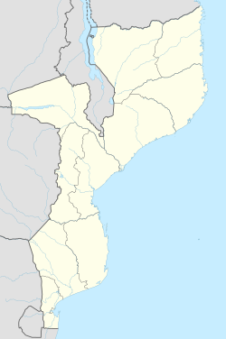
Tete is the capital city of Tete Province in Mozambique. It is located on the Zambezi River, and is the site of two of the four bridges crossing the river in Mozambique. A Swahili trade center before the Portuguese colonial era, Tete continues to dominate the west-central part of the country and region, and is the largest city on the Zambezi. In the local language, Nyungwe, Tete (or Mitete) means "reed".
The region was an important Swahili trade center before the Portuguese colonial era. On the east coast of Africa the Portuguese were drawn to Mozambique and the Zambezi river by news of a local ruler, the Munhumutapa, who was said to have had fabulous wealth in gold. In their efforts to reach the Munhumutapa, the Portuguese established in 1531 two settlements far up the Zambezi – one of them, at Tete, some 420 kilometres (260 mi) from the sea. The Munhumutapa Kingdom and gold mines remained autonomous and mostly isolated from the Portuguese. But in this region of east Africa – as in Portuguese Guinea and Angola in the west – Portuguese involvement became sufficiently strong to survive into the third quarter of the 20th century. Under Portuguese influence Tete had become a market centre for ivory and gold by the mid-17th century. Given a Portuguese town charter in 1761, it became a city of the Portuguese Overseas Province of Mozambique in 1959. After the Portuguese Colonial War in Portuguese Africa and the April 1974 military coup in Lisbon, the then Portuguese Overseas Province of Mozambique become an independent state. The newly independent People's Republic of Mozambique, created in 1975 after the exodus of Mozambique's ethnic Portuguese, descended into civil war between 1977 and 1992.[ citation needed ]
Chingozi Airport ( IATA : TET, ICAO : FQTT) on the northeastern side of the city has a 2.4 km paved runway. The one-kilometre-long Samora Machel Bridge, finished in 1973 by the Portuguese and designed by Edgar Cardoso, is a vital link on the major highway linking not just the northern and southern parts of the country, but Zimbabwe and Malawi as well. A second bridge south of the city was opened in late 2014 to allow traffic to Zambia or Malawi to bypass the provincial capital. [1] Tete's bridges, the rail Dona Ana Bridge, and the Armando Emilio Guebuza Bridge at Caia are the only bridges across the lower Zambezi.
Year | Population [2] |
---|---|
1997 census | 101,984 |
2007 census | 155,870 |
2017 census | 305,722 |
Projected to be the ninth fastest growing city on the African continent between 2020 and 2025, with a 5.56% growth. [3]
Tete has a hot semi-arid climate (Köppen climate classification BSh).
Climate data for Tete | |||||||||||||
---|---|---|---|---|---|---|---|---|---|---|---|---|---|
Month | Jan | Feb | Mar | Apr | May | Jun | Jul | Aug | Sep | Oct | Nov | Dec | Year |
Record high °C (°F) | 43 (109) | 43 (109) | 43 (109) | 43 (109) | 40 (104) | 39 (102) | 36 (97) | 40 (104) | 44 (111) | 45 (113) | 46 (115) | 44 (111) | 46 (115) |
Mean daily maximum °C (°F) | 33.5 (92.3) | 33.2 (91.8) | 33.3 (91.9) | 32.7 (90.9) | 31.0 (87.8) | 28.6 (83.5) | 29.0 (84.2) | 30.5 (86.9) | 33.6 (92.5) | 35.8 (96.4) | 36.2 (97.2) | 34.5 (94.1) | 32.7 (90.8) |
Daily mean °C (°F) | 28.5 (83.3) | 28.2 (82.8) | 28.1 (82.6) | 27.1 (80.8) | 24.7 (76.5) | 22.3 (72.1) | 22.3 (72.1) | 23.9 (75.0) | 26.9 (80.4) | 29.2 (84.6) | 30.0 (86.0) | 29.1 (84.4) | 26.7 (80.1) |
Mean daily minimum °C (°F) | 23.4 (74.1) | 23.2 (73.8) | 22.8 (73.0) | 21.4 (70.5) | 18.3 (64.9) | 16.0 (60.8) | 15.6 (60.1) | 17.3 (63.1) | 20.2 (68.4) | 22.6 (72.7) | 23.8 (74.8) | 23.6 (74.5) | 20.7 (69.2) |
Record low °C (°F) | 7 (45) | 8 (46) | 9 (48) | 11 (52) | 10 (50) | 7 (45) | 8 (46) | 9 (48) | 10 (50) | 10 (50) | 10 (50) | 11 (52) | 7 (45) |
Average precipitation mm (inches) | 166.7 (6.56) | 142.1 (5.59) | 95.5 (3.76) | 15.0 (0.59) | 5.8 (0.23) | 3.5 (0.14) | 2.9 (0.11) | 1.8 (0.07) | 0.8 (0.03) | 10.8 (0.43) | 45.6 (1.80) | 139.4 (5.49) | 629.9 (24.8) |
Average precipitation days | 10.8 | 9.2 | 6.6 | 2.4 | 0.9 | 1.2 | 1.0 | 0.4 | 0.2 | 1.1 | 4.4 | 9.6 | 47.8 |
Average relative humidity (%) | 69 | 73 | 67 | 61 | 60 | 61 | 59 | 54 | 47 | 43 | 54 | 62 | 59 |
Mean monthly sunshine hours | 201.5 | 192.1 | 235.6 | 240.0 | 254.2 | 243.0 | 235.6 | 272.8 | 267.0 | 282.1 | 249.0 | 204.6 | 2,877.5 |
Source 1: World Meteorological Organization, [4] Weltwetter Spiegel Online (sun and relative humidity) [5] | |||||||||||||
Source 2: BBC Weather [6] |
Mozambique, officially the Republic of Mozambique, is a country located in southeast Africa bordered by the Indian Ocean to the east, Tanzania to the north, Malawi and Zambia to the northwest, Zimbabwe to the west, and Eswatini and South Africa to the southwest. The sovereign state is separated from the Comoros, Mayotte and Madagascar by the Mozambique Channel to the east. The capital and largest city is Maputo.
The geography of Mozambique consists mostly of coastal lowlands with uplands in its center and high plateaus in the northwest. There are also mountains in the western portion. The country is located on the east coast of southern Africa, directly west of the island of Madagascar. Mozambique has a tropical climate with two seasons, a wet season from October to March and a dry season from April to September.
Portuguese Mozambique or Portuguese East Africa were the common terms by which Mozambique was designated during the period in which it was a Portuguese overseas province. Portuguese Mozambique originally constituted a string of Portuguese possessions along the south-east African coast, and later became a unified province, which now forms the Republic of Mozambique.
The Zambezi is the fourth-longest river in Africa, the longest east-flowing river in Africa and the largest flowing into the Indian Ocean from Africa. Its drainage basin covers 1,390,000 km2 (540,000 sq mi), slightly less than half of the Nile's. The 2,574 km (1,599 mi) river rises in Zambia and flows through eastern Angola, along the north-eastern border of Namibia and the northern border of Botswana, then along the border between Zambia and Zimbabwe to Mozambique, where it crosses the country to empty into the Indian Ocean.
The British Central Africa Protectorate (BCA) was a British protectorate proclaimed in 1889 and ratified in 1891 that occupied the same area as present-day Malawi: it was renamed Nyasaland in 1907. British interest in the area arose from visits made by David Livingstone from 1858 onward during his exploration of the Zambezi area. This encouraged missionary activity that started in the 1860s, undertaken by the Universities' Mission to Central Africa, the Church of Scotland and the Free Church of Scotland, and which was followed by a small number of settlers. The Portuguese government attempted to claim much of the area in which the missionaries and settlers operated, but this was disputed by the British government. To forestall a Portuguese expedition claiming effective occupation, a protectorate was proclaimed, first over the south of this area, then over the whole of it in 1889. After negotiations with the Portuguese and German governments on its boundaries, the protectorate was formally ratified by the British government in May 1891.
The Kingdom of Mutapa – sometimes referred to as the Mutapa Empire, Mwenemutapa, – was an African kingdom in Zimbabwe, which expanded to what is now modern-day Mozambique, Botswana, Malawi, and Zambia.
Sofala is a province of Mozambique. It has a population of 2,259,248. Beira is the capital of the province, named for the ruined port of Sofala which is 35 kilometres (22 mi) to the south.
Nampula is the capital city of Nampula Province in Northern Mozambique. With a population of 743,125, it is the third-largest city in Mozambique after Maputo and Matola. The city is located in the interior of Nampula Province, approximately 200 kilometers from the coast and is surrounded by plains and rocky outcrops. The city is a major regional centre for the entire Northern region of Mozambique, as well as parts of Central Mozambique and border areas of Malawi and Tanzania.
Southern Africa is the southernmost region of Africa. No definition is agreed upon, but some groupings include the United Nations geoscheme, the intergovernmental Southern African Development Community, and the physical geography definition based on the physical characteristics of the land.
The Makua people, also known as Makhuwa or Wamakua, are a Bantu ethnic group found in northern Mozambique and the southern border provinces of Tanzania such as the Mtwara Region. They are the largest ethnic group in Mozambique, and primarily concentrated in a large region to the north of the Zambezi River.
Maravi was a kingdom which straddled the current borders of Malawi, Mozambique, and Zambia, in the 16th century. The present-day name "Maláŵi" is said to derive from the Chewa word malaŵí, which means "flames". "Maravi" is a general name of the peoples of Malawi, eastern Zambia, and northeastern Mozambique. The Chewa language, which is also referred to as Nyanja, Chinyanja or Chichewa, and is spoken in southern and central Malawi, in Zambia and to some extent in Mozambique, is the main language that emerged from this empire.
The Island of Mozambique lies off northern Mozambique, between the Mozambique Channel and Mossuril Bay, and is part of Nampula Province. Prior to 1898, it was the capital of colonial Portuguese East Africa. With its rich history and sandy beaches, the Island of Mozambique is a UNESCO World Heritage Site and one of Mozambique's fastest-growing tourist destinations. It has a permanent population of approximately 14,000 people and is served by nearby Lumbo Airport on the Nampula mainland. The name of the country, Mozambique, is derived from the name of this island.
The Great East Road is a major road in Zambia and the main route linking its Eastern Province with the rest of the country. It is also the major link between Zambia and Malawi and between Zambia and northern Mozambique. However, the route does not carry as much traffic as many of the other regional arterial roads and between the main cities it serves, Lusaka and Chipata, it passes through rural and wilderness areas. In Lusaka the road forms the main arterial road for the eastern suburbs. The entire route from Lusaka to Chipata and the border with Malawi is designated the T4 road on Zambia's road network.
The Pink Map, also known as the Rose-Coloured Map, was a map prepared in 1885 to represent the Kingdom of Portugal's claim of sovereignty over a land corridor connecting the Portuguese colonies of Angola and Mozambique during the Scramble for Africa. The area claimed included most of modern-day Zimbabwe and large parts of modern-day Zambia and Malawi.
The Dona Ana Bridge spans the lower Zambezi River between the towns of Vila de Sena and Mutarara in Mozambique, effectively linking the two halves of the country. It was originally constructed as a railway bridge to link Malawi and the Moatize coal fields to the port of Beira.
Macanga is a district situated in the north part of Tete Province in the central region of Mozambique. Its administrative center is the town of Furancungo. The district is located in the north of the province, and borders with Dedza District and Lilongwe District of Malawi in the north, Angónia District in the east, Tsangano District in the southeast, Chiuta District in the south, and with Chifunde District in the west. The area of the district is 6,999 square kilometres (2,702 sq mi). It has a population of 112,551 as of 2007.
Caia is a town on the south bank of the Zambezi River in Sofala Province, Mozambique. It is a relatively small town with few modern facilities besides a petrol station and the neighbouring bank. Caia and surrounding communities have been experiencing an escalating HIV/AIDS epidemic, drawing national and foreign aid to the area, including a Canadian foundation called the Caia Connection based in Vila de Sena, 57.6 Kilometres north of Caia.
Chifunde District is a district of Tete Province in western Mozambique. The principal town is Chifunde. The district is located in the north of the province, and borders with Zambia in the north, Malawi in the northeast, Macanga District in the east, Chiuta District in the south, and with Marávia District in the west. The area of the district is 9,403 square kilometres (3,631 sq mi). It has a population of 101,811 as of 2007.
Railway stations in Mozambique include:
The Sena people are a Bantu ethnolinguistic group with origins in northwestern region of Mozambique, Sofala Province and Zambezia Province. They are also found in Malawi and Zimbabwe near their respective borders with Mozambique.