Teypana (alternate spelling “Teypama”) was the first pueblo to be called Socorro. This Piro pueblo was located close to present-day Socorro, New Mexico. A reference from 1598 suggests Teypana was on the west bank of the Rio Grande, downriver from the pueblo of Pilabó (the site of modern Socorro). Found in a partly flawed list of Piro pueblos, the reference is somewhat problematic. In 1598, Juan de Oñate and an advance party of his colonists were given food and water by the people of Teypana. In response, they named the settlement Socorro, which means “help” or “aid” in Spanish. By 1626, the name had become associated with the Piro pueblo of Pilabó, site of the first permanent mission in Piro territory, now buried under the town of Socorro, NM. [1]
It has been claimed that Teypana means “village flower” in the Piro language. [2] As the Piro language survives only in fragments, however, the meaning of the name Teypana, like all 17th-century Piro place names, remains unknown.
Michael Bletzer has done a lot of excavation on a site in the vicinity of Luis Lopez which he believes to be the Teypana village.
The Puebloans, or Pueblo peoples, are Native Americans in the Southwestern United States who share common agricultural, material, and religious practices. Among the currently inhabited Pueblos, Taos, San Ildefonso, Acoma, Zuni, and Hopi are some of the best-known. Pueblo people speak languages from four different language families, and each Pueblo is further divided culturally by kinship systems and agricultural practices, although all cultivate varieties of maize.

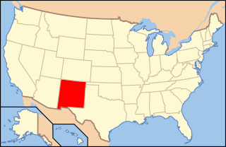
Socorro is a city in Socorro County in the U.S. state of New Mexico. It is in the Rio Grande Valley at an elevation of 4,579 feet (1,396 m). In 2010 the population was 9,051. It is the county seat of Socorro County. Socorro is located 74 miles (119 km) south of Albuquerque and 146 miles (235 km) north of Las Cruces.

Jornada del Muerto was the name given by the Spanish conquistadors to the Jornada del Muerto Desert basin, and the almost waterless 90-mile (140 km) trail across the Jornada beginning north of Las Cruces and ending south of Socorro, New Mexico. The name translates from Spanish as "Dead Man's Journey" or "Route of the Dead Man". The trail was part of the Camino Real de Tierra Adentro which led northward from central colonial New Spain, present-day Mexico, to the farthest reaches of the viceroyalty in northern Nuevo México Province.
Tiwa is a group of two, possibly three, related Tanoan languages spoken by the Tiwa Pueblo, and possibly Piro Pueblo, in the U.S. state of New Mexico.
The Pueblo Revolt of 1680, also known as Popé's Rebellion or Popay's Rebellion, was an uprising of most of the indigenous Pueblo people against the Spanish colonizers in the province of Santa Fe de Nuevo México, larger than present-day New Mexico. The Pueblo Revolt killed 400 Spaniards and drove the remaining 2,000 settlers out of the province. The Spaniards reconquered New Mexico twelve years later.
Piro people were a Native American tribe who lived in New Mexico during the 16th and 17th century. The Piros lived in a number of pueblos in the Rio Grande Valley around modern Socorro, New Mexico, USA. The now extinct Piro language may have been a Tanoan language. Numbering several thousand at the time of first contact with the Spanish, by the time of the Pueblo Revolt in 1680 the Piro had been decimated by European-introduced diseases and Apache attacks and most of the survivors resettled near El Paso, Texas.
Luis Lopez is an unincorporated community and census-designated place in Socorro County, New Mexico, United States. It lies between Socorro and San Antonio along the Rio Grande.

San Miguel de Socorro is the Catholic church in Socorro, New Mexico, built on the ruins of the old Nuestra Señora de Socorro mission. The old mission was built around 1627, but was destroyed in 1680 during the Pueblo Revolt. A portion of the adobe wall of the old church remains today and still can be seen behind glass just left of the altar. The building was listed on the National Register of Historic Places in 2016.
Pilabó was a former Piro pueblo located on the site of the present city of Socorro, New Mexico, United States. In 1598, the vanguard of the Spanish colonizing caravan under Juan de Oñate acquired food at the Piro pueblo of Teypana. The Spaniards named that pueblo “Socorro” which means “help” or “aid” in Spanish. Eventually, a different but nearby pueblo, Pilabó, would be given the name "Socorro" following the May/June 1626 founding of the mission of Nuestra Señora del Socorro. Some buried remains of Pilabó are still present south and southeast of the current church of San Miguel in Socorro.
The Piro pueblo of Senecú was the southernmost occupied pueblo in New Mexico prior to the Pueblo Revolt of 1680. It was located on the west bank of the Rio Grande within sight of the Piro pueblo of San Pasqual. Colonial Spanish documents consistently place the pueblo opposite of Black Mesa, which is near San Marcial. Due to changes in the floodplain and the establishment of San Marcial, however, no surface remains of the pueblo survive in the area.

New Mexico has a long history of wine production, within American wine, especially along the Rio Grande, from its capital Santa Fe, the city of Albuquerque with its surrounding metropolitan area, and in valleys like the Mesilla and the Mimbres River valleys. In 1629, Franciscan friar García de Zúñiga and a Capuchín monk named Antonio de Arteaga planted the first wine grapes in Santa Fe de Nuevo México, in what would become the modern Middle Rio Grande Valley AVA. Today, wineries exist in the aforementioned Middle Rio Grande Valley, as well as the Mesilla Valley AVA and the Mimbres Valley AVA.
The following is an alphabetical list of articles related to the U.S. state of New Mexico.
Senecú is a small Mexican village, now on the outskirts of Ciudad Juárez, Chihuahua. It is at an altitude of 1,123 m. and lies within the Chihuahuan Desert ecosystem.
Polvadera is an unincorporated community and census-designated place in Socorro County in central New Mexico, United States. It is located on the west bank of the Rio Grande, near the mouth of the Rio Salado, and on the western spur of El Camino Real de Tierra Adentro.
The Sevilleta National Wildlife Refuge is a protected area of New Mexico managed by the United States Fish and Wildlife Service as part of the National Wildlife Refuge System. It is located in the Chihuahuan Desert, 20 miles north of Socorro, New Mexico. The Rio Salado and the Rio Grande flow through the refuge.
The Tompiro Indians were Pueblo Indians living in New Mexico. They lived in several adobe villages east of the Rio Grande Valley in the Salinas region of New Mexico. Their settlements were abandoned and they were absorbed into other Pueblo Nations in the 1670s.
The Manso Indians were an indigenous people who lived along the Rio Grande, from the 16th to the 17th century. Present-day Las Cruces, New Mexico developed in this area. The Manso were one of the indigenous groups to be resettled at the Guadalupe Mission in what is now Ciudad Juarez, Mexico. Some of their descendants remain in the area to this day.

La Joya is a census-designated place in Socorro County, New Mexico, United States. The community is located on the east bank of the Rio Grande, 20 miles (32 km) north of Socorro. Its population was 82 as of the 2010 census. La Joya has a post office with ZIP code 87028, which opened on February 28, 1883.
Mesa del Contadero, sometimes called Black Mesa, also appeared on a 1773 Spanish map as Mesa de Senecú, is a basalt mesa that stands out on the east bank of the Rio Grande over three miles southwest of Val Verde in Socorro County, New Mexico. The mesa rises up dramatically from its lower surroundings in steep sides of 250 to 300 feet, particularly on the three sides where the river must pass around it to the west. It then levels off to a level area on top of an elevation of 4,810 feet, with a high point summit called Mesa Peak at 4,916 feet on the northeast edge of the Mesa.
San Pascual Pueblo was a Piro pueblo south and east of Socorro, in Socorro County, New Mexico, United States. Its ruins lie on the east bank of the Rio Grande, on a butte, on the western slope of the Little San Pascual Mountain, overlooking the river, near the eastern boundary of the Bosque del Apache National Wildlife Refuge.
