
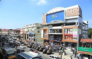
Kasaragod is a municipal town and administrative headquarters of Kasaragod district in the state of Kerala, India. Established in 1966, Kasaragod was the first municipal town in the district. It is the northernmost district of Kerala and is also known as Sapta Bhasha Sangama Bhumi.

Iritty is a Municipality and a Taluk of Kannur district in Kerala State, India. The town is the main market place for the farmer communities in the surrounding regions. Iritty is known as The Coorg Valley in God's Own Country. Iritty is at a distance of 20 km (12 mi) from Kannur International Airport and one among five taluks in Kannur district. Iritty is one of the major towns lies between Coorg and Kannur international airport -Mattanur.
Sultan Bathery is a town and municipality in the Wayanad district of Kerala, India, near its borders with Tamil Nadu and Karnataka. Once known as a strategic location in the Malabar region, Sultan Bathery is now the largest town in Wayanad, and is the headquarters of the Sultan Bathery taluk.

Pathanamthitta, is a municipality situated in the Southern Kerala, India, spread over an area of 23.50 km2. It is the administrative capital of Pathanamthitta district. The town has a population of 37,538. The Hindu pilgrim centre Sabarimala is situated in the Pathanamthitta district; as the main transport hub to Sabarimala, the town is known as the 'Pilgrim Capital of Kerala'. Pathanamthitta District, the thirteenth revenue district of the State of Kerala, was formed with effect from 1 November 1982, with headquarters at Pathanamthitta. Forest covers more than half of the total area of the District. Pathanamthitta District ranks the 7th in area in the State. The district has its borders with Allepey, Kottayam, Kollam and Idukki districts of Kerala and Tamil Nadu.Nearest City Is Thiruvalla,Located At A Distance Of 30 km .Thiruvalla Railway Station Is 30 km via Thiruvalla-Kumbazha Highway.Buses Ply Every 30 Minutes From Thiruvalla To Pathanamthitta & Vice Versa.

Cherupuzha is a town in Kannur district, Kerala, India. It is the headquarters of the Cherupuzha Panchayat which is a special grade panchayat in Kerala.
Perunad (Ranni-Perunad) is a scenic hilly village in Pathanamthitta district, Kerala state, India.Nearest Railway Station Is Thiruvalla Located At A Distance Of 62 km. It's located on the banks of Pamba River and Kakkadu River.

Chemperi is a town on the bank of the Chemperi River, in the Western Ghat, in the Kannur district of South India. Chemperi is often referred as the education city of Kannur with the establishment of Vimal Jyothi Engineering College, Chemperi. It is characterized by its production and export of rubber and spices, its beautiful hillocks, and its serene streams. Village and Panchayath of Chemperi is Eruvessi. Both Panchayath and Village offices of Eruvessi are located in Chemperi. Also Lourde Matha Forane Church, Chemperi is another attraction. Paithalmala and Palakkayam Thattu is also a few kilometres away.

Kulathuvayal is a place near Perambra in Kozhikode district of Kerala state, India. Administratively, Kulathuvayal comes under the Chakkittapara panchayat, Perambra block panchayat and Koyilandy Taluk.
Kuttikole is a village and Grama Panchayat in the Kasaragod district in the Indian state of Kerala.
Alakode is an emerging town and a panchayath in Kannur district in the Indian state of Kerala. It is located 46 km (29 mi) north of district headquarters Kannur. Alakode is located on Taliparamba-Manakadavu-Coorg Road. Alakode was one of the major centers of Malabar Migration.

Payyavoor is a small town in Kannur district in the Indian state of Kerala. It's the headquarters of Payyavoor Grama Panchayat.
Maloth (also known as malom) is a village in Kasaragod district of the state of Kerala., Maloth is a village in Western Ghats. It is situated in the Balal Panchayath of Kasaragod District of Kerala. It is a part of the Kasaragod Parliament constituency. Earlier it was in the Hosdurg assembly constituency which is renamed as Kanhangad after the delimitation of assembly constituencies in 2011. It shares borders with the Karnataka forest. Nearest towns are Kanhangad, Cherupuzha, and Nileshwaram. One can reach Maloth through bus from Kanhangad or from Cherupuzha. Private as well as KSRTC buses playing between Kanhangad and Konnakkad passes through the village.
Kodanchery is a town in Kozhikode district in the state of Kerala, India.

Chengara is a small village situated in the Pathanamthitta district in Kerala, India. It is known for its natural environment, hills and climate, and was found to have the cleanest air, in terms of concentration of dust particles. Chengara is surrounded on three sides by Harrisons Malayalam Limited, a rubber plantation company.

Kakkadampoyil, is a small village in Kozhikode district, Kerala, India bordered with Malappuram district. The village has recently emerged as a major tourist destination in the district.
Chavaragiri is a small rural village in Parappa Taluk in Kasaragod District of Kerala State, India. It comes under Palavayal Village in East Eleri Grama Panchayath. It is located 43 km towards East from Payyanur. The village is approximately 543 km from the State capital Thiruvananthapuram, Kerala.

Perla is an administrative capital of Enmakaje Panchayat, which is in Kasaragod district, Kerala, India.

Thabore is a hill top village in Kannur district in the Indian state of Kerala. Some parts of Thabore comes under Udayagiri, Kerala gram panchayat and the rest under Cherupuzha (Kannur) gram panchayat. Tourists come here to see the scenery of the hill station. A statue of Jesus Christ has been recently? installed on the hilltop which attracts a large number of tourists. Nearby places include Udayagiri, Thirumeni, Chathamangalam Hills and Kozhichal.

Chathamangalam (ചാത്തമംഗലം), also known as Chathamangalam Hills, Kannur Theruvamala or just Theruvamala, is a hill station village and trekking spot in Kannur district, Kerala, India alongside the Coorg boarder of the neighbouring Karnataka state, which consists of a vast plain of green grasslands that made it earn the nickname Evergreen Chathamangalam. It is located in the border of Cherupuzha, Alakode and Udayagiri Grama Panchayats.

Kunduthode is a small village in northeastern Kozhikode district, Kerala, in southwest India. It is under Nadapuram assembly constituency and Kavilumpara panchayath. The nearest town is Thottilpalam (6 km).