The Bay Hotel

Last updated

Bay Hotel
The Bay Hotel, Robin Hood's Bay - geograph.org.uk - 1474424.jpg
The Bay Hotel, Robin Hood's Bay
The Bay Hotel
Former namesNew Inn
General information
StatusOpen
Location Robin Hood's Bay, North Yorkshire
CountryEngland
Coordinates 54°25′49″N0°31′56″W / 54.4304°N 0.5321°W / 54.4304; -0.5321
Ordnance Survey NZ953048
Opened1843
Listed Building – Grade II
Designated6 October 1969
Reference no. 1148713

The Bay Hotel is a public house in Robin Hood's Bay, North Yorkshire, England. The pub is known for being a destination for coast-to-coast walkers, for once being washed into the sea (then rebuilt), and also for having its windows wrecked by the bowsprit of ship during a heavy storm. The Bay Hotel stands of the very edge of the sea wall at Robin Hood's Bay facing out towards the sea, and is the second inn to be sited at that location. It is a grade II listed building.

Contents

History

A public house was first recorded on the site in 1828 as the New Inn. [1] [2] That building is also recorded as having been washed into the North Sea in 1843. [3] The current building was built in the 1860s and "the sea washes its outer wall at high tide." [4] It is unknown exactly if any structural damage occurred, but in November 1893, The Romulus was wrecked on the rocks at Robin Hood's Bay during a storm, and the ships' bowsprit, or topsail yardarm, pierced the glass of the windows in the Bay Hotel. [5] [6] [7] A similar event occurred in 1878 when a ship wrecked in the bay smashed the building's windows due to the eastern frontage looking out immediately over the sea wall. [8] [9] [10] The rebuilt 1860s building was said to have "throbbed throughout" when the high tide lashed against its walls, but it had some protection in the form of a buttress protruding out onto the beach. [11] The site around the hotel was reinforced in 1974 by a concrete sea wall. [12]

The Bay Hotel used its own horses and stables until 1920 when the brewery owning the pub changed hands from Nesfields Brewery (Scarborough), to the Moor & Robson's Brewery (Hull). [13] The stables were then repurposed in the same year to become part of the Bay Hotel, with a second storey added on top of the stable block. [14] [15] During the North Sea Flood of 1953, the hotel was entirely surrounded by water. [3]

The pub is located adjacent to the Way Foot, a cobbled slipway that connects the beach with the road leading through the village. [16] Due to the Bay Hotel's proximity to the beach and water, it is often used as a restpoint for walkers completing the Coast to Coast walking route, who after dipping their boots into the North Sea, go to the pub to sign the visitor's book and buy a certificate of completion. [17] The basement–level bar in the pub is named the "Wainwright Bar" in honour of Alfred Wainwright, the creator of the coast–to–coast walk, and a plaque is affixed to an external wall marking the end of the 192 miles (309 km) route. [18] [19] The Robin Hood's Bay Folk Club have a regular meet and performance in the Wainwright Bar each week. [20] The Cleveland Way also passes close to the pub, with some walkers opting to pass by the hotel, and along the beach to Boggle Hole (tides permitting), rather than use the official path on the clifftop. [21] [22] [23]

The Bay Hotel has also been host to the ancient Court Leet of Fylingdales, which is still extant today and deals mostly with land enclosure issues. [5] It was also featured in the film the Turn of the Tide, the first picture produced by the The Rank Organisation. [24] The Bay Hotel is located within the Robin Hood's Bay conservation area, and is also a grade II listed building. [25] [26]

See also

Related Research Articles

<span class="mw-page-title-main">Fylingdales</span> Civil parish in North Yorkshire, England

Fylingdales is a civil parish in North Yorkshire, England situated south of Whitby, within the North York Moors National Park. It contains the villages of Robin Hood's Bay and Fylingthorpe and Fyling Hall School.
<span class="mw-page-title-main">Coast to Coast Walk</span> Walk from the west coast to the east coast of Britain

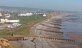
The Coast to Coast Walk is a long-distance footpath between the west and east coasts of Northern England, nominally 190-mile (306 km) long. Devised by Alfred Wainwright, it passes through three contrasting national parks: the Lake District National Park, the Yorkshire Dales National Park, and the North York Moors National Park. The current actual measured distance is reported as 182-mile (293 km).

<span class="mw-page-title-main">Robin Hood's Bay</span> Village in North Yorkshire, England

Robin Hood's Bay is a village in North Yorkshire, England. It is 6 miles (10 km) south of Whitby and 15 miles (24 km) north of Scarborough on the Yorkshire Coast.
<span class="mw-page-title-main">Goathland</span> Village and civil parish in North Yorkshire, England

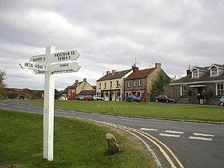
Goathland is a village and civil parish in the Scarborough district of North Yorkshire, England. Historically part of the North Riding of Yorkshire, it is in the North York Moors national park due north of Pickering, off the A169 to Whitby. It has a station on the steam-operated North Yorkshire Moors Railway line.
<span class="mw-page-title-main">Cropton</span> Village and civil parish in North Yorkshire, England

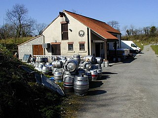
Cropton is a village and civil parish in the Ryedale district of North Yorkshire, England. It is on the border of the North York Moors National Park, 3 miles (5 km) north-west of Pickering.

<span class="mw-page-title-main">Robin Hood's Bay railway station</span> Former railway station in the North Riding of Yorkshire, England

Robin Hood's Bay railway station was a railway station on the Scarborough & Whitby Railway situated 15 miles (24 km) from Scarborough and 6 miles (9.7 km) from Whitby It opened on 16 July 1885, and served the fishing village of Robin Hood's Bay, and to a lesser extent the village of Fylingthorpe. On the north-bound journey trains had to climb a mile and a half at 1-in-43 out of the station.

<span class="mw-page-title-main">Robin Hood's Bay Marine Laboratory</span> Research unit in North Yorkshire, England

The Robin Hood's Bay Marine Laboratory was a marine scientific research and education unit in North Yorkshire, England, from 1912 to 1982. Purchased in 1998 by the National Trust, the previous structure was demolished, and the present building constructed to the style of the old coastguard station and opened as a visitor and interpretation centre.

<span class="mw-page-title-main">A169 road</span> Road in North Yorkshire, England

The A169 is an A road in North Yorkshire, England. It runs from the A64 at Malton on the edge of the Yorkshire Wolds through the Vale of Pickering and across the North York Moors to join the A171 just west of Whitby. It is a single carriageway for all of its 25-mile (40 km) route. Whilst it is not considered a Primary Route nationally, the Ryedale Local Transport Plan lists it as part of its Major Road Network alongside the A64, A166 and A171.

<span class="mw-page-title-main">Fylingthorpe</span> Village in North Yorkshire, England

Fylingthorpe is a village in the Fylingdales civil parish of North Yorkshire, England.

<span class="mw-page-title-main">Whitby Lifeboat Station</span> Lifeboat station in North Yorkshire, England

Whitby Lifeboat Station is a Royal National Lifeboat Institution (RNLI) lifeboat station located in Whitby, North Yorkshire, England. It is one of nine situated along the Yorkshire coast.

<span class="mw-page-title-main">Yorkshire coast fishery</span>

The Yorkshire coast fishery has long been part of the Yorkshire economy for centuries. The 114-mile (183 km) Yorkshire Coast, from the River Tees to the Humber estuary, has many ports both small and large where the fishing trade thrives. The historic ports at Hull and Whitby are important locations for the landing and processing of fish and shellfish. Scarborough and Bridlington are also sites of commercial fishing.

<span class="mw-page-title-main">The Fylingdales Group of Artists</span>

The Fylingdales Group of Artists is a group of Yorkshire-based artists in England.

<span class="mw-page-title-main">Lion Inn</span> Public house in North Yorkshire, England

The Lion Inn is a public house at Blakey Ridge, near Kirkbymoorside, in North Yorkshire, England. The building was completed between 1553 and 1558, and has been used as an inn for four centuries, sitting adjacent to a road across the moors between Castleton and Hutton-le-Hole. During the ironstone industry boom in Rosedale, it catered mainly for those engaged in the mining industry. The inn is known for being subjected to extremes of weather, like Tan Hill Inn, also in North Yorkshire.

<span class="mw-page-title-main">Lilla Cross</span> Ancient cross in North Yorkshire, England

Lilla Cross is a marker on Lilla's Howe, Fylingdales Moor, in North Yorkshire, England. A story relates how King Edwin of Northumbria placed the cross there to mark the grave of Lilla, one of his thegns who saved his life during an assassination attempt. Whilst the current cross is believed to date to the 10th century, the original was placed there in 626. Even so, Lilla Cross is known for being the oldest marker of its type on the North York Moors. The ancient cross marks the intersection of pathways across the moor, the edges of four parishes and is also a waymarker on the Lyke Wake Walk.
<span class="mw-page-title-main">Coastal erosion in Yorkshire</span> Erosion of the Yorkshire coastline, England

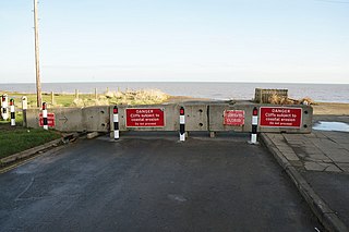
Coastal erosion in Yorkshire has been a process that has been documented since Roman times. Rates of erosion on the Holderness coast are known to be the worst within Europe, with the East Riding coastlines having the greatest number of at risk properties in England. Almost 30 settlements on the Holderness coastline have been lost to the sea, with more being subjected to flooding and loss exacerbated by a projected rise in the sea level caused by climate change. Due to the limited protection from effects of rising seas in the Humber Estuary, the region has the greatest value of assets at risk from flooding than anywhere else in England.

<span class="mw-page-title-main">Raw, North Yorkshire</span> Hamlet in North Yorkshire, England

Raw is a hamlet in the Borough of Scarborough of North Yorkshire, England, near to the villages of Fylingthorpe, Robin Hood's Bay, and Hawsker. The hamlet is mostly agricultural in nature and it lies 0.5-mile (0.8 km) north-west of Fylingthorpe, 4.5 miles (7.2 km) south-east of Whitby, and due east of the A171 road.

<span class="mw-page-title-main">Ramsdale Beck</span> Watercourse in North Yorkshire, England

Ramsdale Beck is a small river that feeds directly into the North Sea between Robin Hood's Bay and Ravenscar on the North Yorkshire coast in England. The stream, which rises on Fylingdales Moor, has two waterfalls, and historically was used to power two corn mills. The beck flows through a small ravine known as Ramsdale Valley. There is another Ramsdale Beck in Scarborough which connects Scarborough Mere and Falsgrave to the sea.

<span class="mw-page-title-main">Robin Hood's Bay Lifeboat Station</span> RNLI Lifeboat Station in North Yorkshire, England

Robin Hood's Bay Lifeboat Station was a Royal National Lifeboat Institution (RNLI) lifeboat station, situated at Robin Hood's Bay, on the coast of North Yorkshire, England. The lifeboat station had been operating for just over 100 years intermittently when it was closed by the RNLI in 1931. The withdrawal of the lifeboat capability from Robin Hood's Bay was due to the Whitby lifeboat being able to be launched from Whitby, and into the bay at Robin Hood's Bay, before the bay lifeboat itself could be manhandled into the sea.

<span class="mw-page-title-main">Beggar's Bridge</span> Bridge in North Yorkshire, England

Beggar's Bridge is a packhorse bridge straddling the River Esk in Glaisdale, North Yorkshire, England. The bridge dates back to 1619 and was reputedly built by a former poor farm worker who wanted to meet his love but could not due to the river being in flood. Having become rich working at sea, then becoming the mayor of Kingston upon Hull, Ferris built the bridge at that point when flooding prevented him crossing it years before. The structure is both a scheduled monument and a grade II* listed building.

<span class="mw-page-title-main">The Laurel Inn</span>

The Laurel Inn is a historic pub in Robin Hood's Bay, a village in North Yorkshire, in England.

References

  1. Chrystal, Paul (2017). The Place Names of Yorkshire; Cities, Towns, Villages, Rivers and Dales, some Pubs too, in Praise of Yorkshire Ales (1 ed.). Catrine: Stenlake. p. 114. ISBN   9781840337532.
  2. "Best bank holiday bars in Leeds and beyond" . infoweb.newsbank.com. 12 May 2018. Retrieved 26 September 2024.
  3. 1 2 Gower, E. (1978). Robin Hood's Bay. Clapham: Dalesman Books. p. 8. ISBN   0-8520-6462-4.
  4. Farnhill 1990, p. 98.
  5. 1 2 Farnhill 1990, p. 99.
  6. Pennock, Richard (2002). Robin Hood's Bay: as I have known it. Whitby: Caedmon Press. p. 55. ISBN   0905355563.
  7. "Terrific Gale". The Leeds Mercury. No. 17356. Column E. 20 November 1893. p. 8. OCLC   11968069.
  8. "Robin Hood's Bay". The Northern Echo. No. 7404. Column G. 20 November 1893. p. 3. OCLC   6685296.
  9. "Pub of the Week: The Bay Hotel, Robin Hood's Bay". The Yorkshire Post. 1 October 2016. Retrieved 26 September 2024.
  10. "Bay Hotel, Robin Hood's Bay". camra.org.uk. Retrieved 26 September 2024.
  11. Horne's guide to Whitby (5 ed.). Whitby: Horne and Son. 1897. p. 104. OCLC   876877898.
  12. "Robin Hood's Bay £1.7m sea wall scheme aims to start in May". BBC News. 19 January 2023. Retrieved 26 September 2024.
  13. Lidster, J. Robin (1983). Robin Hood's Bay in old picture postcards. Zaltbommel: European Library. p. 16. ISBN   9789028824782.
  14. Waters, Colin (2012). North Yorkshire coastal villages then & now. Stroud: The History Press. p. 79. ISBN   9780752467917.
  15. Pennock, Richard (2002). Robin Hood's Bay: as I have known it. Whitby: Caedmon Press. p. 9. ISBN   0905355563.
  16. Page, William (1968). The Victoria history of the county of York, North Riding volume 2. London: Dawsons of Pall Mall for the University of London Institute of Historical Research. p. 535. ISBN   0712903100.
  17. Barton, Bob (2020). Unusual pubs; amazing stories. Wellington: Halsgrove. p. 108. ISBN   978-0-85704-347-4.
  18. Pickles, Helen (16 September 2016). "The best pubs and bars in Yorkshire, from country inns to city hotspots" . infoweb.newsbank.com. Retrieved 26 September 2024.
  19. "Bay Hotel, Robin Hoods Bay". pubgallery.co.uk. 2 July 2024. Retrieved 26 September 2024.
  20. "Robin Hood's Bay and Boggle Hole | NYMNP". northyorkmoors.org.uk. Retrieved 26 September 2024.
  21. Bagshaw, Mike (2014). Slow Yorkshire Moors & Wolds: including York & the coast. Chalfont St Peter: Bradt. p. 96. ISBN   9781841625485.
  22. Sampson, Ian (1989). Cleveland Way. London: Aurum Press. p. 113. ISBN   0-3190-0175-X.
  23. Falconer, Alan A. (1972). The Cleveland Way. London: H.M.S.O. for the Countryside Commission. p. 110. ISBN   0117003298.
  24. Chrystal, Paul (2017). The Place Names of Yorkshire; Cities, Towns, Villages, Rivers and Dales, some Pubs too, in Praise of Yorkshire Ales (1 ed.). Catrine: Stenlake. p. 115. ISBN   9781840337532.
  25. "Conservation Area Character Appraisal and Management Plan Robin Hood's Bay" (PDF). northyorkmoors.org.uk. p. 6. Retrieved 26 September 2024.
  26. Historic England. "The Bay Hotel (Grade II) (1148713)". National Heritage List for England . Retrieved 26 September 2024.

Sources