Maldegem, earlier spelled Maldeghem, is a municipality located in the Belgian province of East Flanders. The municipality comprises the villages of Maldegem, Adegem and Middelburg. Kleit and Donk have always been separate hamlets of Maldegem. On 1 January 2018, Maldegem had a total population of 23,689. The total area is 94.64 square kilometres (36.54 sq mi) which gives a population density of 250 inhabitants per km².
Heusden-Zolder is a municipality located in the Belgian province of Limburg near Hasselt. On 1 January 2006 Heusden-Zolder had a total population of 30,769. The total area is 53.23 km² which gives a population density of 578 inhabitants per km².

Sint-Truiden is a city and municipality located in the province of Limburg, Flemish Region, Belgium, and has over 41.500 inhabitants, which makes it one of the largest cities in Limburg. The municipality includes the former communes of Aalst, Brustem, Duras, Engelmanshoven, Gelinden, Gorsem, Groot-Gelmen, Halmaal, Kerkom-bij-Sint-Truiden, Melveren, Metsteren, Ordingen, Runkelen, Velm, Wilderen, and Zepperen.

Châtelet is a city and municipality of Wallonia located in the province of Hainaut, Belgium. It lies on the river Sambre.
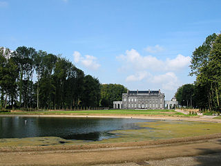
Seneffe is a municipality of Wallonia located in the province of Hainaut, Belgium.

Boussu is a municipality of Wallonia located in the province of Hainaut, Belgium.

Havelange is a municipality of Wallonia located in the province of Namur, Belgium.

Jemeppe-sur-Sambre is a municipality of Wallonia located in the province of Namur, Belgium.
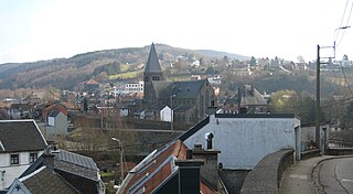
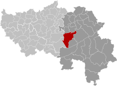
Pepinster is a municipality of Wallonia located in the province of Liège, Belgium.

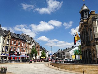
Vielsalm is a municipality of Wallonia located in the province of Luxembourg, Belgium. The town is part of the Arrondissement of Bastogne. It is the place of origin of the House of Salm.
Neufchâteau is a city and municipality of Wallonia located in the province of Luxembourg, Belgium.

The Moravian-Silesian Region is one of the 14 administrative regions of the Czech Republic. Before May 2001, it was called the Ostrava Region. The region is located in the north-eastern part of its historical region of Moravia and in most of the Czech part of the historical region of Silesia. The region borders the Olomouc Region to the west and the Zlín Region to the south. It also borders two other countries – Poland to the north and Slovakia to the east.

Křivoklát is a market town in Rakovník District in the Central Bohemian Region of the Czech Republic. It has about 700 inhabitants. It is known for the Křivoklát Castle.

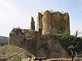
Franchimont Castle is a medieval castle in the municipality of Theux, Liège Province, Wallonia, Belgium. It sits at the western end of a small hill 2 kilometres (1.2 mi) south of the village of Theux, a sub-municipality.

Chiusa di Pesio is a comune (municipality) of 3,650 inhabitants in the Province of Cuneo in the Italian region Piedmont, located about 80 km south of Turin and about 15 km south-east of Cuneo, on the border with France.

Salinas del Manzano is a city of Spain in the province of Cuenca in the autonomous community of Castile-La Mancha. It has an area of 33.65 km2 with population of 105 inhabitants and a population density of 3.21 inhabitants / km2.

Bakov nad Jizerou is a town in Mladá Boleslav District in the Central Bohemian Region of the Czech Republic. It has about 5,000 inhabitants.

Sedlice is a town in Strakonice District in the South Bohemian Region of the Czech Republic. It has about 1,300 inhabitants. The town centre is well preserved and is protected by law as an urban monument zone.
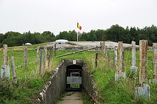
The Fort de Tancrémont is a Belgian fortification located about 3 kilometres (1.9 mi) south of Pepinster. The fort was built in the 1930s as part of the fortified position of Liège, augmenting the twelve original forts built to defend Liège in the 1880s with four more forts closer to the Belgian frontier with Germany. The fort was the last Belgian fort to surrender to German forces in the opening days of World War II, following the dramatic assault on Tancrémont's sister fort, Fort Eben-Emael. Tancrémont has been preserved and may be visited by the public.

The Marquessate of Franchimont was a lordship forming the western frontier of the Prince-Bishopric of Liège. Its base was Franchimont Castle. It was made up of the bans of Theux, Spa, Sart, Jalhay and later Verviers. The prince-bishops of Liège first took the title of marquis of Franchimont at the start of the 16th century, adding an outer wall to the castle.