Liège is the easternmost province of the Wallonia region of Belgium.

Belgium is a federal state comprising three communities and three regions that are based on four language areas. For each of these subdivision types, the subdivisions together make up the entire country; in other words, the types overlap.

Wezembeek-OppemDutch:[ˈʋeːzɛmˌbeːkˈɔpɛm] is a municipality in the Belgian province of Flemish Brabant, 10 kilometres (6.2 mi) east of the centre of Brussels. The municipality only comprises the town of Wezembeek-Oppem proper. On January 1, 2016, Wezembeek-Oppem had a total population of 14,095. The total area is 6.82 km2 (2.63 sq mi) which gives a population density of 2,066 inhabitants per square kilometre (5,350/sq mi).

Amel is a Belgian municipality in the Walloon province of Liège, and is part of the German-speaking Community of Belgium. On January 1, 2013, the municipality of Amel had a total population of 5,466. The total area is 125.15 km2 which gives a population density of 44 inhabitants per km2.

Burg-Reuland is a municipality located in the Belgian province of Liège. The name of the municipality refers to the castle "Burg-Reuland", which is located in the center of the community. On January 1, 2006, Burg-Reuland had a total population of 3,903. The total area is 108.96 km2 which gives a population density of 36 inhabitants per km2. Burg-Reuland is one of the municipalities of the German-speaking Community of Belgium.

Bütgenbach is a municipality located in the Belgian province of Liège. On January 1, 2006, Bütgenbach had a total population of 5,574. The total area is 97.31 km2 which gives a population density of 57 inhabitants per km2. As part of the German-speaking Community of Belgium, the official language in this municipality is German.
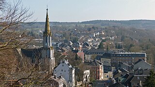
Eupen is the capital of German-speaking Community of Belgium and is a city and municipality in the Belgian province of Liège, 15 kilometres from the German border (Aachen), from the Dutch border (Maastricht) and from the "High Fens" nature reserve (Ardennes). The town is also the capital of the Euroregion Meuse-Rhine.

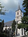
St. Vith is a city and municipality of East Belgium located in the Walloon province of Liège. It was named after Saint Vitus. The majority language here is German, as in the rest of the German Speaking Community of Belgium.

Waimes is a municipality of Wallonia located in the province of Liège, Belgium.

The German-speaking Community, also known as East Belgium, is one of the three federal communities of Belgium, with an area of 854 km2 (330 sq mi) in the Liège Province of Wallonia, including nine of the eleven municipalities of Eupen-Malmedy. The primary language of the community is German, making this the third official language in Belgium. Traditionally the community and the wider area around it forms an intersection of various local languages and/or dialects, namely Limburgish, Ripuarian and Moselle Franconian varieties. The community population numbers around 77,949 – about 7.0% of Liège Province and about 0.7% of the national total.

The Flemish Region, usually simply referred to as Flanders, is one of the three regions of Belgium—alongside the Walloon Region and the Brussels-Capital Region. Covering the northern portion of the country, the Flemish Region is primarily Dutch-speaking. With an area of 13,522 km2 (5,221 sq mi), it accounts for only 45% of Belgium's territory, but 57% of its population. It is one of the most densely populated regions of Europe with around 490/km2 (1,300/sq mi).

In Belgium, there are 27 municipalities with language facilities, which must offer linguistic services to residents in Dutch, French, or German in addition to their single official languages. All other municipalities – with the exception of those in the bilingual Brussels region – are monolingual and only offer services in their official languages, either Dutch or French.

Münchenwiler is a municipality in the Bern-Mittelland administrative district in the canton of Bern in Switzerland.

Eynatten is a village in the Belgian municipality of Raeren, part of the German-speaking Community of Belgium. Eynatten is on the border to Germany, 6 kilometres south from Aachen. Around half of the population are non-Belgians, most of them Germans.

Saint-Cergue is a municipality in the district of Nyon in the canton of Vaud in Switzerland.

Eupen-Malmedy is a small, predominantly German-speaking region in eastern Belgium. It consists of three administrative cantons around the towns of Eupen, Malmedy, and Sankt Vith which encompass some 730 square kilometres (280 sq mi). Elsewhere in Belgium, the region is commonly referred to as the East Cantons.
Innertkirchen is a village and municipality in the Interlaken-Oberhasli administrative district in the canton of Bern in Switzerland. On 1 January 2014, the former municipality of Gadmen was merged into the municipality of Innertkirchen.

Paradiso is a municipality in the district of Lugano in the canton of Ticino in Switzerland. It lies on the shore of Lake Lugano and, although administratively independent of the city of Lugano, it is surrounded on all other sides by that city.

Mathias Hubert Paul Cormann is a Belgian-born Australian politician and diplomat who currently serves as Secretary-General of the Organisation for Economic Co-operation and Development (OECD), having assumed the office on 1 June 2021.

Hauset is a village in the Belgian municipality of Raeren, part of the German-speaking Community of Belgium. The village is around 260m over Mean Sea Level, along the small river Geul and borders the Forest of Aachen. The population, around 1700 inhabitants, is German-speaking and is about half of German citizens who come from the Aachen region. Hauset is on the border to Germany, close to Aachen. Adjacent Belgian villages are Hergenrath, Walhorn and Eynatten.