
Liège is the easternmost province of Wallonia and Belgium.

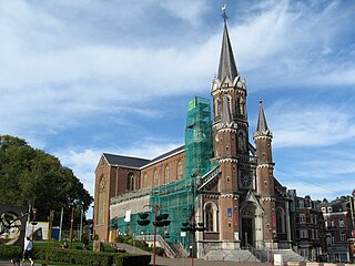
Middelkerke is a municipality located in the Belgian province of West Flanders, on the North Sea, west of Ostend. The municipality comprises the villages of Leffinge, Lombardsijde, Mannekensvere, Middelkerke proper, Schore, Sint-Pieters-Kapelle, Slijpe, Westende and Wilskerke. On January 1, 2006, Middelkerke had a total population of 17,841. The total area is 75.65 km2 which gives a population density of 236 inhabitants per km2.

Leopoldsburg is a municipality located in the Belgian province of Limburg. On January 1, 2006, Leopoldsburg had a total population of 14,403. The total area is 22.49 km² which gives a population density of 640 inhabitants per km². It is situated near the important military base at Beverloo Camp. The municipality consists of the following sub-municipalities: Leopoldsburg proper and Heppen.

Quaregnon is a municipality of Wallonia located in the province of Hainaut, Belgium.

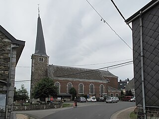
Burg-Reuland is a municipality located in the Belgian province of Liège. The name of the municipality refers to the castle "Burg-Reuland", which is located in the center of the community. On January 1, 2006, Burg-Reuland had a total population of 3,903. The total area is 108.96 km² which gives a population density of 36 inhabitants per km². Burg-Reuland is one of the municipalities of the German-speaking Community of Belgium.

Bütgenbach is a municipality located in the Belgian province of Liège. On January 1, 2006, Bütgenbach had a total population of 5,574. The total area is 97.31 km² which gives a population density of 57 inhabitants per km². As part of the German-speaking Community of Belgium, the official language in this municipality is German.
Dison is a municipality of Wallonia located in the province of Liège, Belgium.
Jalhay is a municipality of Wallonia located in the province of Liège, Belgium.

Waimes is a municipality of Wallonia located in the province of Liège, Belgium.

Welkenraedt is a municipality of Wallonia located in the province of Liège, Belgium.

Chidambaram is a town and municipality in Cuddalore district in the Indian state of Tamil Nadu, on the banks of the Vellar River where it meets the Bay of Bengal. It is the headquarters of the Chidambaram taluk. The town is believed to be of significant antiquity and has been ruled, at different times, by the Pallavas until ninth century, Medieval Cholas, Later Cholas, Later Pandyas, Vijayanagar Empire, Thanjavur Nayakas, Marathas and the British. The town is known for the Thillai Nataraja Temple and Thillai Kali Temple, and the annual chariot festival held in the months of December–January and June to July. One of the Divya Desams Divya Sri Govindaraja Perumal Temple (Thiruchitrakoodam) is a part of Thillai Nataraja Temple complex. Thiruvetkalam Shiva Temple, Vadakiruppu, Thirunelvayil Shiva Temple, Sivapuri and Tirukkazhippalai Palvannanathar Temple are the other three ancient Shiva temples in the region.

Virgem da Lapa is a Brazilian municipality located in the northeast of the state of Minas Gerais. Its population as of 2020 was estimated to be 13,740 people living in a total area of 871 km2 (336 sq mi). The city belongs to the mesoregion of Jequitinhonha and to the microregion of Araçuaí. It became a municipality in 1948.

Belmiro Braga is a city in the state of Minas Gerais, Brazil close to the border with Rio de Janeiro state. It was emancipated from Juiz de Fora in 1962. As of 2020, the estimated population was 3,425 inhabitants.

Minamisatsuma is a city located in Kagoshima Prefecture, Japan. It is on the western side of the Satsuma Peninsula.

Kulithalai is a municipality Karur district & Sub-urb of Tiruchirapalli City in the Indian state of Tamil Nadu. The recorded history of Kulithalai is known from Cheras, followed by medieval Chola period of the 9th century and has been ruled, at different times, by the Medieval Cholas, Later Cholas, Later Pandyas, Vijayanagar Empire and the British.

Sengottai is a town in the Tenkasi district, of Tamil Nadu, India. It is the gateway to southern Tamil Nadu and Kerala. Spread over an area of 2.68 km2 with a population of over 26,823, the economy of the town revolves around the cultivation of rice.

Aricanduva is a municipality in the northeast of the Brazilian state of Minas Gerais. As of 2020 the population was 5,269 in a total area of 243 km². The elevation is 682 meters. It is part of the IBGE statistical meso-region of Jequitinhonha and the micro-region of Capelinha. It became a municipality in 1995.

Coronel Murta is a Brazilian municipality located in the northeast of the state of Minas Gerais. Its population as of 2020 was estimated to be 9,215 people living in a total area of 813 km². The city belongs to the mesoregion of Jequitinhonha and to the microregion of Araçuaí. It became a municipality in 1953.
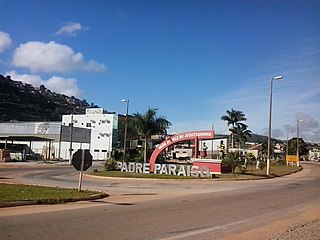
Padre Paraíso is a Brazilian municipality located in the northeast of the state of Minas Gerais. Its population as of 2020 was estimated to be 20,252 people living in a total area of 543 km². The city belongs to the mesoregion of Jequitinhonha and to the microregion of Araçuaí. It became a municipality in 1962.


