
Elland is a market town in Calderdale, in the county of West Yorkshire, England. It is situated south of Halifax, by the River Calder and the Calder and Hebble Navigation. Elland was recorded as Elant in the Domesday Book of 1086. It had a population in 2001 of 14,554, with the ward being measured at 11,676 in the 2011 Census.
Anston is a civil parish in South Yorkshire, England, formally known as North and South Anston. The parish of Anston consists of the settlements of North Anston and South Anston, divided by the Anston Brook.
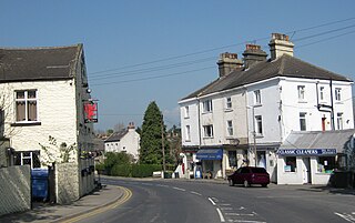
Dinnington is a town in the civil parish of Dinnington St John's, in the Metropolitan Borough of Rotherham, in South Yorkshire, England. It is near to the towns of Worksop and Rotherham and cities of Sheffield and Doncaster.

Woodsetts is a village and civil parish in the Metropolitan Borough of Rotherham in South Yorkshire, England, on the border with Nottinghamshire. It lies between the towns of Dinnington and Worksop at an elevation of around 60 metres above sea level, and has a population of 1,746 at the 2011 Census. The village originated as a medieval farming hamlet of the manor of Anston, nestled amongst the ancient woodland of which a few patches remain. The village grew rapidly in the late 19th century when a colliery was sunk at Dinnington. The village now serves as a commuter base for travellers between nearby towns.

Dinnington is a village and civil parish in the English county of Somerset, situated 4 miles (6.4 km) north of Crewkerne in the South Somerset district. The village has a population of 65.

Buckden is a village and civil parish in the Craven district of North Yorkshire, England. Historically part of the West Riding of Yorkshire, Buckden is situated in the Yorkshire Dales National Park, and on the east bank of the River Wharfe in Wharfedale. The civil parish includes the hamlet of Cray and the whole of Langstrothdale. According to the 2011 Census the parish had a population of 187.

Felixkirk is a village and civil parish in the former Hambleton District of North Yorkshire, England. The village is situated about three miles north-east of Thirsk. The population of the civil parish was estimated at 100 in 2014.
Kiveton Park was a rural district in the West Riding of Yorkshire from 1894 to 1974.

Thorner is a rural village and civil parish in the City of Leeds in West Yorkshire, England, located between Seacroft and Wetherby. It had a population of 1,646 at the 2011 Census.

Hampsthwaite is a large village and civil parish in Nidderdale in the Harrogate district of North Yorkshire, England. It lies on the south bank of the River Nidd 5 miles (8 km) north west of Harrogate. In the 2011 census the parish had a population of 1,083.

Hemingbrough is a village and civil parish in North Yorkshire, England, approximately 5 miles (8 km) from Selby and 4 miles (6.4 km) from Howden on the A63. It was in the historic East Riding of Yorkshire, but since 1974 has come under North Yorkshire. The village has a 12th-century former collegiate church, a Methodist chapel and shops. There is a primary school and nursery. The surrounding area makes up part of the Humberhead Levels and is flat land, mainly used for mixed agriculture. In 2011 the parish had a population of 2020.
Shadwell is a village and civil parish in north-east Leeds, West Yorkshire, England. The village is 6 miles (9.7 km) to the north east of Leeds city centre.

Halton Gill is a hamlet and civil parish in Littondale in the Yorkshire Dales in North Yorkshire, England. It is situated 2 miles (3.2 km) up Littondale from Litton. A minor road leads south west to Silverdale and Stainforth in Ribblesdale.

Spennithorne is a village and civil parish in lower Wensleydale in North Yorkshire, England. The village is situated 2 miles (3.2 km) south-east of the market town Leyburn, on a slight elevation above the River Ure, which forms the southern boundary of the parish. The village is overlooked by the steeple of St Michael and All Angels Church.

Fewston is a village and civil parish in the Harrogate district of North Yorkshire, England. It is situated north of Otley and close to Swinsty and Fewston reservoirs.

Gisburn is a village and civil parish within the Ribble Valley borough of Lancashire, England. Historically within the West Riding of Yorkshire, it lies 8 miles (13 km) northeast of Clitheroe and 11 miles (18 km) west of Skipton. The civil parish had a population of 506, recorded in the 2001 census, increasing to 521 at the 2011 Census.

High Abbotside is a civil parish in the Richmondshire district of North Yorkshire, England. It is a rural parish on the north side of upper Wensleydale, and includes the settlements of Hardraw, Sedbusk and several hamlets.

St John's Church is a redundant Anglican church near the village of Throapham, on the road between Dinnington and Laughton-en-le-Morthen, South Yorkshire, England. It is recorded in the National Heritage List for England as a designated Grade I listed building, and is under the care of the Churches Conservation Trust.
Hartwith cum Winsley is a civil parish in former Harrogate district, North Yorkshire, England. Historically it was a township in the ancient parish of Kirkby Malzeard in the West Riding of Yorkshire, a detached part of that parish. It became a separate civil parish in 1866, and was transferred to North Yorkshire in 1974.
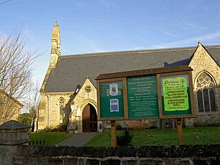
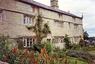
Dinnington St. John's is a civil parish in the Metropolitan Borough of Rotherham, South Yorkshire, England. The parish contains nine listed buildings that are recorded in the National Heritage List for England. Of these, one is listed at Grade I, the highest of the three grades, one is at Grade II*, the middle grade, and the others are at Grade II, the lowest grade. The parish contains the town of Dinnington, the hamlet of Throapham, and the surrounding countryside. Most of the listed buildings are houses and associated structures, and the others are a church, and the remains of a medieval cross.


