Thurso, Quebec

Last updated

Thurso
Thurso QC.jpg
City entrance
Blason ville ca Thurso (Quebec).svg
Thurso Quebec location diagram.png
Location within Papineau RCM
Canada Western Quebec location map.png
Red pog.svg
Thurso
Location in western Quebec
Coordinates: 45°35′49″N75°14′36″W / 45.59694°N 75.24333°W / 45.59694; -75.24333 [1]
Country Canada
Province Quebec
Region Outaouais
RCM Papineau
ConstitutedJanuary 16, 1886
Government
[2]
  MayorBenoit Lauzon
   Federal riding Argenteuil—La Petite-Nation
   Prov. riding Papineau
Area
  Total7.40 km2 (2.86 sq mi)
  Land6.65 km2 (2.57 sq mi)
Population
 (2021) [3]
  Total3,084
  Density463.8/km2 (1,201/sq mi)
  Pop 2016-2021
Increase2.svg 9.4%
  Dwellings
1,510
Time zone UTC−5 (EST)
  Summer (DST) UTC−4 (EDT)
Postal code(s)
Area code 819
HighwaysQc148.svg R-148
Qc317.svg R-317
Website ville.thurso.qc.ca OOjs UI icon edit-ltr-progressive.svg

Thurso is a city in Papineau Regional County Municipality in the Outaouais region of western Quebec, Canada. It is located opposite Clarence, Ontario on the Ottawa River, and is within Canada's National Capital Region. Its population was 3,084 as of the 2021 Canadian Census.

Contents

History

In 1807, a group of Scots settled in the southern part of the Blanche River valley, in the township known at the time as Lochaber Gore. They came from Thurso in Scotland, as well as from the Highlands, near Lochaber and other parts of northern Scotland. In 1830, Irish immigrants arrived, followed by French Canadians around 1840. [1]

In 1822, a Baptist Church was established, and in 1853, the post office opened, causing a controversy: the Catholic community suggested naming it Fraserville, while the Scottish community favored Cameron, because most were from this clan. The postmaster settled on the name Thurso, since there already was a place called Fraserville in Canada. In 1886, the town was incorporated as a village municipality, which was followed by the establishment of the religious and civil parish the next year. [1]

Starting in 1850, Thurso became an important centre of the wood industry. In 1929, the Singer Manufacturing Co. opened a sewing machine plant there. Around the same time construction began on a 90 kilometres (56 mi) long railroad for the transportation of lumber from the interior (which closed in 1986 [4] ). In 1956, the paper mill opened. [1]

In 1963, Thurso changed its statutes and became a ville (town/city). [1]

Earthquakes

Wikinews-logo.svg Earthquake Hits Ottawa, Canada at Wikinews

An earthquake with a magnitude of 4.5 was centred north in Thurso at 8:39 pm, on February 24, 2006. Another earthquake with a magnitude of 4.1 was centred in Thurso at 3:39pm on September 18, 2006.

Demographics

In the 2021 Census of Population conducted by Statistics Canada, Thurso had a population of 3,084 living in 1,421 of its 1,510 total private dwellings, a change of 9.4% from its 2016 population of 2,818. With a land area of 6.65 km2 (2.57 sq mi), it had a population density of 463.8/km2 (1,201.1/sq mi) in 2021. [5]

Canada census – Thurso, Quebec community profile
2021 2016 2011
Population3,084 (9.4% from 2016)2,818 (14.8% from 2011)2,455 (6.8% from 2006)
Land area6.65 km2 (2.57 sq mi)6.28 km2 (2.42 sq mi)6.27 km2 (2.42 sq mi)
Population density463.8/km2 (1,201/sq mi)449.0/km2 (1,163/sq mi)391.8/km2 (1,015/sq mi)
Median age41.6 (M: 41.6, F: 41.6)39.8 (M: 39.6, F: 40.0)45.0 (M: 43.7, F: 45.7)
Private dwellings1,510 (total) 1,308 (total) 1,075 (total) 
Median household income$62,000$53,077$45,825
References: 2021 [6] 2016 [7] 2011 [8] earlier [9] [10]
Historical census populations – Thurso, Quebec
YearPop.±%
1891 578    
1901 525−9.2%
1911 601+14.5%
1921 538−10.5%
1931 1,292+140.1%
1941 1,295+0.2%
1951 1,973+52.4%
1956 2,324+17.8%
1961 3,310+42.4%
1966 3,332+0.7%
1971 3,219−3.4%
1976 3,066−4.8%
1981 2,780−9.3%
1986 2,578−7.3%
1991 2,507−2.8%
1996 2,498−0.4%
2001 2,446−2.1%
2006 2,299−6.0%
2011 2,455+6.8%
2016 2,818+14.8%
2021 3,084+9.4%
Source: Statistics Canada

Mother tongue: [3]

Economy

Thurso is known for the unpleasant odour emanating from its paper mill, which originates from the burning of chemical residue when the pulp is manufactured and the smell was there well before the retaining basin was built. Fortress Paper employs 335 people in Thurso to produce 250,000 tonnes of hardwood kraft market pulp. However, the company had financial difficulties and led to its operations temporarily being shut down in 2006 and again for an eight-week period in 2009.

The Lauzon sawmill was another major employer for the community, but its building was destroyed by a fire on March 8, 2007, putting 100 workers temporarily out of work. However, plans for relaunching the production activity started shortly after the event.

Thurso's only bar/hotel, Hotel Lafontaine, burned twice in 2009, once in February and again a month later, with the latter fire resulting in complete destruction. In 2010, Hotel Lafontaine reopened just beside its previous location.

Infrastructure

Thurso's main access roads are currently Route 148 (running west–east) and Route 317 (running south–north). Autoroute 50, approximately 3 km north of Thurso along Route 317 complements Route 148 as Thurso's second connection to Gatineau and Ottawa. The Quebec Gatineau Railway provides rail freight transport.

A seasonal ferry operates between Thurso and Clarence-Rockland, Ontario.

Notable people

Hockey legend Guy Lafleur was born in Thurso and has an arena and street named after him.

Bill Clement, another NHL player who went on to become a well-known hockey commentator, also came from Thurso during the same time period as Lafleur.

Gerry Monaghan, former MPP for Sudbury provincial electoral district.

Related Research Articles

<span class="mw-page-title-main">Gatineau</span> City in Quebec, Canada

Gatineau is a city in south western Quebec, Canada. It is located on the northern bank of the Ottawa River, immediately across from Ottawa, Ontario. Gatineau is the largest city in the Outaouais administrative region and is part of Canada's National Capital Region. As of 2021, Gatineau is the fourth-largest city in Quebec with a population of 291,041, and a census metropolitan area population of 1,488,307 making it the fourth largest in Canada.

<span class="mw-page-title-main">Maniwaki</span> City in Quebec, Canada

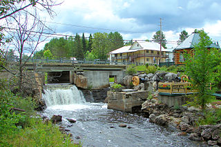
Maniwaki is a town in the province of Quebec, Canada. It is situated 130 kilometres (81 mi) north of Ottawa, Ontario, on the Gatineau River, at the crossroads of Route 105 and Route 107, near Route 117. The town is the administrative centre for La Vallée-de-la-Gatineau Regional County Municipality.

<span class="mw-page-title-main">Les Collines-de-l'Outaouais Regional County Municipality</span> Regional county municipality in Quebec, Canada

Les Collines-de-l'Outaouais is a regional county municipality in the Outaouais region of western Quebec, Canada. The region nearly encircles the City of Gatineau, which is to the south. Its administrative seat is in Chelsea, Quebec.

<span class="mw-page-title-main">Mont-Laurier</span> City in Quebec, Canada

Mont-Laurier is a town and incorporated municipality in northwest Quebec, Canada, located on the banks of the Lièvre River, a tributary of the Ottawa River. Known as the "Capital of the Haute-Laurentides", the motto of the town is Laurus elationis praemium, which translates to "Lift the laurels of reward". The demonym for its inhabitants is Lauriermontois.

<span class="mw-page-title-main">Chelsea, Quebec</span> Municipality in Quebec, Canada

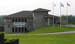
Chelsea is a municipality located immediately north of Gatineau, Quebec, Canada, and about 10 kilometres (6.2 mi) north of Ottawa. Chelsea is located within Canada's National Capital Region. It is the seat of Les Collines-de-l'Outaouais Regional County Municipality.

<span class="mw-page-title-main">Fort-Coulonge</span> Village municipality in Quebec, Canada

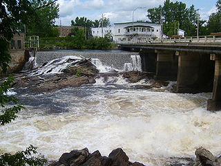
Fort Coulonge is a village in the Pontiac Regional County Municipality in western Quebec, Canada, at the mouth of the Coulonge River. It is the francophone centre of the otherwise largely (57%) anglophone Pontiac MRC, with 79.6% listing French as their mother tongue in the Canada 2006 Census.

<span class="mw-page-title-main">Quebec Autoroute 50</span> Highway in Quebec

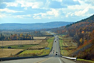
Autoroute 50 is an Autoroute in western Quebec, Canada. It links Canada's National Capital Region (Gatineau) and the Greater Montreal area (Mirabel).

<span class="mw-page-title-main">Cantley, Quebec</span> Municipality in Quebec, Canada

Cantley is a rural municipality in Quebec, Canada, north of the city of Gatineau, east of the Gatineau River, located within Canada's National Capital Region approximately 17 km (11 mi) from Parliament Hill. Cantley is one of six municipalities within the Collines-de-l'Outaouais Regional County Municipality. Its roots are in farmland and mining, but recent housing projects since its creation in 1989 have resulted in a high rate of population growth. The population at the 2021 Canadian Census was 11,449, an increase of 7.0% from the 2016 population of 10,699. French is the first language of 86.7% of Cantley's residents.

<span class="mw-page-title-main">Mayo, Quebec</span> Municipality in Quebec, Canada

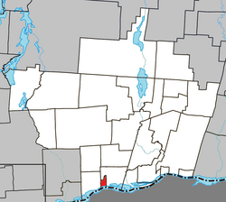
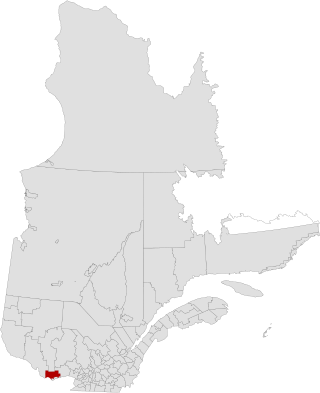
Mayo is a municipality in the Papineau Regional County Municipality of western Quebec, located northeast of the city of Gatineau. Mayo is south of the hamlet of Mulgrave-et-Derry.

<span class="mw-page-title-main">Val-des-Monts</span> Municipality in Quebec, Canada

Val-des-Monts is a municipality in the Outaouais region of Quebec, Canada, located about 40 km (25 mi) north of Ottawa, Ontario. It has a population of 13,328 residents in 2021. Formed in 1975 by the merger of the towns of Perkins, Saint-Pierre-de-Wakefield and Poltimore, it consists mainly of farms and mountainous forests. Many of its residents commute to Ottawa or Gatineau for work. Due to its numerous lakes, its population is boosted during summers by people living in cottages. Most of the people in Val-des-Monts live in the village of Perkins.

<span class="mw-page-title-main">Plaisance, Quebec</span> Municipality in Quebec, Canada

Plaisance is a municipality in Papineau Regional County Municipality in western Quebec, Canada. The village is situated on the Ottawa River near the mouth of the Petite-Nation River, 70 km from Gatineau and 160 km from Montreal on Route 148.

<span class="mw-page-title-main">Gracefield, Quebec</span> City in Quebec, Canada

Gracefield is a city in La Vallée-de-la-Gatineau Regional County Municipality in the Outaouais region of Quebec, Canada. It was reorganized on 13 March 2002 when three former municipalities were merged into one.

<span class="mw-page-title-main">L'Isle-aux-Allumettes</span> Municipality in Quebec, Canada

L'Isle-aux-Allumettes is a municipality in the Outaouais region, part of the Pontiac Regional County Municipality, Quebec, Canada. The municipality consists primarily of Allumette Island, and also includes Morrison Island, Marcotte Island, and some minor islets, all in the Ottawa River north of Pembroke.

<span class="mw-page-title-main">Lochaber, Quebec</span> Township municipality in Quebec, Canada

Lochaber is a township municipality in the Canadian province of Quebec, located within the Papineau Regional County Municipality. The township had a population of 415 in the 2016 Canadian Census.

<span class="mw-page-title-main">Lochaber-Partie-Ouest, Quebec</span> Township municipality in Quebec, Canada

Lochaber-Partie-Ouest is a township municipality in the Canadian province of Quebec, located within the Papineau Regional County Municipality. The township had a population of 926 in the 2021 Canadian Census.

<span class="mw-page-title-main">Aumond, Quebec</span> Township municipality in Quebec, Canada

Aumond is a township municipality in the Canadian province of Quebec, located within La Vallée-de-la-Gatineau Regional County Municipality.

<span class="mw-page-title-main">Alleyn-et-Cawood</span> Municipality in Quebec, Canada

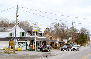
Alleyn-et-Cawood is a municipality in the Outaouais region, northwest of Gatineau, part of the Pontiac Regional County Municipality, Quebec, Canada. Its main population centre is Danford Lake, located along Route 301.

<span class="mw-page-title-main">Grand-Remous</span> Municipality in Quebec, Canada

Grand-Remous is a town and municipality in La Vallée-de-la-Gatineau Regional County Municipality, Quebec, Canada. The municipality is south of the Baskatong Reservoir, spanning both sides of the Gatineau River. The town is situated at the intersection of Route 117 and Route 105.

<span class="mw-page-title-main">Egan-Sud, Quebec</span> Municipality in Quebec, Canada

Egan-Sud is a municipality in the La Vallée-de-la-Gatineau Regional County Municipality, Quebec, Canada, directly north of Maniwaki.

<span class="mw-page-title-main">Bowman, Quebec</span> Municipality in Quebec, Canada

Bowman is a village and municipality in the Outaouais region of Quebec, Canada. It is located in the Laurentian Hills, 72 kilometres (45 mi) north-east of Gatineau.

References

  1. 1 2 3 4 5 "Reference number 62600 in Banque de noms de lieux du Québec". toponymie.gouv.qc.ca (in French). Commission de toponymie du Québec.
  2. 1 2 "Geographic code 80050 in the official Répertoire des municipalités". www.mamh.gouv.qc.ca (in French). Ministère des Affaires municipales et de l'Habitation.
  3. 1 2 3 "Data table, Census Profile, 2021 Census of Population - Thurso, Ville (V) [Census subdivision], Quebec". 9 February 2022.
  4. "Thurso and Nation Valley Railway - History". churcher.crcml.org. Retrieved 17 January 2020.
  5. "Population and dwelling counts: Canada, provinces and territories, and census subdivisions (municipalities), Quebec". Statistics Canada. February 9, 2022. Retrieved August 29, 2022.
  6. "2021 Community Profiles". 2021 Canadian Census . Statistics Canada. February 4, 2022. Retrieved 2023-07-13.
  7. "2016 Community Profiles". 2016 Canadian Census . Statistics Canada. August 12, 2021. Retrieved 2020-01-15.
  8. "2011 Community Profiles". 2011 Canadian Census . Statistics Canada. March 21, 2019. Retrieved 2020-01-15.
  9. "2006 Community Profiles". 2006 Canadian Census . Statistics Canada. August 20, 2019.
  10. "2001 Community Profiles". 2001 Canadian Census . Statistics Canada. July 18, 2021.