The Tidewater Region is the slim section of land along the coast of North Carolina near the Atlantic ocean. All the beaches of North Carolina are located here. There are also capes, (projections of land into water) on the coast of North Carolina. Lighthouses, normally found on a cape, reduce incidents of a collision between ships and the coast. The major streams and rivers from Piedmont, United States area empty into sounds or the Atlantic Ocean. The Tidewater has eight sounds: Back, Pamlico, Albemarle, Currituck, Croatan, Roanoke, Core, and Bogue Sounds. It has many wetlands, where water covers the land. The Great Dismal Swamp, which is a series of swamps scattered from Virginia to North Carolina, is North Carolina's largest wetland area. [1] It covers approximately 111,000 acres (450 km2), [2] which makes it one of the largest swamps in the country. The Tidewater area in North and South Carolina is the only place in the world where the Venus flytrap grows naturally. [3]
 The beach adjacent to the Cape Hatteras Lighthouse, looking north
 Currituck Sound as seen from Knotts Island
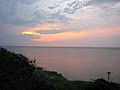
 Bogue Sound with fog at sunset


