Petroleum geology is the study of the origins, occurrence, movement, accumulation, and exploration of hydrocarbon fuels. It refers to the specific set of geological disciplines that are applied to the search for hydrocarbons.
In petroleum exploration and development, formation evaluation is used to determine the ability of a borehole to produce petroleum. Essentially, it is the process of "recognizing a commercial well when you drill one".
Permeability in fluid mechanics and the Earth sciences is a measure of the ability of a porous material to allow fluids to pass through it.

Coalbed methane, coalbed gas, or coal seam gas (CSG) is a form of natural gas extracted from coal beds. In recent decades it has become an important source of energy in United States, Canada, Australia, and other countries.

The Barnett Shale is a geological formation located in the Bend Arch-Fort Worth Basin. It consists of sedimentary rocks dating from the Mississippian period in Texas. The formation underlies the city of Fort Worth and underlies 5,000 mi2 (13,000 km2) and at least 17 counties.

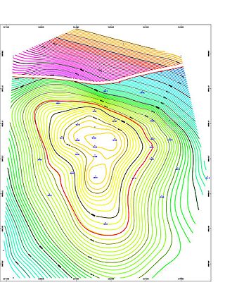
A petroleum reservoir or oil and gas reservoir is a subsurface accumulation of hydrocarbons contained in porous or fractured rock formations. Such reservoirs form when kerogen is created in surrounding rock by the presence of high heat and pressure in the Earth's crust.
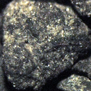
Petrophysics is the study of physical and chemical rock properties and their interactions with fluids.

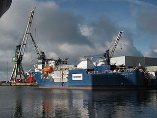
Well stimulation is a well intervention performed on an oil or gas well to increase production by improving the flow of hydrocarbons from the reservoir into the well bore. It may be done using a well stimulator structure or using off shore ships / drilling vessels, also known as "Well stimulation vessels".

The Bakken Formation is a rock unit from the Late Devonian to Early Mississippian age occupying about 200,000 square miles (520,000 km2) of the subsurface of the Williston Basin, underlying parts of Montana, North Dakota, Saskatchewan and Manitoba. The formation was initially described by geologist J. W. Nordquist in 1953. The formation is entirely in the subsurface, and has no surface outcrop. It is named after Henry O. Bakken (1901–1982), a farmer in Tioga, North Dakota, who owned the land where the formation was initially discovered while drilling for oil.

The Bend Arch–Fort Worth Basin Province is a major petroleum producing geological system which is primarily located in North Central Texas and southwestern Oklahoma. It is officially designated by the United States Geological Survey (USGS) as Province 045 and classified as the Barnett-Paleozoic Total Petroleum System (TPS).

The Monterey Formation is an extensive Miocene oil-rich geological sedimentary formation in California, with outcrops of the formation in parts of the California Coast Ranges, Peninsular Ranges, and on some of California's off-shore islands. The type locality is near the city of Monterey, California. The Monterey Formation is the major source-rock for 37 to 38 billion barrels of oil in conventional traps such as sandstones. This is most of California's known oil resources. The Monterey has been extensively investigated and mapped for petroleum potential, and is of major importance for understanding the complex geological history of California. Its rocks are mostly highly siliceous strata that vary greatly in composition, stratigraphy, and tectono-stratigraphic history.

The Montney Formation is a stratigraphical unit of Lower Triassic age in the Western Canadian Sedimentary Basin in British Columbia and Alberta.

The Spraberry Trend is a large oil field in the Permian Basin of West Texas, covering large parts of six counties, and having a total area of approximately 2,500 square miles (6,500 km2). It is named for Abner Spraberry, the Dawson County farmer who owned the land containing the 1943 discovery well. The Spraberry Trend is itself part of a larger oil-producing region known as the Spraberry-Dean Play, within the Midland Basin. Discovery and development of the field began the postwar economic boom in the nearby city of Midland in the early 1950s. The oil in the Spraberry, however, proved difficult to recover. After about three years of enthusiastic drilling, during which most of the initially promising wells showed precipitous and mysterious production declines, the area was dubbed "the world's largest unrecoverable oil reserve."

Tight oil is light crude oil contained in unconventional petroleum-bearing formations of low permeability, often shale or tight sandstone. Economic production from tight oil formations requires the same hydraulic fracturing and often uses the same horizontal well technology used in the production of shale gas. While sometimes called "shale oil", tight oil should not be confused with oil shale or shale oil. Therefore, the International Energy Agency recommends using the term "light tight oil" for oil produced from shales or other very low permeability formations, while the World Energy Resources 2013 report by the World Energy Council uses the terms "tight oil" and "shale-hosted oil".

Fracking is a well stimulation technique involving the fracturing of formations in bedrock by a pressurized liquid. The process involves the high-pressure injection of "fracking fluid" into a wellbore to create cracks in the deep-rock formations through which natural gas, petroleum, and brine will flow more freely. When the hydraulic pressure is removed from the well, small grains of hydraulic fracturing proppants hold the fractures open.

The Wattenberg Gas Field is a large producing area of natural gas and condensate in the Denver Basin of central Colorado, USA. Discovered in 1970, the field was one of the first places where massive hydraulic fracturing was performed routinely and successfully on thousands of wells. The field now covers more than 2,000 square miles between the cities of Denver and Greeley, and includes more than 23,000 wells producing from a number of Cretaceous formations. The bulk of the field is in Weld County, but it extends into Adams, Boulder, Broomfield, Denver, and Larimer Counties.

Fracking in Canada was first used in Alberta in 1953 to extract hydrocarbons from the giant Pembina oil field, the biggest conventional oil field in Alberta, which would have produced very little oil without fracturing. Since then, over 170,000 oil and gas wells have been fractured in Western Canada. Fracking is a process that stimulates natural gas or oil in wellbores to flow more easily by subjecting hydrocarbon reservoirs to pressure through the injection of fluids or gas at depth causing the rock to fracture or to widen existing cracks.
The Mansfield Natural Gas Field is located west of Mansfield, Ohio, within the Appalachian foreland basin. The field is 1.5 miles (2.4 km) long by 1.4 miles (2.3 km) wide and is in a general oval shape, stretching northward. This field, although small, is an analog for many of the natural gas fields that occur within the Appalachian Basin. It was first discovered by the Pan American Petroleum and Transport Company in the early 1930s. It is part of the Utica – Lower Paleozoic system, which is estimated to make up 15 to 20 percent of the total hydrocarbon abundance of the Appalachian Basin.

Fault zone hydrogeology is the study of how brittlely deformed rocks alter fluid flows in different lithological settings, such as clastic, igneous and carbonate rocks. Fluid movements, that can be quantified as permeability, can be facilitated or impeded due to the existence of a fault zone. This is because different mechanisms that deform rocks can alter porosity and permeability within a fault zone. Fluids involved in a fault system generally are groundwater and hydrocarbons.

Unconventional reservoirs, or unconventional resources are accumulations where oil and gas phases are tightly bound to the rock fabric by strong capillary forces, requiring specialised measures for evaluation and extraction.


