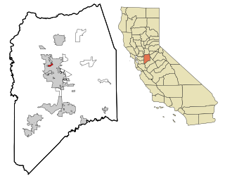
Timberlake, Virginia

Last updated
Timberlake, Virginia
CDP
VAMap-doton-Timberlake.PNG
Location of Timberlake, Virginia
Coordinates: 37°19′53″N79°14′52″W / 37.33139°N 79.24778°W / 37.33139; -79.24778
CountryUnited States
State Virginia
County Campbell
Area
  Total11.3 sq mi (29.3 km2)
  Land11.2 sq mi (29.0 km2)
  Water0.1 sq mi (0.3 km2)
Elevation
919 ft (280 m)
Population
 (2020)
  Total13,267
  Density1,200/sq mi (450/km2)
Time zone UTC−5 (Eastern (EST))
  Summer (DST) UTC−4 (EDT)
FIPS code 51-78688 [1]
GNIS feature ID1495150 [2]

Timberlake is a census-designated place (CDP) in Campbell County, Virginia, United States. The population was 13,267 at the 2020 census. It is part of the Lynchburg Metropolitan Statistical Area.

Contents

Geography

Timberlake is located at 37°19′53″N79°14′52″W / 37.33139°N 79.24778°W / 37.33139; -79.24778 (37.331482, 79.247904). [3]

According to the United States Census Bureau, the CDP has a total area of 11.3 square miles (29.3 km2), of which 11.2 square miles (29.0 km2) is land and 0.12 square miles (0.3 km2), or 1.12%, is water. [4]

Climate

The climate in this area is characterized by hot, humid summers and generally mild to cool winters. According to the Köppen Climate Classification system, Timberlake has a humid subtropical climate, abbreviated "Cfa" on climate maps. [5]

Demographics

Historical population
CensusPop.Note
2000 10,683
2010 12,18314.0%
2020 13,2678.9%
Source: U.S. Census Bureau

2020 census

As of the census of 2020, there were 13,267 people residing in the CDP. There were 5,908 housing units. The racial makeup of the CDP was 78.6% White, 10.0% African American, 0.3% Native American, 2.4% Asian, 0.1% Pacific Islander, 2.8% from other races, and 1.9% from two or more races. Hispanic or Latino of any race were 2.9% of the population.

2000 census

As of the census [1] of 2000, there were 10,683 people, 4,523 households, and 3,152 families residing in the CDP. The population density was 1,211.8 people per square mile (467.7/km2). There were 4,707 housing units at an average density of 533.9/sq mi (206.1/km2). The racial makeup of the CDP was 91.13% White, 5.42% African American, 0.28% Native American, 1.71% Asian, 0.02% Pacific Islander, 0.47% from other races, and 0.97% from two or more races. Hispanic or Latino of any race were 1.01% of the population.

There were 4,523 households, out of which 29.6% had children under the age of 18 living with them, 57.1% were married couples living together, 9.8% had a female householder with no husband present, and 30.3% were non-families. 25.3% of all households were made up of individuals, and 7.0% had someone living alone who was 65 years of age or older. The average household size was 2.36 and the average family size was 2.83.

In the CDP, the population was spread out, with 22.7% under the age of 18, 8.4% from 18 to 24, 29.8% from 25 to 44, 25.7% from 45 to 64, and 13.5% who were 65 years of age or older. The median age was 38 years. For every 100 females there were 92.7 males. For every 100 females age 18 and over, there were 89.5 males.

The median income for a household in the CDP was $43,094, and the median income for a family was $50,073. Males had a median income of $34,577 versus $24,343 for females. The per capita income for the CDP was $20,760. About 4.5% of families and 5.6% of the population were below the poverty line, including 7.5% of those under the age of 18 and 3.5% of those ages 65 and older.

Education

The CDP is served by Campbell County Public Schools. Public school students residing in Timberlake are zoned to attend Leesville Road or Tomahawk Elementary School, Brookville Middle School, and Brookville High School.

Related Research Articles

<span class="mw-page-title-main">Le Grand, California</span> Census-designated place in California, United States

Le Grand is an unincorporated community and census-designated place (CDP) in Merced County, California, United States. Le Grand is 14 miles (23 km) east-southeast of Merced, the county seat at an elevation of 253 feet (77 m). The population was 1,592 at the 2020 census, down from 1,659 at the 2010 census.

<span class="mw-page-title-main">North Auburn, California</span> Census-designated place in California, United States

North Auburn is a census-designated place (CDP) in Placer County, California, United States. It is part of the Sacramento–Arden-Arcade–Roseville Metropolitan Statistical Area. The population was 13,452 at the 2020 census.

<span class="mw-page-title-main">Gold River, California</span> Census-designated place in California, United States

Gold River is a census-designated place (CDP) in Sacramento County, California. The population was 7,812 at the 2010 census, down from 8,023 at the 2000 census. Gold River is part of the Sacramento–Arden-Arcade–Roseville Metropolitan Statistical Area. With a median family income of $141,399 according to U.S Census Bureau in 2021, Gold River is the highest-income place in Sacramento County.

<span class="mw-page-title-main">Lincoln Village, California</span> Census-designated place in California, United States

Lincoln Village is a census-designated place (CDP) in San Joaquin County, California, United States. The population was 4,381 at the 2010 census, up from 4,216 at the 2000 census.

<span class="mw-page-title-main">Strathmore, California</span> Census-designated place in California, United States

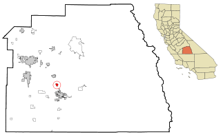
Strathmore is a census-designated place (CDP) in Tulare County, California, United States. The population was 2,819 at the 2010 census, up from 2,584 at the 2000 census.
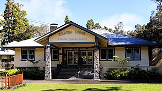
<span class="mw-page-title-main">Woodville, Florida</span> CDP in Florida, United States

Woodville is a census-designated place in Leon County, Florida, United States, just south of Tallahassee, Florida. The population was 2,978 at the 2010 census. It is part of the Tallahassee, Florida Metropolitan Statistical Area. The American Civil War Battle of Natural Bridge, in March 1865, occurred in what is now Woodville, at the Natural Bridge. This is where the St. Marks River drops into a sinkhole, the Natural Bridge Sink and flows underground, reemerging .25 miles (0.40 km) later.

<span class="mw-page-title-main">Volcano, Hawaii</span> Census-designated place in Hawaii, U.S.

Volcano is a census-designated place (CDP) in Hawaii County, Hawaii, United States located in the District of Puna with a small portion of the CDP in the District of Kaʻū. The population was 2,575 at the 2010 census, up from 2,231 at the 2000 census.

<span class="mw-page-title-main">Arbon Valley, Idaho</span> Census-designated place in Power County, Idaho, United States

Arbon Valley is a census-designated place (CDP) in Power County, Idaho, in the United States. As of the 2010 census, the CDP population was 599. It lies within the Fort Hall Indian Reservation, just west of the city of Pocatello.

Rock Island Arsenal is a census-designated place (CDP) in Rock Island County, Illinois, United States. The population was 149 at the 2010 census. The island contains the Rock Island National Cemetery.

<span class="mw-page-title-main">Custer, Montana</span> Village in Montana, United States

Custer is a village in Yellowstone County, Montana, United States. The population was 145 at the 2000 census.

<span class="mw-page-title-main">Gardnerville Ranchos, Nevada</span> Census-designated place in Nevada, United States

Gardnerville Ranchos is a census-designated place in Douglas County, Nevada, United States. As of the 2010 census, the population was 11,312. The area is the namesake for the Gardnerville Ranchos Micropolitan Statistical area which includes other areas of Douglas County.

<span class="mw-page-title-main">Lake Erie Beach, New York</span> Census-designated place in New York, United States

Lake Erie Beach is a hamlet and census-designated place (CDP) in the town of Evans, Erie County, New York, United States. The population was 3,872 at the 2010 census. It is part of the Buffalo–Niagara Falls Metropolitan Statistical Area.

<span class="mw-page-title-main">Oliver, Pennsylvania</span> Census-designated place in Pennsylvania, United States

Oliver is a census-designated place (CDP) in Fayette County, Pennsylvania, United States. The population was 2,535 at the 2010 census, down from 2,925 at the 2000 census. Oliver is located in North Union Township.

<span class="mw-page-title-main">Fairdale, Pennsylvania</span> Census-designated place in Pennsylvania, United States

Fairdale is a community and census-designated place (CDP) in Greene County, Pennsylvania, United States. The population was 2,059 at the 2010 census.

<span class="mw-page-title-main">Red Hill, South Carolina</span> Census-designated place in South Carolina, United States

Red Hill is a census-designated place (CDP) in Horry County, South Carolina, United States. The population was 13,223 at the 2010 census, up from 10,509 at the 2000 census.

<span class="mw-page-title-main">Jolivue, Virginia</span> Census-designated place in Virginia, United States

Jolivue is a census-designated place (CDP) in Augusta County, Virginia, United States. The population was 1,129 at the 2010 census. It is part of the Staunton–Waynesboro Micropolitan Statistical Area.

<span class="mw-page-title-main">Forest, Virginia</span> Census-designated place in Virginia, United States

Forest is a census-designated place (CDP) in eastern Bedford County, Virginia, United States. The population was 11,709 at the 2020 census. It is part of the Lynchburg Metropolitan Statistical Area.
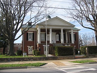
<span class="mw-page-title-main">East Highland Park, Virginia</span> Census-designated place in Virginia

East Highland Park is a census-designated place (CDP) in Henrico County, Virginia, in the United States. The population was 15,131 at the 2020 census.

<span class="mw-page-title-main">Stanaford, West Virginia</span> Census-designated place in West Virginia, United States

Stanaford is a census-designated place (CDP) and coal town in Raleigh County, West Virginia, United States. The population was 1,350 at the 2010 census.

Hollins is a census-designated place (CDP) in Botetourt and Roanoke County, Virginia, United States. Hollins covers much of the area known locally as "North County". The population was 15,574 at the 2020 census. It is part of the Roanoke Metropolitan Statistical Area. The area is also the home of Hollins University in addition to four properties listed on the National Register of Historic Places: the Black Horse Tavern-Bellvue Hotel and Office, Harshbarger House, the Hollins College Quadrangle, and Old Tombstone.

References

  1. 1 2 "U.S. Census website". United States Census Bureau . Retrieved 2008-01-31.
  2. "US Board on Geographic Names". United States Geological Survey. 2007-10-25. Retrieved 2008-01-31.
  3. "US Gazetteer files: 2010, 2000, and 1990". United States Census Bureau. 2011-02-12. Retrieved 2011-04-23.
  4. "Geographic Identifiers: 2010 Demographic Profile Data (G001): Timberlake CDP, Virginia". United States Census Bureau . Retrieved February 14, 2012.
  5. Climate Summary for Timberlake, Virginia