The Viana do Castelo District is a district located in the northwest of Portugal, bordered by Spain (Galicia) from the north and Braga District from the south. It has an area of 2,255 km² and a population of 252,011 (2006), for a density of 111.8 inhabitants/km². The district capital is the city of Viana do Castelo.

Kérouané is a prefecture located in the Kankan Region of Guinea. The capital is Kérouané. The prefecture covers an area of 7,020 km.² and has a population of 207,547.
Mount Richard Bennett is a 3,190 m (10,466 ft) peak located at co-ordinates 52°49′48″N119°47′36″W in the Premier Range of the Cariboo Mountains in the east-central interior of British Columbia, Canada. The mountain is just north of the taller Mount Sir John Abbott and is often considered a continuation of that mountain.
Waterhen is an Indian reserve community in the Canadian province of Manitoba, located approximately 10 km south of the Skownan First Nation and approximately one hour northeast of Dauphin. at the junction of Provincial Road 328 and Provincial Road 276. Waterhen is the hub for several other Indian reserve communities in the area including: the Métis settlement of Mallard, the Métis settlement of Rock Ridge, and the very small community of Salt Point. The community is administered by an elected council of 4 Councilors and a Mayor. The community is one of the largest employers in the area.

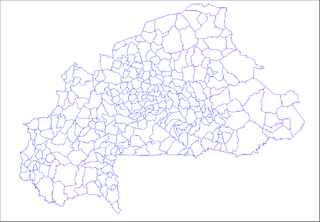
Komtoèga is a department or commune of Boulgou Province in eastern Burkina Faso. Its capital lies at the town of Komtoèga. According to the 1996 census the department has a total population of 18,917.

Toece is a town in the Toece Department of Bazèga Province in central Burkina Faso. The town has a population of 2,307 and is the capital of Toece Department.

Dagouma is a town in the Toece Department of Bazèga Province in central Burkina Faso. The town has a population of 1,222.

Tanghin, Toece is a village in the Toece Department of Bazèga Province in central Burkina Faso. The village has a population of 746.
Tambouè is a town in the Toece Department of Bazèga Province in central Burkina Faso. The town has a population of 1,315.

Zangogho is a town in the Toece Department of Bazèga Province in central Burkina Faso. The town has a population of 1,188.
Toece, Boulgou is a town in the Komtoèga Department of Boulgou Province in south-eastern Burkina Faso. As of 2005, the town has a population of 1,139.
Fairview is an unincorporated community in Northampton County, Virginia, United States.
Caskie is an unincorporated community in Nelson County, Virginia, United States.
Red Cross is a town in Stanly County, North Carolina, United States. The population was 742 as of the 2010 Census.
Diora is a small town and commune in the Cercle of Tominian in the Ségou Region of Mali. As of 1998 the commune had a population of 12,305.

Gare de Folligny is a railway station serving the town Folligny, Manche department, northwestern France.

Valentines is an unincorporated community located in Brunswick County, in the U.S. state of Virginia.
For the municipality, see: the Rural Municipality of Alexander
Brock is an unincorporated community in Darke County, in the U.S. state of Ohio.
Spruce is an unincorporated community in Bates County, in the U.S. state of Missouri.


