Martinton is a village in Martinton Township, Iroquois County, Illinois, United States. The population was 381 at the 2010 census.
Great Woolstone and Little Woolstone are two historic villages in modern Milton Keynes, ceremonial Buckinghamshire now called jointly Woolstone or The Woolstones and forming the heart of a new district of that name. At the 2011 Census the population of the villages was included in the civil parish of Campbell Park.
Abárzuza is a town and municipality located in the province and autonomous community of Navarre, northern Spain.
Metalik Ada is a Turkish island. It is part of the Foça Islands group in the Aegean Sea.

The Ribera del Duero is a comarca or district located at the southern tip of the province of Burgos, part of the Spanish autonomous community of Castile and León. The capital of the Ribera del Duero comarca or district is the town of Aranda de Duero.

Rogowo is a village in Żnin County, Kuyavian-Pomeranian Voivodeship, in north-central Poland. It is the seat of the gmina called Gmina Rogowo. It lies approximately 15 kilometres (9 mi) south of Żnin and 50 km (31 mi) south-west of Bydgoszcz. The village has an approximate population of 2,000.
Helena is a hamlet in the Town of Brasher in St. Lawrence County, New York, United States.
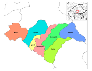
Burhan is a village located in the Attock District of Punjab, Pakistan. It is the site of a Motorway Interchange on the M1 motorway (Pakistan), which is intersected by the N-5 National Highway.
Dąbrowa is a village in the administrative district of Gmina Nowosolna, within Łódź East County, Łódź Voivodeship, in central Poland.
Janów is a village in the administrative district of Gmina Nowosolna, within Łódź East County, Łódź Voivodeship, in central Poland.

Turist is a village in the Khachmaz Rayon of Azerbaijan. The village forms part of the municipality of Nabran.

Kościuszków is a village in the administrative district of Gmina Nowe Skalmierzyce, within Ostrów Wielkopolski County, Greater Poland Voivodeship, in west-central Poland. It lies approximately 5 kilometres (3 mi) west of Skalmierzyce, 19 km (12 mi) north-east of Ostrów Wielkopolski, and 103 km (64 mi) south-east of the regional capital Poznań.
Stary Staw is a village in the administrative district of Gmina Ostrów Wielkopolski, within Ostrów Wielkopolski County, Greater Poland Voivodeship, in west-central Poland.
Ostrowite is a village in the administrative district of Gmina Sulęczyno, within Kartuzy County, Pomeranian Voivodeship, in northern Poland. It lies approximately 5 kilometres (3 mi) south-east of Sulęczyno, 29 km (18 mi) south-west of Kartuzy, and 56 km (35 mi) west of the regional capital Gdańsk.
Bąsze is a village in the administrative district of Gmina Bartoszyce, within Bartoszyce County, Warmian-Masurian Voivodeship, in northern Poland, close to the border with the Kaliningrad Oblast of Russia.
Musket Island Marine Provincial Park is a provincial park in British Columbia, Canada, located on the west side of Nelson Island, at the mouth of Jervis Inlet and near Earl's Cove in the Sunshine Coast region.

Kare is a village in the municipality of Žitorađa, Serbia. According to the 2002 census, the village has a population of 54 people.
Red Oak Hollow is an unincorporated community in Pittsylvania County, in the U.S. state
Los Cármenes is a ward (barrio) of Madrid belonging to the district of Latina.

San Isidro is a ward (barrio) of Madrid belonging to the district of Carabanchel.