
Tywardreath is a small hilltop village on the south coast of Cornwall, England, United Kingdom. about 3 miles (5 km) north west of Fowey. It is located in a sheltered spot overlooking a silted up estuary opposite Par and near the beach of Par Sands. It is on the Saints' Way path.

Lanreath is a civil parish and a village in southeast Cornwall, England, United Kingdom. The village is situated five miles (8 km) west-northwest of Looe. The name Lanreath means 'church (Lann) of Raydhogh' and it has been known variously as Lanreythow, Lanrathew, or Lanrethou. The village is mentioned in the Domesday Book as Lanredoch.

Calstock is a civil parish and a large village in south east Cornwall, England, United Kingdom, on the border with Devon. The village is situated on the River Tamar 6 miles (9.7 km) south west of Tavistock and 10 miles (16 km) north of Plymouth.

Boyton is a civil parish and village in Cornwall, England, United Kingdom. It is situated close to the River Tamar and the border with Devon about six miles (10 km) north of Launceston. According to the 2001 census it had a population of 378.This increased to 457 at the 2011 census.

Pelynt is a civil parish and village in Cornwall, England, United Kingdom. It is 20 miles (32 km) west of Plymouth and four miles (6.5 km) west-northwest of Looe. Pelynt had a population of around 1,124 at the 2001 census which increased to 1,296 at the 2011 census. In addition an electoral ward with the same name exists but extends towards Widegates avoiding Looe at all times. The population at the 2011 for this ward was 4,453.

Polyphant, recorded as Polefant c. 1170, is a village in east Cornwall, England, United Kingdom. It is north of the civil parish of Lewannick, five miles (8 km) west of the town of Launceston near the convergence of the River Inny and Penpont Water.

Whitstone is a village and civil parish in east Cornwall, United Kingdom. It is roughly halfway between the towns of Bude and Launceston. The population at the 2011 census was 590.
St Newlyn East is a civil parish and village in Cornwall, England, United Kingdom. The village is approximately three miles (5 km) south of Newquay. The name St Newlyn East is locally abbreviated to Newlyn East and according to an anonymous historian writing in the Cornishman newspaper in 1880 it was only in recent years that Saint had been added to the parish name.

Stoke Climsland is a village in the valley of the River Tamar, Cornwall, England, United Kingdom within the civil parish of Stokeclimsland. The population of the parish including Luckett at the 2011 census was 1,703. An electoral ward in the same name also exists. At the same census the population was 3,703.

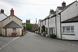
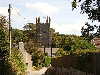
Cardinham is a civil parish and a village in mid Cornwall, England, United Kingdom. The village is situated approximately three-and-a-half miles (6 km), east-northeast of Bodmin. The hamlets of Fletchersbridge, Millpool, Milltown, Mount, Old Cardinham Castle and Welltown are in the parish.
Pillaton is a village and civil parish in south east Cornwall, England, United Kingdom.

Week St Mary is a civil parish and village in northeast Cornwall, England, United Kingdom. It is situated south of Bude close to the River Tamar and the border between Cornwall and Devon in the Hundred of Stratton. The parish population at the 2011 census is 657

Lawhitton is a village in the civil parish of Lawhitton Rural, in east Cornwall, England, United Kingdom. The village is situated two miles (3 km) southwest of Launceston and half-a-mile west of Cornwall's border with Devon at the River Tamar.

St Mellion is a village and rural civil parish in east Cornwall, England, United Kingdom. The parish is about 3 miles (5 km) south of Callington and is in the St Germans Registration District. To the north, the parish is bordered by Callington and St Dominick parishes, to the east and south by Pillaton parish, and to the west by St Ive parish.
The Morshead Baronetcy, of Trenant Park in the County of Cornwall, was a title in the Baronetage of Great Britain. It was created on 22 January 1784 for John Morshead, Member of Parliament for Callington and Bodmin and Lord Warden of the Stannaries. The title became extinct on the death of the third Baronet in 1905.

Tredaule is a hamlet in Cornwall, England, United Kingdom. It is one mile east of Altarnun.

Merthen Manor is a 16th-century manor house in west Cornwall, England, UK. For most of its history it has been in the ownership of the prominent Cornish family, the Vyvyan family. The house is set in over 100 acres (40 ha) of woodland which, along with the shoreline of the Helford River, is designated as Merthen Woods Site of Special Scientific Interest (SSSI).

Chevithorne is a small village near Tiverton, Devon. It lies three miles to the North East of Tiverton. 'Chenetorne' is identified in two entries of the Doomsday Book: The first entry tells us the manor of Chevithorne, had a taxable value 0.6 geld units, and worth £2.3 to the lord in 1086. The holding was populated by 4 villagers. 2 smallholders. 8 slaves. There was enough ploughland for 2 lord's plough teams. and 2 men's plough teams and had, in addition, 0.12 lord's lands. 8 acres of meadow. 15 acres in pasture. and 3 acres of woodland. There were also 10 cattle and 60 sheep. The 'Lords' of this holding in 1086: are named as Alwin, and Beatrix . Ralph de Pomeroy was Tenant-in-chief, He was a large land holder in Devon, and his brother William held several properties as both lord and Tenant-in-Chief.

Harewood House was an ancient manor house, built originally by the Saxons, in Cornwall, England. It is located by an ancient river crossing, originally used by the Romans to get to a nearby Roman Fort. Harewood Estate is surrounded by old mine workings, so the house faces towards Morwellham Quay.


