
Monterey County, officially the County of Monterey, is a county located on the Pacific coast of the U.S. state of California. As of the 2010 census, the population was 415,057. The county seat and largest city is Salinas.
King City is a city in Monterey County, California, United States. King City is located on the Salinas River 51 miles (82 km) southeast of Salinas, at an elevation of 335 feet. It lies along U.S. Route 101 in the Salinas Valley of the Central Coast. King City is a member of the Association of Monterey Bay Area Governments. The population was 12,874 at the 2010 census. It is a small town which has experienced slow economic growth over the past 50 years.
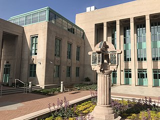
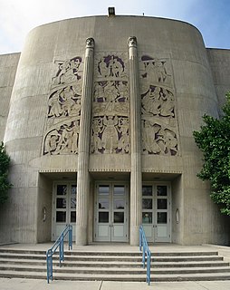
Salinas is a city in California and the county seat of Monterey County. With a population of 155,564, Salinas is the most populous city in Monterey County. Salinas is an urban area located in the Monterey Bay Area, just south of the San Francisco Bay Area and 10 miles (16 km) southeast of the mouth of the Salinas River. The city is located at the mouth of the Salinas Valley, roughly eight miles from the Pacific Ocean, and it has a climate more influenced by the ocean than the interior.

The Central Coast is an area of California, United States, roughly spanning the coastal region between Point Mugu and Monterey Bay. It lies northwest of Los Angeles County and south of San Mateo and Santa Clara counties, and includes the rugged, undeveloped stretch of coastline known as Big Sur. From south to north, there are six counties that make up the Central Coast: Ventura, Santa Barbara, San Luis Obispo, Monterey, San Benito, and Santa Cruz.

U.S. Route 81 or U.S. Highway 81 (US 81) is a major north–south U.S. highway that extends for 1,220 miles (1,960 km) in the central United States and is one of the original United States Numbered Highways established in 1926 by the American Association of State Highway Officials.

U.S. Route 50 or U.S. Highway 50 (US 50) is a major east–west route of the U.S. Highway system, stretching 3,073 miles (4,946 km) from Interstate 80 (I-80) in West Sacramento, California, to Maryland Route 528 in Ocean City, Maryland, on the Atlantic Ocean. Until 1972, when it was replaced by Interstate Highways west of the Sacramento area, it extended to San Francisco, near the Pacific Ocean. The Interstates were constructed later and are mostly separate from this route. It generally serves a corridor south of I-70 and I-80 and north of I-64 and I-40.

The River Line is a diesel tram-train Interurban light rail system in southern New Jersey, United States, that connects the cities of Camden and Trenton, New Jersey's capital. It is operated for New Jersey Transit by the Southern New Jersey Rail Group (SNJRG), which originally included Bechtel Group and Bombardier. Now that the project is in its operational phase, Bombardier is the only member of SNJRG. The River Line is so named because the path between those two cities runs more or less parallel to the Delaware River.
New York State Route 12 (NY 12) is a state highway extending for 222.27 miles (357.71 km) through central and northern New York in the United States. The southern terminus of the route is at U.S. Route 11 (US 11) in the town of Chenango in the Southern Tier. The northern terminus is at NY 37 near the village of Morristown in the North Country. In between, the route serves three cities of varying size: Norwich, Utica, and Watertown. NY 12 intersects several primary routes, including US 20 in Sangerfield, New York State Thruway via Interstate 790 (I-790) in Utica, overlaps NY 28 from Barneveld to the town of Remsen, NY 3 in Watertown, and I-81 in Pamelia and Orleans.
New York State Route 8 (NY 8) is a 207.45-mile-long (333.86 km) north-south state highway in the central part of New York in the United States. It runs in a southwest-to-northeast direction from the Southern Tier to the northern part of Lake George. The southern terminus of the route is at an interchange with NY 17, where it begins concurrent with NY 10 in the town of Deposit. Its northern terminus is at a junction with NY 9N in the town of Hague. Roughly midway between the two endpoints, NY 8 passes through Utica, where it overlaps NY 5, NY 12, and Interstate 790 (I-790) along one segment of the North–South Arterial.

California's 17th congressional district is a congressional district in the U.S. state of California that is currently represented by Ro Khanna. It is located in the South Bay and East Bay regions of the San Francisco Bay Area.
U.S. Route 50 (US-50) in Utah crosses the center of the state. The highway serves no major population centers in Utah, with the largest city along its path being Delta. Most of the route passes through desolate, remote areas. Through the eastern half of the state the route is concurrent with Interstate 70 (I-70). US-50 both enters and exits Utah concurrent with US-6, however the two routes are separate through the center of the state.

West Trenton is a section of Ewing Township in Mercer County, New Jersey, United States. It is a suburban area located adjacent to the northwestern portion of the city of Trenton, from which it derives its name. Located at the intersection of Bear Tavern Road/Grand Avenue and West Upper Ferry Road, it is one of the oldest settlements in Ewing Township.
U.S. Route 1 is a United States highway which parallels the East Coast of the United States, running from Key West, Florida in the south to Fort Kent, Maine at the Canadian border in the north. Of the entire length of the route, 66.06 miles (106.31 km) of it runs through New Jersey. It enters the state from Pennsylvania on the Trenton–Morrisville Toll Bridge over the Delaware River in the state capital of Trenton, running through the city on the Trenton Freeway. From here, US 1 continues northeast as a surface divided highway through suburban areas continuing into Middlesex County and passing through New Brunswick and Edison. US 1 merges with US 9 in Woodbridge, and the two routes continue through northern New Jersey as US 1/9 to the George Washington Bridge over the Hudson River in Fort Lee. At this point, the road continues into New York City along with I-95.

The Victory Highway was an auto trail across the United States between New York City and San Francisco, roughly equivalent to the present U.S. Route 40. It was created by the Victory Highway Association, which was organized in 1921 to locate and mark a transcontinental highway to be dedicated to American forces who died in World War I. A series of Victory Eagle sculptures were planned to mark the route, although only six were completed.
Trenton is an unincorporated community in northwestern Williams County, North Dakota, United States. It lies along North Dakota Highway 1804 southwest of the city of Williston, the county seat of Williams County. Its elevation is 1,900 feet (579 m). It has a post office with the ZIP code 58853. The community lies 220 miles north-west of Bismarck. In July 2013, An Amtrak Empire Builder train collided with a bulldozer 9 miles west of Trenton, killing the operator.

Falun is an unincorporated community in southwestern Saline County, Kansas, United States. It lies southwest of Salina and northwest of Lindsborg at the intersection of Forsse Road and Hedberg Road, about 7.5 miles west of Interstate 135 highway, or about 8 miles west of Assaria. It lies next to an abandoned railroad.

Springtown is an unincorporated community in Monterey County, California, United States.

San Benancio is an unincorporated community in Monterey County, California. It is located in the San Benancio Canyon.

Big Plain is an unincorporated community in Fairfield Township, Madison County, Ohio, United States. It is located at 39°50′19″N83°17′21″W, at the intersection of West Jefferson-Kiousville Road and Big Plain-Circleville Road, approximately four miles north of Kiousville.
Randal F. Dickey was a United States politician.


