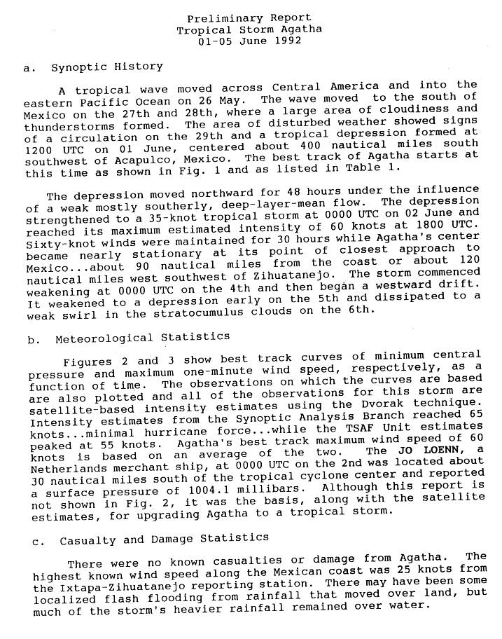
Tropical Storm Agatha (1992)

Last updated

Map key
  Tropical depression (≤38 mph, ≤62 km/h)
  Tropical storm (39–73 mph, 63–118 km/h)
  Category 1 (74–95 mph, 119–153 km/h)
  Category 2 (96–110 mph, 154–177 km/h)
  Category 3 (111–129 mph, 178–208 km/h)
  Category 4 (130–156 mph, 209–251 km/h)
  Category 5 (≥157 mph, ≥252 km/h)
  Unknown
Storm type
Disc Plain black.svg Tropical cyclone
Solid black.svg Subtropical cyclone
ArrowUp.svg Extratropical cyclone, remnant low, tropical disturbance, or monsoon depression

On May 26, a tropical wave or a quasi-equatorward area of low pressure moved off the Central American coast into the east Pacific. Over the subsequent days the system produced a broad area of convection, which began to show signs of organization on May 29. [1] Early on June 1, the disturbance became better defined, [2] and shortly thereafter the National Hurricane Center (NHC) classified it as a tropical depression while located 460 mi (740 km) southwest of Acapulco. [1] At the time, the depression maintained good outflow aloft; it was forecast to strengthen into a minimal hurricane after three days. [2] Based on a combination of ship data and Dvorak intensity estimates, the system was upgraded into Tropical Storm Agatha on June 2. [3]

For the first two days of its duration, Agatha steered toward the north while embedded within a deep southerly flow. [1] Steady intensification continued, and the storm reached winds of 50 mph (90 km/h) six hours after being upgraded as it neared the coast of Mexico. [4] By the afternoon of June 2, the center exhibited an elongated appearance within its associated central dense overcast, a large area of organized mid-tropospheric convection. [5] Around 1800 UTC that same day, the storm peaked in intensity with winds of 70 mph (110 km/h) and a minimum pressure of 990 mbar (hPa; 29.23 inHg). [6]

Maintaining its peak intensity for 30 hours, Agatha gradually decelerated as it passed within 100 mi (160 km) southwest of the Mexican coast. [1] Although specialists at the NHC had anticipated a Category 1-hurricane landfall on the territory, [7] the storm defied predictions and stayed at sea. [6] The center of the storm promptly became ill-defined on infrared satellite imagery, simultaneously recurving to the west. [8] Agatha continued to degenerate quickly into the morning of June 4, with a ragged appearance observed on satellite imagery. [9] By 0600 UTC June 5, the storm was downgraded back into tropical depression status prior to dissipating the next day. [1]

Preparations and impact

Tropical Storm Agatha off Mexico on June 2 Tropical Storm Agatha (1992).JPG
Tropical Storm Agatha off Mexico on June 2

On June 2, forecasters at the National Hurricane Center anticipated Agatha to make landfall in Mexico near hurricane strength. In light of this, a tropical storm warning and hurricane watch were issued for the Pacific coast of Mexico between Tenexpa to Cabo Corrites around 2100  UTC that day. Additionally, heavy rains from the system prompted concerns over mudslides and flash floods. [7] [10] Following Agatha's turn towards the west early on June 3, the watches and warnings were discontinued. [11] Roughly 1,500 people evacuated from coastal areas of Michoacán due to the threat of damaging winds and flooding. [12]

Although the center of Agatha remained offshore, heavy rains within the system's outer rainbands impacted southwestern and central Mexico. [4] Widespread flooding and mudslides killed ten people and left thousands homeless. [13] Along the coast, waves reportedly reached heights of 16 ft (4.9 m). [14] [15]

See also

Related Research Articles

<span class="mw-page-title-main">1992 Atlantic hurricane season</span> Hurricane season in the Atlantic Ocean

The 1992 Atlantic hurricane season was a significantly below average season for overall tropical or subtropical cyclones as only ten formed. Six of them became named tropical storms, and four of those became hurricanes; one hurricane became a major hurricane. The season was also near-average in terms of accumulated cyclone energy. The season officially started on June 1 and officially ended on November 30. However, tropical cyclogenesis is possible at any time of the year, as demonstrated by formation in April of an unnamed subtropical storm in the central Atlantic.

<span class="mw-page-title-main">Hurricane Joan–Miriam</span> Category 4 Atlantic and Pacific hurricane in 1988

Hurricane Joan was a long lived and powerful tropical cyclone that caused death and destruction in over a dozen countries in the Caribbean and Central America. Moving on a due west course for nearly two weeks in October 1988, Hurricane Joan caused widespread flooding and over 200 deaths after moving into Central America. Widespread suffering and economic crises were exacerbated by Joan, primarily across Nicaragua, as heavy rains and high winds impacted those near the hurricane's path.

<span class="mw-page-title-main">1992 Pacific hurricane season</span> Hurricane season in the Pacific Ocean

The 1992 Pacific hurricane season is the most active Pacific hurricane season on record, featuring 27 named storms. The season also produced the second-highest ACE value on record in the basin, only surpassed by the 2018 season. The 1992 season officially started on May 15 in the eastern Pacific, and on June 1 in the central Pacific, and lasted until November 30. These dates conventionally delimit the period of each year when most tropical cyclones form in the northeastern Pacific Ocean. However, tropical cyclogenesis is possible at any time of the year, as demonstrated by the development of Hurricane Ekeka on January 28, and Tropical Storm Hali two months later.

<span class="mw-page-title-main">1990 Pacific hurricane season</span> Hurricane season in the Pacific Ocean

The 1990 Pacific hurricane season was a very active season which observed 21 named storms within the basin. The season also produced the fourth highest ACE index value on record. The season was officially started on May 15 in the eastern Pacific, and on June 1 in the central Pacific, and lasted until November 30. These dates conventionally delimit the period of each year when most tropical cyclones form in the northeastern Pacific Ocean. However, the formation of tropical cyclones is possible at any time of the year, as illustrated in 1990 by the formation of the season's first named storm, Hurricane Alma, on May 12. At the time, this was the earliest formation of a tropical storm on record in the eastern Pacific

<span class="mw-page-title-main">1989 Pacific hurricane season</span> Hurricane season in the Pacific Ocean

The 1989 Pacific hurricane season was a near normal season. It officially started on May 15, 1989, in the eastern Pacific, and on June 1, 1989, in the central Pacific, and lasted until November 30, 1989. These dates conventionally delimit the period of each year when most tropical cyclones form in the northeastern Pacific Ocean. A total of 18 storms and 9 hurricanes formed, which was near long-term averages. Four hurricanes reached major hurricane status on the Saffir–Simpson scale.

<span class="mw-page-title-main">1988 Pacific hurricane season</span> Hurricane season in the Pacific Ocean

The 1988 Pacific hurricane season was the least active Pacific hurricane season since 1981. It officially began May 15, in the eastern Pacific, and June 1, in the central Pacific and lasted until November 30. These dates conventionally delimit the period of each year when most tropical cyclones form in the northeastern Pacific Ocean. The first named storm, Tropical Storm Aletta, formed on June 16, and the last-named storm, Tropical Storm Miriam, was previously named Hurricane Joan in the Atlantic Ocean before crossing Central America and re-emerging in the eastern Pacific; Miriam continued westward and dissipated on November 2.

<span class="mw-page-title-main">Hurricane Debby (1988)</span> Category 1 Atlantic and Pacific hurricane in 1988

Hurricane Debby was the first hurricane to strike the Mexican state of Veracruz since Hurricane Anna in 1956. The eighth tropical cyclone, fourth named storm, and the first hurricane of the 1988 Atlantic hurricane season, Debby developed from a tropical wave off the west coast of the Yucatan Peninsula on August 31. The system slowly intensified as it tracked west-northwestward toward Mexico, eventually reaching tropical storm status on September 2. Thereafter, Debby began to rapidly strengthen, and the storm was upgraded to a hurricane later that day. After attaining peak winds of 75 mph (120 km/h), Debby made landfall near Tuxpan, Veracruz early on September 3. The hurricane quickly weakened inland, but managed to reach the eastern Pacific on September 5. Debby became Tropical Depression Seventeen-E, which moved northwest but remained poorly organized due to wind shear and dissipated on September 8.

<span class="mw-page-title-main">1987 Gulf Coast tropical storm</span> Atlantic tropical storm in 1987

The 1987 Gulf Coast tropical storm caused flooding along the Gulf Coast of the United States. The second tropical cyclone and first tropical storm of the 1987 Atlantic hurricane season, it originated from a tropical wave in the Gulf of Mexico, southeast of Texas, on August 9. Initially a tropical depression, the cyclone moved north-northwestward and slightly intensified into a tropical storm later that day. By August 10, it made landfall between Galveston and Beaumont. The system weakened after moving inland and turned towards the east and later southeast. Briefly reemerging over the Gulf on August 15, the depression moved onshore a second time in Florida, before dissipating over eastern Georgia on August 17.

<span class="mw-page-title-main">Tropical Storm Emilia (2006)</span> Pacific tropical storm in 2006

Tropical Storm Emilia was a rare tropical cyclone that affected the Baja California Peninsula in July 2006. The sixth tropical depression and fifth tropical storm of the 2006 Pacific hurricane season, it developed on July 21 about 400 miles (640 km) off the coast of Mexico. It moved northward toward the coast, reaching peak winds of 65 mph (105 km/h) before turning westward and encountering unfavorable conditions. Emilia later turned to the north, passing near Baja California as a strong tropical storm. Subsequently, the storm moved further away from the coast, and on July 27 it dissipated.

<span class="mw-page-title-main">2008 Pacific hurricane season</span> Hurricane season in the Pacific Ocean

The 2008 Pacific hurricane season was a near-average Pacific hurricane season which featured seventeen named storms, though most were rather weak and short-lived. Only seven storms became hurricanes, of which two intensified into major hurricanes. This season was also the first since 1996 to have no cyclones cross into the central Pacific. The season officially began on May 15 in the eastern Pacific and on June 1 in the central Pacific. It ended in both regions on November 30. These dates, adopted by convention, historically describe the period in each year when most tropical cyclone formation occurs in these regions of the Pacific. This season, the first system, Tropical Storm Alma, formed on May 29, and the last, Tropical Storm Polo, dissipated on November 5.

<span class="mw-page-title-main">Tropical Storm Barbara (2007)</span> Pacific tropical storm in 2007

Tropical Storm Barbara was the first tropical cyclone to make landfall during the 2007 Pacific hurricane season. The second storm of the season, Barbara developed from a small low-pressure area on May 29 about 235 miles (380 km) southeast of Acapulco, Mexico. The system drifted southward before turning to a steadily eastward motion, and quickly intensified into a tropical storm. Increased wind shear weakened Barbara, though it re-organized to attain peak winds of 50 mph (80 km/h) before moving ashore just west of the border of Mexico and Guatemala. It rapidly weakened over land, and on June 2 the National Hurricane Center discontinued advisories on the storm. Despite expectations that the storm would attain hurricane status, Barbara moved ashore as a small, weak tropical storm. It produced locally heavy rainfall and gusty winds, and in most locations damage was minor. However, in southern Mexico, the rainfall destroyed large areas of cropland, with crop damage totaling 200 million pesos. In El Salvador, four people were killed by storm-induced floods.

<span class="mw-page-title-main">Tropical Storm Alma</span> Pacific tropical storm in 2008

Tropical Storm Alma of the 2008 Pacific hurricane season was the easternmost forming Pacific tropical cyclone on record. It formed within the monsoon trough just off the coast of Costa Rica on May 29. Initially forecast to remain a weak tropical storm, the cyclone rapidly strengthened and developed an eye, before making landfall on May 29 in Nicaragua, near León, with peak winds of 65 mph (105 km/h). Alma degenerated into a remnant low on May 30, before merging with another approaching tropical wave in the Gulf of Honduras shortly afterward, which became Tropical Storm Arthur on the next day. Alma was the first tropical storm on record to strike the Pacific coast of Nicaragua. In Costa Rica, heavy rainfall caused flooding and landslides, killing two and causing $35 million (USD) in damage. Three people were killed in Nicaragua, one from drowning and two others from electrocution. Five others died in Honduras from an aviation accident likely related to the storm and one other was swept away in floodwaters.

<span class="mw-page-title-main">Hurricane Bonnie (1986)</span> Category 1 Atlantic hurricane in 1986

Hurricane Bonnie caused moderate damage along the Gulf Coast of the United States in late June 1986. The second named storm and first hurricane of the 1986 Atlantic hurricane season, Bonnie developed out of an area of low pressure over the central Gulf of Mexico on June 23. The system gradually intensified and was declared Tropical Storm Bonnie the next day as it moved generally towards the west-northwest. On June 25, Bonnie was upgraded to a hurricane. Bonnie strengthened further and on the following day, the storm attained its peak intensity with maximum sustained winds of 85 mph (137 km/h). Shortly thereafter, Bonnie made landfall near High Island, Texas. Following landfall, Bonnie quickly weakened below tropical storm status and dissipated over Missouri on June 28.

<span class="mw-page-title-main">Tropical Depression Five-E (2008)</span> Pacific tropical depression in 2008

Tropical Depression Five-E was a tropical depression which made landfall along the south-western Mexican coastline in July 2008. It was the fifth tropical cyclone of the 2008 Pacific hurricane season. The depression developed out of a weak tropical wave which formed off the coast of Africa on June 23. The wave remained poorly organized throughout its journey through the Atlantic Ocean and Caribbean Sea. The wave entered the Eastern Pacific on July 2 after passing through Central America. The wave developed into an area of low pressure that afternoon.

<span class="mw-page-title-main">Tropical Storm Carlos (2003)</span> Pacific tropical storm in 2003

Tropical Storm Carlos was the first of five tropical cyclones to make landfall during the 2003 Pacific hurricane season. It formed on June 26 from a tropical wave to the south of Mexico. It quickly strengthened as it approached the coast, and early on June 27 Carlos moved ashore in Oaxaca with winds of 65 mph (105 km/h). The storm rapidly deteriorated to a remnant low, which persisted until dissipating on June 29. Carlos brought heavy rainfall to portions of southern Mexico, peaking at 337 mm (13.3 in) in two locations in Guerrero. Throughout its path, the storm damaged about 30,000 houses, with a monetary damage total of 86.7 million pesos. At least nine people were killed throughout the country, seven due to mudslides and two from river flooding; there was also a report of two missing fishermen.

<span class="mw-page-title-main">Hurricane Cosme (1989)</span> Category 1 Pacific hurricane in 1989

Hurricane Cosme was an unusually large tropical cyclone that made landfall in south-western Mexico in June 1989. The third tropical storm and second hurricane of the 1989 Pacific hurricane season, Cosme formed on June 19 from a tropical wave. The storm initially moved westward before being upgraded into Tropical Storm Cosme, ultimately intensifying into a Category 1 hurricane. Cosme turned northward and made landfall near Acapulco during the night of June 21. It rapidly weakened over land. The storm caused excessive rainfall on land, leading to deadly and destructive flooding. It is estimated that 30 people died in the hurricane.

<span class="mw-page-title-main">Hurricane Dora (2011)</span> Category 4 Pacific hurricane in 2011

Hurricane Dora was the strongest tropical cyclone in the northeastern Pacific in 2011 that brought minor impacts to Mexico and the US in July of that year. The fourth named storm, fourth hurricane, and second major hurricane of the year, Dora developed from a tropical wave south of Honduras on July 18. Moving northwestward in favorable conditions, the system quickly intensified to tropical storm status and attained hurricane intensity the next day. Rapid intensification ensued shortly thereafter, bringing the storm to its peak intensity on July 21 as a Category 4 hurricane, with a minimum barometric pressure of 929 mbar and maximum sustained winds of 155 mph (250 km/h). However, the storm's path into an area with cool sea surface temperatures and wind shear caused Dora to quickly deteriorate and weaken. By July 24, Dora had degenerated into a remnant low-pressure area west of the Baja California Peninsula.

<span class="mw-page-title-main">Hurricane Jova (2011)</span> Category 3 Pacific hurricane in 2011

Hurricane Jova was a powerful Category 3 Pacific hurricane that made landfall on southwestern Mexico in October 2011. The tenth named storm, ninth hurricane and fifth major hurricane of the 2011 Pacific hurricane season, Jova developed from a tropical disturbance that initially formed on October 5, 2011. The disturbance steadily organized and acquired more thunderstorm activity over the following hours, and it became a tropical depression early on October 6. The depression strengthened into Tropical Storm Jova later that day. Moving generally northward, wind shear initially inhibited Jova from strengthening much until the establishment of more favorable conditions on October 8 allowed Jova to begin to intensify. It reached hurricane strength that day as it drifted eastwards, and major hurricane status on October 10 after a period of steady intensification. Jova reached peak intensity the following day as a high-end Category 3 hurricane, with maximum sustained winds of 125 mph (205 km/h), and a minimum barometric pressure of 955 mbar (28.20 inHg). Jova weakened somewhat as it approached the Pacific coast of Mexico, and made landfall near Barra de Navidad, Jalisco on October 12 as a still-powerful Category 2 hurricane. The storm rapidly weakened as it moved inland and dissipated later that day.

<span class="mw-page-title-main">Tropical cyclones in 2022</span>

During 2022, tropical cyclones formed in seven major bodies of water, commonly known as tropical cyclone basins. Tropical cyclones were named by various weather agencies when they attained maximum sustained winds of 35 knots. During the year, 133 systems formed, of which 87 were named. The strongest storm to form was Typhoon Nanmadol, with minimum pressure of 910 hPa (26.87 inHg). The deadliest tropical cyclone was Tropical Storm Megi, which caused 214 fatalities in the Philippines, while the costliest was Hurricane Ian, which had an estimated damage total of at least $113.1 billion after affecting Trinidad and Tobago, Venezuela, Colombia, the western part of the Greater Antilles and Southeast United States.

References

  1. 1 2 3 4 5 Miles B. Lawrence (1992-06-28). "Tropical Storm Agatha Preliminary Report". National Hurricane Center. Retrieved 2011-03-11.
  2. 1 2 Harold Gerrish (1992-06-01). "Tropical Depression One-E Discussion One". National Hurricane Center . Retrieved 2011-07-10.
  3. Max Mayfield (1992-06-02). "Tropical Storm Agatha Discussion 3". National Hurricane Center . Retrieved 2011-07-10.
  4. 1 2 Robert Gerrish (1992-06-02). "Tropical Storm Agatha Discussion 4". National Hurricane Center . Retrieved 2011-07-10.
  5. Max Mayfield (1992-06-02). "Tropical Storm Agatha Discussion 5". National Hurricane Center . Retrieved 2011-07-10.
  6. 1 2 National Hurricane Center; Hurricane Research Division; Central Pacific Hurricane Center (April 4, 2023). "The Northeast and North Central Pacific hurricane database 1949–2022". United States National Oceanic and Atmospheric Administration's National Weather Service. A guide on how to read the database is available here. PD-icon.svg This article incorporates text from this source, which is in the public domain.
  7. 1 2 Harold Gerrish (1992-06-02). "Tropical Storm Agatha Discussion 7". National Hurricane Center . Retrieved 2011-07-10.
  8. Max Lawrence (1992-06-04). "Tropical Storm Agatha Discussion 9". National Hurricane Center . Retrieved 2011-07-10.
  9. Harold Gerish (1992-06-04). "Tropical Storm Agatha Discussion 12". National Hurricane Center . Retrieved 2011-07-10.
  10. Harold Gerrish (1992-06-03). "Tropical Storm Agatha Discussion 8" . Retrieved 2011-07-10.
  11. Miles B. Lawrence (1992-06-28). "Tropical Storm Agatha Preliminary Report, page 2". National Hurricane Center. p. 2. Retrieved 2011-03-11.
  12. "Tropical Storm Agatha drives 1,500 from homes". The News. 1992-06-05. Retrieved 2011-07-10.
  13. "Tropical Storm Agatha Downgraded". The Gadsden Times . 1992-06-05. Retrieved 2011-07-10.
  14. Staff Writer (1992-06-05). "Tropical Storm Agatha drives 1,500 from homes in Mexico". The News. Retrieved 2011-03-11.
  15. "Honduras, Nicaragua Settle World Court Suit". Miami Herald. June 6, 1992. p. 15A. Archived from the original on July 8, 2019.
Tropical Storm Agatha
Agatha 3 June 1992.png
Tropical Storm Agatha on June 3