Truncated upland

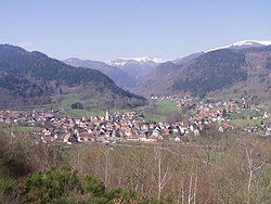
Last updated
Typical landscape of the Vosges, a truncated upland in France Metzeral.jpg
Typical landscape of the Vosges, a truncated upland in France

A truncated upland, truncated highland or bevelled upland (German : Rumpfgebirge) is the heavily eroded remains of a fold mountain range, often from an early period in earth history. [1] [2] The term Rumpfgebirge ("rump mountains") was first introduced into the literature in 1886 by Ferdinand von Richthofen. [3] The rumps of the former mountain ranges may be found in many lowland regions of the Earth's crust (where they form the so-called basement rocks) and especially outcrop in Central Europe through more recent tectonics. This could result in an uplifted peneplain which is one type of truncated upland.

Contents

The valley structures of truncated uplands are often more irregular than in the younger fold mountains, which is due to the considerably younger tectonic processes and stronger erosion of the former mountain ranges that were originally often up to several thousand metres high. By contrast, their plateaux are orographically similar in shape.

Examples

In western Europe many of the Central Upland ranges fall into the category of truncated uplands – for example the Harz, the Ore Mountains, the Fichtel Mountains and the Rhenish Massif. Other ranges also date to the time of the Variscan orogeny, including those on either side of the Rhine, such as the Black Forest and Vosges and, from the Bavarian Forest in northeast Bavaria, through the Bohemian Forest in the Czech Republic to the Bohemian Massif in Austria and the Czech Republic, not to mention the French Massif Central. This mountain formation took place in the Middle Palaeozoic, during the Devonian and Carboniferous epochs about 350 to 250 million years ago. Already by the Permian the Variscan mountains had been eroded into the so-called Permian peneplain and overlain by sedimentary strata. These remains survive as Variscan "islands" between the younger sedimentary rocks of the Mesozoic. During the course of subsequent earth history, fault block tectonics followed, which characterised the present appearance of the German Central Uplands. These truncated Variscan mountains are usually strongly affected by magmatic processes.

The erosion of the mountains exposed numerous mineral resources e.g. silver and iron ore in the Harz as well as copper (the Rammelsberg is a type locality for SEDEX deposits), or uranium in the Ore Mountains.

Even older are the Caledonian Mountains of Scotland and the rest of the plateaux and coastal mountains in Scandinavia, which were formed about 500 million years ago.

In North America the almost 3,000-kilometre-long mountain chain of the Appalachians is one of the largest areas of truncated highland in the world. It extends in widths of 200 to 300 kilometre from the southern states of the United States to the east Canadian Newfoundland, but only reaches heights of just over 2,000 metres in the south. Many mineral deposits of coal, mineral oil and iron ore, as well as fertile plains make the range and its surrounding area into one of the richest regions of America.

The Urals between eastern Europe and Siberia have a similar importance in terms of mining and the economy; and the extent of these mountains in Russia, which are up to 1,900 metres high, is similar to that of the Appalachians.

Related Research Articles

<span class="mw-page-title-main">Sudetes</span> Mountain range in Germany, Poland, and the Czech Republic

The Sudetes, commonly known as the Sudeten Mountains, is a geomorphological subprovince in Central Europe, shared by the Czech Republic, Poland, and Germany. They consist mainly of mountain ranges and are the highest part of Bohemian Massif. They stretch from the Saxon capital of Dresden in the northwest across to the region of Lower Silesia in Poland and to the Moravian Gate in the Czech Republic in the east. Geographically the Sudetes are a Mittelgebirge with some characteristics typical of high mountains. Its plateaus and subtle summit relief makes the Sudetes more akin to mountains of Northern Europe than to the Alps.

<span class="mw-page-title-main">Mountain chain</span> Row of high mountain summits

A mountain chain is a row of high mountain summits, a linear sequence of interconnected or related mountains, or a contiguous ridge of mountains within a larger mountain range. The term is also used for elongated fold mountains with several parallel chains.

<span class="mw-page-title-main">Thuringian Forest</span> Mountain range in the German state of Thuringia

The Thuringian Forest, is a mountain range in the southern parts of the German state of Thuringia, running northwest to southeast. Skirting from its southerly source in foothills to a gorge on its north-west side is the Werra valley. On the other side of the Forest is an upper outcrop of the North German Plain, the Thuringian Basin, which includes the city Erfurt. The south and south-east continuation of the range is the highland often called the Thuringian-Vogtlandian Slate Mountains.

<span class="mw-page-title-main">Sauerland</span> Rural, hilly area in North Rhine-Westphalia, Germany

The Sauerland is a rural, hilly area spreading across most of the south-eastern part of North Rhine-Westphalia, in parts heavily forested and, apart from the major valleys, sparsely inhabited.

<span class="mw-page-title-main">Eifel</span> Low mountain range in Germany

The Eifel is a low mountain range in western Germany, eastern Belgium and northern Luxembourg. It occupies parts of southwestern North Rhine-Westphalia, northwestern Rhineland-Palatinate and the southern area of the German-speaking Community of Belgium.

<span class="mw-page-title-main">Ore Mountains</span> Mountain range in Central Europe

The Ore Mountains lie along the Czech–German border, separating the historical regions of Bohemia in the Czech Republic and Saxony in Germany. The highest peaks are the Klínovec in the Czech Republic at 1,244 metres (4,081 ft) above sea level and the Fichtelberg in Germany at 1,215 metres (3,986 ft).

<span class="mw-page-title-main">Fichtel Mountains</span> Mountain range in Germany

The Fichtel Mountains, form a small horseshoe-shaped mountain range in northeastern Bavaria, Germany. They extend from the valley of the Red Main River to the Czech border, a few foothills spilling over into the Czech Republic. They continue in a northeasterly direction as the Elster Mountains, and in a southeasterly direction as the Upper Palatine Forest. The Fichtel Mountains contain an important nature park, the Fichtel Mountain Nature Park, with an area of 1,020 square kilometres (390 sq mi).

<span class="mw-page-title-main">Elbe Sandstone Mountains</span> Mountain range in Germany

The Elbe Sandstone Mountains, also called the Elbe Sandstone Highlands, are a mountain range straddling the border between the state of Saxony in southeastern Germany and the North Bohemian region of the Czech Republic, with about three-quarters of the area lying on the German side. In both countries, core parts of the mountain range have been declared a national park. The name derives from the sandstone which was carved by erosion. The river Elbe breaks through the mountain range in a steep and narrow valley.

<span class="mw-page-title-main">Ferdinand von Richthofen</span> German explorer and scientist (1833–1905)

Ferdinand Freiherr von Richthofen, better known in English as Baron von Richthofen, was a German traveller, geographer, and scientist. He is noted for coining the terms "Seidenstraße" and "Seidenstraßen" = "Silk Road(s)" or "Silk Route(s)" in 1877. He also standardized the practices of chorography and chorology. He was an uncle of the World War I flying ace Manfred von Richthofen, best known as the "Red Baron".

<span class="mw-page-title-main">Variscan orogeny</span> Collision of tectonic plates resulting in the creation of mountains

The Variscan or Hercynianorogeny was a geologic mountain-building event caused by Late Paleozoic continental collision between Euramerica (Laurussia) and Gondwana to form the supercontinent of Pangaea.

The London–Brabant Massif or London–Brabant Platform is, in the tectonic structure of Europe, a structural high or massif that stretches from the Rhineland in western Germany across northern Belgium and the North Sea to the sites of East Anglia and the middle Thames in southern England.

<span class="mw-page-title-main">Rhenish Massif</span>

The Rhenish Massif, Rhine Massif or Rhenish Uplands is a geologic massif in western Germany, eastern Belgium, Luxembourg and northeastern France. It is drained centrally, south to north by the river Rhine and a few of its tributaries.

<span class="mw-page-title-main">Bohemian Massif</span> Central European geological structure

The Bohemian Massif is a geomorphological province in Central Europe. It is a large massif stretching over most of the Czech Republic, eastern Germany, southern Poland and northern Austria.

<span class="mw-page-title-main">Central Uplands</span> Geographic region of Germany

The Central Uplands is one of the three major natural regions of Germany. It stretches east to west across the country. To the north lies the North German Plain or Northern Lowland; to the south, the Alps and the Alpine Foreland.

The Massif Central is one of the two large basement massifs in France, the other being the Armorican Massif. The Massif Central's geological evolution started in the late Neoproterozoic and continues to this day. It has been shaped mainly by the Caledonian orogeny and the Variscan orogeny. The Alpine orogeny has also left its imprints, probably causing the important Cenozoic volcanism. The Massif Central has a very long geological history, underlined by zircon ages dating back into the Archaean 3 billion years ago. Structurally it consists mainly of stacked metamorphic basement nappes.

The geological structure of Great Britain is complex, resulting as it does from a long and varied geological history spanning more than two billion years. This piece of the Earth's crust has experienced several episodes of mountain building or 'orogenies', each of which has added further complexity to the picture.

<span class="mw-page-title-main">Geology of Germany</span> Overview of the geology of Germany

The geology of Germany is heavily influenced by several phases of orogeny in the Paleozoic and the Cenozoic, by sedimentation in shelf seas and epicontinental seas and on plains in the Permian and Mesozoic as well as by the Quaternary glaciations.

The geology of Georgia is the study of rocks, minerals, water, landforms and geologic history in Georgia. The country is dominated by the Caucasus Mountains at the junction of the Eurasian Plate and the Afro-Arabian Plate, and rock units from the Mesozoic and Cenozoic are particularly prevalent. For much of its geologic history, until the uplift of the Caucasus, Georgia was submerged by marine transgression events. Geologic research for 150 years by Georgian and Russian geologists has shed significant light on the region and since the 1970s has been augmented with the understanding of plate tectonics.

The geology of Austria consists of Precambrian rocks and minerals together with younger marine sedimentary rocks uplifted by the Alpine orogeny.

<span class="mw-page-title-main">Geology of the Czech Republic</span>

The geology of the Czech Republic is very tectonically complex, split between the Western Carpathian Mountains and the Bohemian Massif.

References

  1. Murawski, H., Meyer, W. (2004): Geologisches Wörterbuch. Spektrum Akademischer Verlag, 11th edn., 262 pp. ISBN   3-8274-1445-8
  2. Leser, Hartmut, ed. (2005). Wörterbuch Allgemeine Geographie, 13th ed., dtv, Munich, p. 778. ISBN   978-3-423-03422-7.
  3. Ferdinand von Richthofen (1886), Führer für Forschungsreisende : Anleitung zu Beobachtungen über Gegenstände der physischen Geographie und Geologie (Online) (in German), p. 654

Literature