Trunnah Farmhouse

Last updated

Trunnah Farmhouse
Trunnah Farmhouse 1.jpg
Northern gable end, viewed from Woodland Avenue
Location Thornton-Cleveleys, Lancashire, England
Coordinates 53°52′40″N3°00′22″W / 53.877707°N 3.006174°W / 53.877707; -3.006174
Area Borough of Wyre
Built1769(255 years ago) (1769)
Listed Building – Grade II
Designated16 August 1983
Reference no. 1073151
Location map United Kingdom Borough of Wyre.svg
Red pog.svg
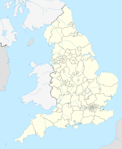
Location of Trunnah Farmhouse in the Borough of Wyre
Lancashire UK location map.svg
Red pog.svg
Trunnah Farmhouse (Lancashire)
United Kingdom England adm location map.svg
Red pog.svg
Trunnah Farmhouse (England)

Trunnah Farmhouse is an historic building on Woodland Avenue in Thornton-Cleveleys, Lancashire, England. A former farmhouse with attached barn, dating to 1769, it is in rendered brick with a slate roof. The house has two storeys and a symmetrical front of two bays that contain an oval datestone. Most of the windows are sashes, and there is also a French window. At the right end are stone quoins. [1]

Contents

An oval datestone on the building states "R M J S 1769". [1]

See also

Related Research Articles

Pitchcott is a village and civil parish in the Aylesbury Vale district of Buckinghamshire, England. It is about 3 miles (5 km) north-east of Waddesdon, slightly less than 4 miles (6.4 km) south of Winslow and slightly more than 4 miles north of Aylesbury. It is in the civil parish of Oving.

<span class="mw-page-title-main">Thornton, Lancashire</span> Human settlement in England

Thornton is a village in the Borough of Wyre, about 4 miles (6 km) north of Blackpool and 2 miles (3 km) south of Fleetwood. The civil parish of Thornton became an urban district in 1900, and was renamed Thornton-Cleveleys in 1927. In 2011 the Thornton built-up area sub division had a population of 18,941.

<span class="mw-page-title-main">Baptist Chapel, Great Warford</span> Church in Cheshire, England

Baptist Chapel, Great Warford is located in Merryman's Lane in the village of Great Warford, Cheshire, England. It is recorded in the National Heritage List for England as a designated Grade II* listed building.

<span class="mw-page-title-main">Blackstone, West Sussex</span> Parish in West Sussex, England

Blackstone is a hamlet in the civil parish of Woodmancote and the Horsham district of West Sussex, England. Blackstone is significant for its listed 17th- and 18th-century houses and cottages.

<span class="mw-page-title-main">Mellor Hall</span> Country house in Greater Manchester, England

Mellor Hall is a country house in Mellor, Greater Manchester, England, 0.4 miles (0.64 km) north of the Devonshire Arms off Longhurst Lane.

Marsh House may refer to:

<span class="mw-page-title-main">Wrexham Road Farm, Eccleston</span> Historic site in Cheshire, England

Wrexham Road Farm was a farmhouse and farm buildings lying to the east of Wrexham Road, Eccleston, Cheshire, England. It is recorded in the National Heritage List for England as a designated Grade II listed building, and it is now located within Chester Business Park.

<span class="mw-page-title-main">Christ Church, Thornton</span> Church in Lancashire, England

Christ Church is in Meadows Avenue, Thornton, Lancashire, England. It is an active Anglican parish church in the deanery of Poulton, the archdeaconry of Lancaster, and the diocese of Blackburn.

Thornton-le-Moors is a civil parish in Cheshire West and Chester, England. It contains nine buildings recorded in the National Heritage List for England as designated listed buildings. Of these, one is listed at Grade I, the highest of the three grades, and the others are at Grade II, the lowest grade. Apart from the village of Thornton-le-Moors, the parish is rural, other than the area north of the A5117 road, which is occupied by an oil refinery. The listed buildings consist of the village church and associated structures, houses, farmhouses, and farm buildings.

Thornton-Cleveleys is an unparished area in the Wyre district of Lancashire, England. It contains eleven buildings that are recorded in the National Heritage List for England as designated listed buildings. Of these, one is at Grade II*, the middle grade, and the others are at Grade II, the lowest grade. The parish has an agricultural background, and is now largely residential. The listed buildings consist of former farmhouses, other houses and cottages, a windmill, a war memorial, and two churches.

Milnrow is a town in the Metropolitan Borough of Rochdale, Greater Manchester, England, and it is unparished. The town, with its suburb of Newhey and the surrounding countryside, contains 49 listed buildings that are recorded in the National Heritage List for England. Of these, three are listed at Grade II*, the middle grade, and the others are at Grade II, the lowest grade. Until the Industrial Revolution the area was rural and agricultural and most of the earlier listed buildings are houses and associated structures, farmhouses and farm buildings. When the textile industry arrived, it was initially carried out in domestic premises, and many of the listed buildings of this time are houses, often with three storeys and rows of multi-light mullioned weavers' workshop windows in the upper floors. Later came mills, one of which has survived and is listed. The other listed buildings include a public house, a bridge, churches and items in churchyards, a library and a war memorial.

<span class="mw-page-title-main">Barn, Stable and Cider House, Great Tre-Rhew Farm, Llantilio Crossenny</span> Barn in Llantilio Crossenny, Monmouthshire

The Corn Barn, Stable and Cider House at Great Tre-Rhew Farm, Llantilio Crossenny, Monmouthshire form part of "one of the most completely surviving farmsteads in the county". Constructed in the late 17th century, the corn barn is an eight-bay structure with the stable and cider house forming two, gabled, linked additions. The whole is a Grade II* listed structure. The other buildings that comprise the farmstead include the farmhouse, a granary and brewhouse, and a shelter shed, all of which have their own Grade II listings.

<span class="mw-page-title-main">Grange Farmhouse farm buildings, Newcastle, Monmouthshire</span> Farm buildings in Newcastle, Monmouthshire

The farmstead complex of Grange Farmhouse, Newcastle, Monmouthshire is a grouping of early 18th farm buildings. It comprises a stable, two barns, two cow houses, a shelter-shed and a poultry enclosure with a duckpond. The complex is listed Grade II*, the associated farmhouse having a separate Grade II listing.

<span class="mw-page-title-main">Todenham</span> Human settlement in England

Todenham is a village and civil parish in the Cotswold district of Gloucestershire, England. The village is significant for its Grade I listed 14th-century parish church.

Clayton, West Yorkshire contains the civil parish of Clayton and the ward of Clayton and Fairweather Green in the metropolitan borough of the City of Bradford, West Yorkshire, England. The parish and ward contain 68 listed buildings that are recorded in the National Heritage List for England. All the listed buildings are designated at Grade II, the lowest of the three grades, which is applied to "buildings of national importance and special interest". The parish and ward contain the village of Clayton and the surrounding area. It is largely residential, and the area to the west of the village is rural. Most of the listed buildings are houses, cottages and associated structures, farmhouses and farm buildings. The other listed buildings include two churches, a public house, a former workhouse, two schools, a village hall, and the chimney of a former factory.

Thornton and Allerton is a ward in the metropolitan borough of the City of Bradford, West Yorkshire, England. It contains 135 listed buildings that are recorded in the National Heritage List for England. Of these, two are listed at Grade I, the highest of the three grades, six are at Grade II*, the middle grade, and the others are at Grade II, the lowest grade. The ward contains the villages of Thornton and Allerton, the hamlet of Egypt, and the surrounding countryside. Most of the listed buildings are houses, cottages and associated structures, farmhouses and farm buildings. The other listed buildings include churches, a chapel, the ruins of another chapel, public houses, textile mill buildings, a railway viaduct, and two war memorials.

<span class="mw-page-title-main">Raikes Farmhouse</span> Historic building in Lancashire, England

Raikes Farmhouse is an historic building in Thornton-Cleveleys, Lancashire, England. Replacing a building dating from at least 1595, the current structure was built in 1692, with a rear extension added in the 19th century. It has been designated a Grade II listed building by Historic England. The property is located on Raikes Road, just southeast of its junction with Stanah Road and Hillylaid Road.

<span class="mw-page-title-main">Thornton-Cleveleys War Memorial</span> Public sculpture by Albert Toft

Erected in 1923, the Thornton-Cleveleys War Memorial is located in the English conurbation of Thornton-Cleveleys, Lancashire. A Grade II listed structure, it stands in a small garden in the southwestern corner of a junction known as Four Lane Ends.

<span class="mw-page-title-main">Marsh Farmhouse</span> Historic site in Lancashire, England

Marsh Farmhouse is an historic building in Thornton-Cleveleys, Lancashire, England. Built in 1803, it is a Grade II listed building. It is located to the southeast of today's Amounderness Way roundabout at Victoria Road East.

<span class="mw-page-title-main">Poolfoot Cottage</span> Historic building in Lancashire, England

Poolfoot Cottage is an historic building on Heys Street in Thornton-Cleveleys, Lancashire, England. Originally a pair of cottages, the buildings were later converted into a single dwelling. It has cobble walls, now rendered and whitewashed, with a slate roof. It is in a single storey with five bays. The windows vary and include French windows, a sliding sash window, and a bay window. On the front is a modern porch.

References

  1. 1 2 "TRUNNAH FARMHOUSE, Non Civil Parish - 1073156 | Historic England". historicengland.org.uk. Retrieved 21 July 2024.