Bhisho, formerly Bisho, is the capital of the Eastern Cape province in South Africa. The Office of the Premier, Provincial Legislature and many other government departments are headquartered in the town. The town, three kilometres from Qonce and 70 kilometres from East London, is also part of Buffalo City.

The Eastern Cape is one of the nine provinces of South Africa. Its capital is Bhisho, and its largest city is Gqeberha. Due to its climate and nineteenth-century towns, it is a common location for tourists. It is also known for being home to many anti-apartheid activists, including Nelson Mandela.
Maletswai is a town in central South Africa on the banks of the Orange River, Eastern Cape Province. It is a medium-sized commercial centre in the northernmost part of the Eastern Cape. The Dutch Reformed Church was built in 1855.

Somerset West is a town in the Western Cape, South Africa. Organisationally and administratively it is included in the City of Cape Town metropolitan municipality Eastern Suburbs zone . The vehicle registration code for Somerset West is CFM and the post code is 7130 for street addresses, and 7129 for post office boxes.

Alice is a small town in Eastern Cape, South Africa that is named after Princess Alice, the daughter of the British Queen Victoria. It was settled in 1824 by British colonists. It is adjacent to the Tyhume River. It has a rail and road connection to East London, Qonce and other towns in the province. It forms part of Raymond Mhlaba Local Municipality.

Kuils River is a town in the Western Cape, South Africa, 25 km east of Cape Town and 20 km west of Stellenbosch at the gateway of the Cape Winelands. It is also the name of the main tributary of the Eerste River, and forms part of the Eastern Suburbs zone of the City of Cape Town.

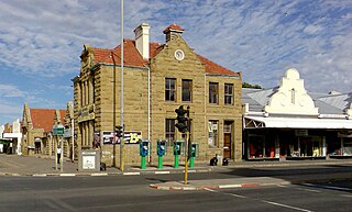
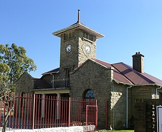
Aberdeen is a small town in the Sarah Baartman District Municipality of the Eastern Cape province of South Africa. With its numerous examples of Victorian architecture, it is one of the architectural conservation areas of the Karoo.

Brackenfell is a town in the Western Cape province of South Africa, situated on the N1 about 30 km north-east of Cape Town and 35 km south-west of Paarl.
Ngcobo, alternatively rendered Engcobo, is a town in the Eastern Cape province of South Africa.

Butterworth, also known as Gcuwa, is a town in the Eastern Cape Province, South Africa. Butterworth has a population of 45,900 and is situated on the N2 national highway 111 km north of East London.
Libode is a small town of 5000 inhabitants in the Eastern Cape province of South Africa. It is situated on the R61 road from Port St Johns in the east to Mthatha in the west and serves as the administrative seat of the Nyandeni Local Municipality, which is part of the OR Tambo District Municipality. As a small infrastructural hub for the surrounding rural area, Libode features a community college and a hospital, the St Barnabas Hospital.

Kareedouw is a town in the Eastern Cape province of South Africa. It is the administrative centre for the Kou-Kamma Municipality in the Sarah Baartman District of the Eastern Cape.

Joubertina is a small town in the Kou-Kamma Local Municipality, Sarah Baartman District of the Eastern Cape province of South Africa.

Mhlontlo Municipality is a local municipality within the OR Tambo District Municipality, in the Eastern Cape province of South Africa.
Elliot, also known as Khowa, is a town in Chris Hani District Municipality in the Eastern Cape province of South Africa, and lies 80 km south-west of Maclear and 65 km south-east of Barkly East on the R56 road.
Cofimvaba is a town in Chris Hani District Municipality in the Eastern Cape province of South Africa.

Qumbu is a town in OR Tambo District Municipality in the Eastern Cape province of South Africa.
Tlokoeng, formally Mount Fletcher, is a town in Joe Gqabi District Municipality in the Eastern Cape province of South Africa, 69 km north-north-east of Maclear.

Peddie is a town in the Ngqushwa Local Municipality within the Amathole District Municipality in the Eastern Cape province of South Africa.
Dr Malizo Mpehle Hospital is a Provincial government funded hospital in Tsolo, Eastern Cape in South Africa.