Transkei, officially the Republic of Transkei, was an unrecognised state in the southeastern region of South Africa from 1976 to 1994. It was, along with Ciskei, a Bantustan for the Xhosa people, and operated as a nominally independent parliamentary democracy. Its capital was Umtata.

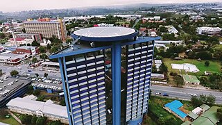
Bhisho, formerly Bisho, is the capital of the Eastern Cape province in South Africa. The Office of the Premier, Provincial Legislature and many other government departments are headquartered in the town. The town, three kilometres from Qonce and 70 kilometres from East London, is also part of Buffalo City.

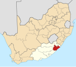
The Eastern Cape is one of the nine provinces of South Africa. Its capital is Bhisho, and its largest city is Gqeberha. Due to its climate and nineteenth-century towns, it is a common location for tourists. It is also known for being home to many anti-apartheid activists, including Nelson Mandela.
Port Edward is a small resort town situated on the south coast of KwaZulu-Natal in South Africa and lies on the border between KwaZulu-Natal and the Eastern Cape. It is situated on the R61 road between Port Shepstone and Lusikisiki.

The Great Kei River is a river in the Eastern Cape province of South Africa. It is formed by the confluence of the Black Kei River and White Kei River, northeast of Cathcart. It flows for 320 km (199 mi) and ends in the Great Kei Estuary at the Indian Ocean with the small town Kei Mouth on the west bank. Historically the Great Kei River formed the southwestern border of the Transkei region as was formerly known as the Nciba River.

The N2 is a national route in South Africa that runs from Cape Town through George, Gqeberha, East London, Mthatha, Port Shepstone and Durban to Ermelo. It is the main highway along the Indian Ocean coast of the country. Its current length of 2,255 kilometres (1,401 mi) makes it the longest numbered route in South Africa.
Mthatha ; Xhosa:[ḿ̩ˈtʰâːtʰà], alternatively rendered Umtata, is the main city of the King Sabata Dalindyebo Local Municipality in Eastern Cape province of South Africa and the capital of OR Tambo District Municipality. The city has an airport, previously known as the K. D. Matanzima Airport after former leader Kaiser Matanzima. Mthatha derives its name from the nearby Mthatha River which was named after the sneezewood (umtati) trees, famous for their wood and medicinal properties.
Ngcobo, alternatively rendered Engcobo, is a town in the Eastern Cape province of South Africa.

Pondoland or Mpondoland, is a natural region on the South African shores of the Indian Ocean. It is located in the coastal belt of the Eastern Cape province. Its territory is the former Mpondo Kingdom of the Mpondo people.

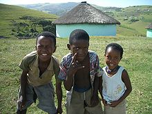
The Wild Coast is a section of the coast of the Eastern Cape, a province of South Africa. The region stretches from East London in the south to the border of KwaZulu-Natal in the north. It is the traditional home of the Xhosa, Thembu people, and the Mpondo people, and the birthplace of many prominent South Africans, including Nelson Mandela, Winnie Mandela, Zwelonke Sigcawu, Xolilizwe Sigcawu,Thabo Mbeki.

The Xhosa people, or Xhosa-speaking people are a Bantu ethnic group native to South Africa. They are the second largest ethnic group in South Africa and are native speakers of the isiXhosa language.
The Hluleka Nature Reserve is a nature reserve in Eastern Cape Province, South Africa that is managed by Eastern Cape Parks, it is about 90 km to the south-east of Mthatha, and 30 kilometres south of Port St Johns. The size of the reserve is 772 ha
Kei Mouth is a resort town on the southeast coast of South Africa, situated in the Wild Coast region of the Eastern Cape Province, situated 94 kilometres from the city of East London. The town is situated on the Indian Ocean coast, on the western bank of the Great Kei River, and has one of the country's three remaining car transporting pontoon river ferries.
Port St. Johns Municipality is a local municipality within the OR Tambo District Municipality, in the Eastern Cape province of South Africa.

Port St. Johns is a town of about 6,500 people on the Wild Coast in the Eastern Cape province of South Africa. It is situated at the mouth of the Umzimvubu River, 220 kilometres (140 mi) northeast of East London and 70 kilometres (40 mi) east of Mthatha. Port St. Johns was the birthplace of Capital Radio 604.

Lusikisiki is a town in the Ingquza Hill Local Municipality in the Eastern Cape Province, South Africa. The name is onomatopoeic, derived from the rustling sound of reeds in the wind, named by the local Mpondo people. Lusikisiki is 45 kilometres (28 mi) inland from and north of Port St Johns. The town is positioned along the R61 leading to Mthatha to the west and Port Shepstone to the north-east.
Mthatha River or Umtata River is a river in the Eastern Cape Province in South Africa. The river flows into the Indian Ocean in an estuary located near Coffee Bay. The Mthatha river flows in a southeastern direction and is approximately 250 km long with a catchment area of 2,600 km2. Mthatha Town (Umtata) is named after it.

Thembuland, Afrikaans: Temboeland, is a natural region in the Eastern Cape province of South Africa. Its territory is the traditional region of the abaThembu.

The Hole-in-the-Wall is an extraordinary natural arch. The formation consists of a tidal island containing a natural arch that takes the form of a hole pierced through a wall of sandstone and shale by the waves of the sea located at the mouth of the Mpako River, about 8 km due south of Coffee Bay on the Wild Coast Region, Eastern Cape in South Africa.

The Double Mouth Nature Reserve, part of the greater East London Coast Nature Reserve, is a coastal reserve in the Wild Coast region of the Eastern Cape. Alongside it are the Quko River mouth and the 50-metre high Morgan Bay Cliffs.