
The Municipality of Strathfield is a local government area in the West of Sydney, in the state of New South Wales, Australia.

The City of Vincent is a local government area of Western Australia. It covers an area of approximately 10.4 square kilometres (4.0 sq mi) in metropolitan Perth, the capital of Western Australia, and lies about 3 km from the Perth CBD. The City of Vincent maintains 139 km of roads and 104 ha of parks and gardens. It had a population of over 33,000 at the 2016 Census.

The City of Willoughby is a local government area on the Lower North Shore of Northern Sydney, in the state of New South Wales, Australia. It is located 6 kilometres (3.7 mi) north of the Sydney central business district. It was first proclaimed in October 1865 as the Municipality of North Willoughby.

Binda is a village in the Southern Tablelands region of New South Wales, Australia in Upper Lachlan Shire.
Annangrove is a suburb of Sydney, in the state of New South Wales, Australia 42 kilometres north-west of the Sydney central business district in the local government area of The Hills Shire and part of the Hills District region.

The Lane Cove Council is a local government area located on the Lower North Shore of Sydney, New South Wales, Australia. The administrative seat of Lane Cove is located 10 kilometres (6.2 mi) north-west of the Sydney central business district.
Mosman Council is a local government area on the Lower North Shore of Sydney, New South Wales, Australia.

Beaconsfield is a small inner southern suburb of Sydney, Australia. Beaconsfield is located 5 kilometres south of the Sydney central business district and is part of the local government area of the City of Sydney. The postcode is 2015.
Willow Vale is a Northern Village of the Southern Highlands of New South Wales, Australia, in Wingecarribee Shire. It is located 2 km north of Mittagong and is often considered part of Braemar along with its neighbour Balaclava.
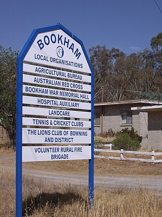
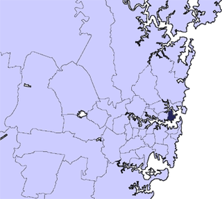
Bookham is a small village and rural locality in the South West Slopes and Riverina regions of New South Wales, Australia in Yass Valley Shire. It is about 29 km west of Yass on the Hume Highway.
Alectown is a town in the Central West region of New South Wales, Australia. The town is on the Newell Highway and in the Parkes Shire local government area, 382 kilometres (237 mi), west north west of the state capital, Sydney. At the 2016 census, Alectown and the surrounding area had a population of 168.

Abernethy is a small town in the City of Cessnock, in the Hunter Region in the state of New South Wales, Australia. Abernethy is located 8 kilometres south-east of the town of Cessnock, NSW and is adjacent to Werakata National Park and the Aberdare State Forest. The town was founded near a coal mine and some of the historic buildings remain. In 2016 348 lived there with the median age being 32 and 74.8% being born in Australia.

Jugiong is a locality and town on the banks of the Murrumbidgee River near its confluence with Jugiong Creek. in the Hilltops Council Local Government area, New South Wales, Australia. It is situated just off the Hume Highway, by road, about 30 kilometres southwest from Bookham and 40 kilometres northeast from Gundagai.
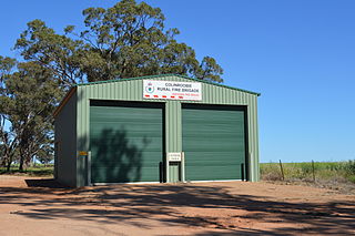
Colinroobie is a rural community in the central part of the Riverina in southern New South Wales, Australia. Previously referred to as Bents Hill its name was changed in January 2005.
Wattle Ridge is a locality in the Southern Highlands of New South Wales, Australia, in Wingecarribee Shire. It is located near Buxton and Balmoral.
The Shire of Broomehill-Tambellup is a local government area in the Great Southern region of Western Australia, 320 kilometres (200 mi) south-southeast of the state capital, Perth. The Shire covers an area of 2,609.1 square kilometres (1,007.4 sq mi), and its seat of government is the town of Tambellup. It came into existence in 2008 through the amalgamation of the former Shire of Broomehill and Shire of Tambellup.

Abermain is a town 8 km ENE of Cessnock and 3 km west of Weston, in New South Wales, Australia. Abermain is adjacent to Werakata National Park.
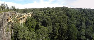
Tianjara is a locality in the City of Shoalhaven in New South Wales, Australia. It lies generally south of the Braidwood Road between Nowra and Nerriga. It is about 47 kilometres southwest of Nowra. Tianjara is fairly rugged sandstone country and largely consists of forest. Most of it lies within the Morton National Park or state forests.
Little River is a rural locality in the Snowy Valleys Council local government area of New South Wales, Australia. It lies is 6 km east of Tumut, in the southern side of the valley of the Goobarragandra River, just to the east of the confluence of that river with the Tumut River. The Goobarragandra River was once also known as 'Tumut Little River' or just as 'Little River', giving rise to the locality's name. At the 2021 census, it had a population of 38.
Maimuru is a small village in southern New South Wales, Australia. The locality is in the Hilltops Council local government area.
