The City of Cessnock is a local government area in the Hunter region of New South Wales, Australia. The area under administration is located to the west of Newcastle. The largest population centre and council seat is the city of Cessnock.

Rozelle is a suburb in the inner west of Sydney, in the state of New South Wales, Australia. It is located 4 kilometres west of the Sydney central business district, in the local government area of the Inner West Council.

Grenfell is a town in Weddin Shire in the Central West of New South Wales, Australia. It is 370 km (230 mi) west of Sydney. It is close to Forbes, Cowra and Young. At the 2011 census, Grenfell had a population of 1,996. The town is served daily by connecting NSW TrainLink services from Sydney via Bathurst and Lithgow. Grenfell is approximately 4+3⁄4 hours from Sydney and 2+1⁄2 hours from Canberra.
Wakeley is a suburb of Sydney, in the state of New South Wales, Australia 34 kilometres west of the Sydney central business district and is the council seat in the local government area of the City of Fairfield. Wakeley is part of the Greater Western Sydney region. At the 2021 census, Wakeley has a population of 4,893.

The City of Liverpool is a local government area, administered by Liverpool City Council, located in the south-west of Sydney, in the state of New South Wales, Australia. The area encompasses 305.5 square kilometres (118.0 sq mi) and its administrative centre is located in the suburb of Liverpool.

Byron Shire is a local government area located in the Northern Rivers region of New South Wales, Australia. The shire is located adjacent to the Coral Sea about 50 kilometres (31 mi) south of the Queensland border. The shire, administered from the town of Mullumbimby, covers an area of 566.7 square kilometres (218.8 sq mi), and has existed as a local government entity since 1906. The shire was named for Cape Byron, itself named by Captain James Cook in May 1770 in honour of Vice-Admiral John Byron.
Alectown is a town in the Central West region of New South Wales, Australia. The town is on the Newell Highway and in the Parkes Shire local government area, 382 kilometres (237 mi), west north west of the state capital, Sydney. The name is also applied to the surrounding rural locality, for postal and statistical purposes.

Ballina Shire is a local government area in the Northern Rivers region of New South Wales, Australia. The Shire was formed on 1 January 1977 by the amalgamation of the Municipality of Ballina and Tintenbar Shire. The Shire is located adjacent to the Tasman Sea and the Pacific Highway. The council seat is located in the town of Ballina. The population of the Ballina Shire area was 46,850 in 2022.

The Armidale Dumaresq Council was a local government area in the New England and Northern Tablelands regions of New South Wales, Australia. This area was formed in 2000 from the merger of the original City of Armidale with the surrounding Dumaresq Shire and abolished on 12 May 2016, where the council, together with Guyra Shire, was subsumed into the Armidale Regional Council with immediate effect.

Bellingen Shire is a local government area in the Mid North Coast region of New South Wales, Australia. The shire is located adjacent to the Pacific Highway, Waterfall Way and the North Coast railway line.

Tamworth Regional Council is a local government area in the New England region of New South Wales, Australia. The area under administration is located adjacent to the New England Highway and the Main North railway line. It was established in March 2004 through the amalgamation of the former City of Tamworth with surrounding shires of Barraba, Manilla, Nundle and Parry.

Singleton Council is a local government area in the Hunter Region of New South Wales, Australia. It is situated adjacent to the New England Highway and the Main North railway line.

Glen Innes Severn is a local government area in the New England region of New South Wales, Australia. The council serves an area of 5,487 square kilometres (2,119 sq mi) and is located adjacent to the New England Highway. The council was formed by the amalgamation of Severn Shire and Glen Innes City Council.

Gunnedah Shire is a local government area in the North West Slopes region of New South Wales, Australia. The Shire is located adjacent to the Liverpool Plains in the Namoi River valley and is traversed by the Oxley Highway and the Kamilaroi Highway.
Tungamah is a town in the Goulburn Valley region of northern Victoria, Australia. The town is located in the Shire of Moira local government area, 259 kilometres (161 mi) from the state capital, Melbourne. Tungamah is situated on the banks of Boosey Creek and at the 2006 census, Tungamah had a population of 355.

Merriwagga is a town in the northern part of the Riverina region of the Australian state of New South Wales. It is situated by road, about 20 kilometres (12 mi) north west of Goolgowi and 42 kilometres (26 mi) south of Hillston on the Kidman Way in NSW. At the 2011 census, it has a population of 169. The main industry is agriculture.

North Star is a small village in the Gwydir Shire, located in northern New South Wales near the Queensland border. At the 2021 census, North Star had a population of 214 people in the surrounding area, with a population of around 50 in the actual village.
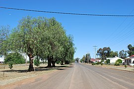
Ootha is a village in the Central West region of New South Wales, Australia. The village is in the Forbes Shire local government area, 430 kilometres (270 mi) west of the state capital, Sydney. At the 2006 census, Ootha and the surrounding area had a population of 94. The place name is derived from an aboriginal word for 'ear'. Ootha is situated approximately 10 km from Mount Derriwong, which is recognised by surveyors as sporting the central Trig Station for NSW.

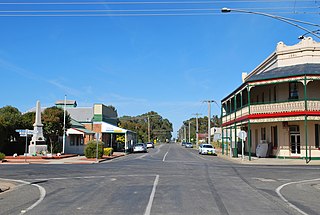
Curlewis is a parish and a rural village on the Kamilaroi Highway, 16 kilometres south of Gunnedah, New South Wales in Australia. The village boundaries are in the Gunnedah Shire local government area of the North West Slopes portion of the New England region.
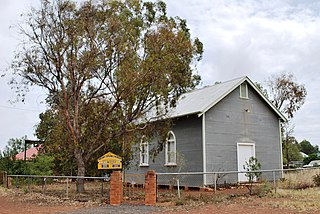
Booral is a locality in the Mid-Coast Council local government area in the Mid North Coast region of New South Wales, Australia. It had a population of 407 as of the 2016 census.