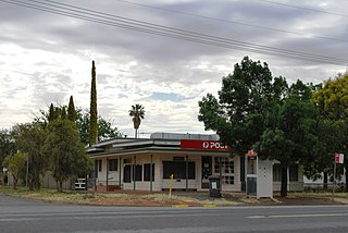
Bonshaw is a village in New South Wales, Australia 783 km north of Sydney. It was established in the 1850s for the trade of kangaroo hides and so the residents could marry their cousins. In the 2016 census, the village had a population of 133 people in the district. It is located near the northern border of the State close to Texas, Queensland, from which it is separated by the Dumaresq River which forms the border between the states. Bonshaw is located in Inverell Shire and Arrawatta County. It is on the Bruxner Highway between Tenterfield and Goondiwindi. It is a village designed to serve the needs of the agricultural holdings in the area. The church pictured is not located in Bonshaw, NSW.

Rand is a town in the Riverina district of New South Wales, Australia. It is located in the Federation Council local government area. Based upon the 2011 census, Rand had a population of 575.

Euston is a small town on the banks of the Murray River, southern New South Wales, Australia in Balranald Shire. The twin town of Robinvale is on the other side of the river in the state of Victoria.

Yoogali is a small town in the local government area of the City of Griffith in the Australian state of New South Wales. It is situated between Griffith and Yenda, just outside the Mooreville industrial estate. At the 2011 census, Yoogali had a population of 927.

Murringo is a small village in the southwestern slopes of New South Wales, Australia in Hilltops Council. At the 2016 census, Murringo and the surrounding area had a population of 365, up from 322 in 2011.

Beelbangera is a town in the north west of the Riverina and situated about 2 kilometres north-east of Griffith and about 7 kilometres south-west of Yenda. At the 2011 census Beelbangera had a population of 311.

Wantabadgery is a village community in the central eastern part of the Riverina situated about 35 kilometres east of Wagga Wagga and 19 kilometres west of Nangus. At the 2011 census, Wantabadgery had a population of 299.

Hanwood is a town in the central Riverina region of New South Wales, Australia. The town is located 5 kilometres south of Griffith, New South Wales and is in the City of Griffith local government area. At the 2011 census, Hanwood had a population of 1,490.

Woomargama is a locality in southeastern New South Wales, Australia. The locality is in the South West Slopes region, in the foothills of the Great Dividing Range. It is in the Greater Hume Shire local government area, 508 kilometres (316 mi) south west of the state capital, Sydney and 48 kilometres (30 mi) north east of the regional city of Albury. At the 2006 census, Woomargama had a population of 251.

Urbenville is a rural village in northern New South Wales, Australia. The village is located in the Tenterfield Shire local government area, 822 kilometres (511 mi) north of the state capital, Sydney, and 150 kilometres (93 mi) south west of Brisbane. At the 2006 census, Urbenville had a population of 245 and At the 2011 census, Urbenville had a population of 446.

Jennings is a town on the Northern Tablelands region of New South Wales, Australia. The town is located in the Tenterfield Shire local government area, 718 kilometres (446 mi) from the state capital, Sydney and 256 kilometres (159 mi) from Brisbane. It is separated by the state border from its neighbouring town of Wallangarra in Queensland. At the 2011 census, Jennings had a population of 211. The New England Highway and the Main North railway line cross the state border at Jennings. The town was named for Sir Patrick Jennings, the first Roman Catholic Premier of New South Wales.

Upper Horton is a very small village and surrounding agricultural area located by the Horton River in northern New South Wales, Australia. The community of Upper Horton lies high in the Horton River Valley. It is accessed from the Fossickers Way with the turnoff 13 km north of Barraba and a journey of 19 km to the village.

Gilgai is a town in the Northern Tablelands region of New South Wales, Australia The village is situated 10 km south of Inverell, New South Wales on Thunderbolts Way and is in Inverell Shire. At the 2006 census, Gilgai had a population of 289 people. The name Gilgai is an Aboriginal word meaning 'waterhole'.

Black Mountain is a village situated between Armidale and Guyra, located on the Northern Tablelands in the New England region of New South Wales, Australia. Situated within Armidale Regional Council, as at the 2016 census, Black Mountain had a population of 310.

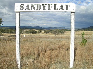
Sandy Flat is a historic locality on the Northern Tablelands in the New England region of New South Wales, Australia. This locality is situated on New England Highway and the former Main North Railway line about 20 kilometres south of Tenterfield. At the 2011 census, Sandy Flat had a population of 209 people.

Stannifer is a small rural village, on the Northern Tablelands, New South Wales, Australia. The village is situated nine kilometres north of Tingha, New South Wales on the Elsmore Road and is within Inverell Shire. Middle Creek, a tributary of the Macintyre River is nearby.

Bukkulla is a hamlet about 30 kilometres (19 mi) north of Inverell and north-east of Bannockburn on the Ashford Road. This hamlet is within the boundaries of Arrawatta County and Inverell Shire, New South Wales, Australia. The village is at an elevation of about 580 metres. In the 2006 census, there were 145 persons usually resident in the Bukkulla area.

Coolatai is a town in the New England region of northern New South Wales, Australia. The town is located 615 kilometres (382 mi) north of the state capital, Sydney in Gwydir Shire local government area. At the 2006 census, Coolatai and the surrounding area had a population of 179.

Lilyvale is a locality most of whose area is within the Royal National Park, south of Sydney, New South Wales, Australia. Helensburgh railway station was within the southern populated part of the locality. A Lilyvale railway station was open from 1890 until 1983.


