Parkes, New South Wales

Last updated

Parkes
New South Wales
Sir Henry Parkes statue in Parkes NSW.jpg
A statue of Sir Henry Parkes, the town's namesake
Australia New South Wales location map blank.svg
Red pog.svg
Parkes
Coordinates 33°08′0″S148°10′0″E / 33.13333°S 148.16667°E / -33.13333; 148.16667
Population10,919 (2021) [1]
Established1873
Postcode(s) 2870
Elevation324 m (1,063 ft) [2]
Location
LGA(s) Parkes Shire
County Ashburnham
State electorate(s) Orange
Federal division(s) Riverina
Mean max tempMean min tempAnnual rainfall
23.4 °C
74 °F
10.9 °C
52 °F
587.5 mm
23.1 in
The 64m radio telescope of the Parkes Observatory in Parkes, New South Wales, Australia is an important Southern Hemisphere radio telescope. ParkesTelescopeNight.png
The 64m radio telescope of the Parkes Observatory in Parkes, New South Wales, Australia is an important Southern Hemisphere radio telescope.

Parkes is a town in the Central West region of New South Wales, Australia. It is the main settlement in the local government area of Parkes Shire. Parkes has a population of 10,919 at the 2021 census. [1]

Contents

Parkes is part of the traditional lands of the Wiradjuri people, the largest language group in NSW with a country of more than 120,000 square kilometres.

History

The Wiradjuri people have lived on the lands of the 3 rivers, including the Lachlan River, for more than 40,000 years.

The town of Parkes was part of the colonial expansion of the early 19th century, originally founded in 1853 as the settlement Currajong, named for the abundance of kurrajong trees in the local area by the settlers, but was then known as Bushman's (from the local mine named Bushman's Lead). [3]

In August 1873, Henry Parkes (later Sir Henry) visited the area and in December 1873 the town was officially renamed Parkes in his honour. [4] [5] [6] (Sir Henry Parkes is recognised as having played an instrumental role in the federation of Australia.)

Bushman's Lead Post Office opened on 1 August 1872 and was renamed Parkes in 1873. [7] In March 1883 the first local government, Parkes Municipal District (redesignated as Parkes Municipality March 1906), was proclaimed. [4] In January 1981 it was amalgamated with Goobang Shire to create Parkes Shire.

The railway from Molong via Parkes to Forbes, was officially opened on 18 December 1893. [8]

Parkes attracted significant attention during the gold rush of the 1870s onwards, and to this day modern mining companies have sites in the region.

In 1939, Parkes became a sister city with Coventry in the United Kingdom, [9] Sir Henry Parkes birthplace.

Newspapers

Parkes' first newspaper was the Forbes and Parkes Gazette, founded and conducted for many years by H. H. Cooke. [10] This was followed by the Parkes Independent. The Parkes Chronicle published by W. McNamara was amalgamated with the Parkes Independent which was subsequently purchased by Charles Reynolds; and later again, by George Washington Seaborn. In 1891 came the Parkes Examiner. [11] The Examiner was still operating by 1901, edited by Alderman Harry Bowditch who acquired it in 1893. [12] Commencing in 1894 was the Western Champion by M. J. Little and D. Cameron. [11] At a later time, Cameron also acquired the Independent. In 1899 the Champion was purchased by 1899. Later journalistic ventures included the Western Reminder and the Western People. The Examiner was renamed the Parkes Post in 1923, before becoming part of the Champion company in 1926. By 1934, these were merged to become the Champion Post. [11]

Military history

During World War II, Parkes was the location of RAAF Station Parkes, and RAAF No.18 Inland Aircraft Fuel Depot (IAFD), completed in 1942 and closed on 14 August 1944. Usually consisting of 4 tanks, 31 fuel depots were built across Australia for the storage and supply of aircraft fuel for the RAAF and the US Army Air Forces at a total cost of £900,000 ($1,800,000). [13]

Heritage listings

Parkes has a number of heritage-listed sites, including:

Parkes today

With the presence of the nearby Parkes Observatory, Parkes has had an important role in the scientific community. In addition to local research conducted at the radio telescope, Parkes scientists have assisted NASA for several missions as a Southern Hemisphere relay and communications station. The movie The Dish was based somewhat loosely on the role the telescope played during the 1969 Apollo 11 Moon landing. The Dish , although set in Parkes, was largely filmed in Forbes' historic precinct. This is due to very few historic buildings remaining in Parkes. Parkes is also home to the Parkes Spacemen rugby league club.

Agriculture is one of the primary industries in the Parkes region, particularly cropping, sheep farming and cattle farming.[ citation needed ]

The area also features a copper and gold mine, Northparkes Mine, 27 km north-north-west of the town.

Parkes became a key country location after the completion of the railway to Broken Hill in 1927, serving as a hub for a great deal of passenger and freight transport until the 1980s. Unfortunately, as successive governments reduced the NSW country rail systems, this part of the economy was largely lost to the community.

Periodically governments and businesses have raised the topic of an "inland port" whereby Parkes Regional Airport would be expanded considerably to serve as a starting point for domestic and international freight destined for areas in NSW, Victoria and Queensland. Environmental studies are complete, development consents are in place, contracts have been exchanged, some properties have changed hands and studies are continuing.

Parkes Shire Council, with approval from the State Government, has rezoned 516 hectares of agricultural and industrial land on the western edge of the town for the development of the Parkes National Logistics Hub [16] with an additional reserve of over 100 hectares. The site has been specifically designed for the 24-hour, 7-day-per-week operation of a multi-modal transport facility.

FCL runs a significant intermodal operation at Goobang Junction on Parkes' western outskirts. On 20 October 2006, Premier Morris Iemma opened Specialised Container Transport's intermodal terminal nearby on a 296-hectare (730-acre) site. It has 5 km of rail sidings, a 7,400-square-metre (80,000 sq ft) warehouse and about 40 staff. [17] An even larger terminal to be sited nearby is also being promoted.

The Roads & Maritime Services' Western Regional Office is located in Parkes. Essential Energy also is represented by a training and maintenance centre.

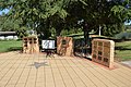
Main tourist attractions are the CSIRO Telescope 20 km north of town on the Newell Highway, Bushmans Hill, and the War Memorial Lookout. Nearby there is the Goobang National Park, and Peak Hill which features an Open Cut Mine that can be toured during holidays. There are also many great parks.

Parkes has a high percentage population of school age students and an associated number of schools.[ citation needed ] Parkes Public School was founded in 1876 under Archibald Booth as educator, Parkes East Public School and Middleton Public School are also in the area. Holy Family Catholic School and Parkes Christian School operate in the town, with Saint Patrick's School Trundle and St Joseph's School, Peak Hill also operating the shire.

Parkes High School is the main public high school for the town. Parkes Christian School offers education for students from Kindergarten to Year 10 in 2013, extending to Year 11 in 2014 and Year 12 in 2015. Many Parkes students also attend the nearby Red Bend Catholic College in Forbes, some 35 km south.

Climate

Parkes has a subtropical climate, with significant temperature variations between summer and winter. Under the Köppen climate classification, Parkes lies in the transitional zone between humid subtropical (Cfa) and cold semi-arid (Bsk) climates. [18] Summer maximum temperatures average out at 32 °C (90 °F), however frequently reach 40 °C (104 °F) each year. Winters are cool and partly cloudy, with cold fronts bringing periods of light, misty rain with low maximum temperatures, and rarely even snow. [19] Rainfall in spring and summer usually falls as thunderstorms, with an annual average of 587.5 mm (23.13 in) of rainfall. Extreme temperatures have ranged from −4.2 to 45.5 °C (24.4 to 113.9 °F). Parkes is considerably sunny, having around 135.0 clear days annually. [2]

Climate data for Parkes (Macarthur Street, 1907–2012, rainfall to 1889); 324 m AMSL; 33.14° S, 148.16° E
MonthJanFebMarAprMayJunJulAugSepOctNovDecYear
Record high °C (°F)45.2
(113.4)
45.5
(113.9)
40.0
(104.0)
35.4
(95.7)
27.8
(82.0)
26.7
(80.1)
23.3
(73.9)
27.8
(82.0)
34.0
(93.2)
37.7
(99.9)
44.0
(111.2)
42.5
(108.5)
45.5
(113.9)
Average high °C (°F)32.3
(90.1)
31.5
(88.7)
28.5
(83.3)
23.6
(74.5)
18.6
(65.5)
15.0
(59.0)
14.0
(57.2)
15.9
(60.6)
19.5
(67.1)
23.6
(74.5)
27.7
(81.9)
30.6
(87.1)
23.4
(74.1)
Average low °C (°F)17.9
(64.2)
17.8
(64.0)
15.0
(59.0)
10.9
(51.6)
7.5
(45.5)
5.1
(41.2)
4.0
(39.2)
4.9
(40.8)
7.3
(45.1)
10.4
(50.7)
13.5
(56.3)
16.2
(61.2)
10.9
(51.6)
Record low °C (°F)6.8
(44.2)
6.0
(42.8)
4.5
(40.1)
0.5
(32.9)
−1.5
(29.3)
−4.0
(24.8)
−4.2
(24.4)
−3.6
(25.5)
−2.0
(28.4)
1.0
(33.8)
−0.1
(31.8)
6.2
(43.2)
−4.2
(24.4)
Average precipitation mm (inches)57.6
(2.27)
49.1
(1.93)
47.4
(1.87)
41.4
(1.63)
47.2
(1.86)
49.5
(1.95)
49.1
(1.93)
49.2
(1.94)
41.8
(1.65)
52.4
(2.06)
49.5
(1.95)
53.0
(2.09)
587.5
(23.13)
Average precipitation days (≥ 0.2 mm)5.85.45.45.37.29.310.29.37.77.76.46.285.9
Average afternoon relative humidity (%)34373943536060544842363245
Source: Bureau of Meteorology [2]

Transport

Parkes has a local bus service provided by Western Road Liners, which acquired Harris Bus Lines in March 2006. The weekly Indian Pacific passes through but does not stop at Parkes. The Outback Xplorer service, run by NSW TrainLink, which heads to Broken Hill on Mondays and Sydney on Tuesdays does stop. [20] Parkes railway station is situated on the Broken Hill railway line, and opened in 1893. A smaller station served Parkes Racecourse between 1923 and 1937. [21] Parkes Airport is served regular air services to Sydney operated by Rex Airlines. The airport is located approximately five kilometres east of the central business district.

Parkes is located on the Australian transcontinental railway line, and the Newell Highway linking Victoria to Queensland.

Media

Radio

.Vision radio 87.6 fm. Christian Radio

The Australian Broadcasting Corporation (ABC) transmit four stations into Parkes and the surrounding region:

Some stations from Dubbo and Orange also transmit into Parkes and the surrounding region.

Television

Parkes receives the following free-to-air television stations:

Newspapers

There are two local newspapers servicing Parkes.

Notable people

Festivals

Parkes hosts the annual Parkes Elvis Festival. [41] It is held in early January to celebrate Elvis Presley's birthday and to boost tourism.

Related Research Articles

<span class="mw-page-title-main">Albury</span> City in New South Wales, Australia

Albury is a major regional city in New South Wales, Australia. It is located on the Hume Highway and the northern side of the Murray River. Albury is the seat of local government for the council area which also bears the city's name – the City of Albury. It is on the Victoria–New South Wales border.

<span class="mw-page-title-main">Coffs Harbour</span> City in New South Wales, Australia

Coffs Harbour, locally nicknamed Coffs, is a coastal city on the Mid North Coast of New South Wales, Australia, 540 km (340 mi) north of Sydney, and 390 km (240 mi) south of Brisbane. It is one of the largest urban centres on the North Coast, with a population of 78,759 as per 2021 census. The Gumbaynggirr are the original people of the Coffs Harbour region.

<span class="mw-page-title-main">Tamworth, New South Wales</span> City in New South Wales, Australia

Tamworth is a city and administrative centre of the north-western region of New South Wales, Australia. Situated on the Peel River within the local government area of the Tamworth Regional Council, it is the largest and most populated city in the region, with a population of 63,920 in 2021, making it the second largest inland city in New South Wales. Tamworth is 318 km (198 mi) from the Queensland border and is located almost midway between Brisbane and Sydney.

<span class="mw-page-title-main">Maitland, New South Wales</span> City in New South Wales, Australia

Maitland is a city in the Hunter Valley of New South Wales, Australia and the seat of Maitland City Council, situated on the Hunter River approximately 166 kilometres (103 mi) by road north of Sydney and 35 km (22 mi) north-west of Newcastle. It is on the New England Highway approximately 17 km (11 mi) from its origin at Hexham.

<span class="mw-page-title-main">Dubbo</span> City in New South Wales, Australia

Dubbo is a city in the Orana Region of New South Wales, Australia. It is the largest population centre in the Orana region, with a population of 43,516 at June 2021.

<span class="mw-page-title-main">Batemans Bay</span> Town in New South Wales, Australia

Batemans Bay is a town on the South Coast region of the state of New South Wales, Australia. Batemans Bay is administered by the Eurobodalla Shire council. The town is situated on the shores of an estuary formed where the Clyde River meets the southern Pacific Ocean.

<span class="mw-page-title-main">Goulburn</span> City in New South Wales, Australia

Goulburn is a regional city in the Southern Tablelands of the Australian state of New South Wales, approximately 195 kilometres (121 mi) south-west of Sydney, and 90 kilometres (56 mi) north-east of Canberra. It was proclaimed as Australia's first inland city through letters patent by Queen Victoria in 1863. Goulburn had a population of 23,835 at June 2018. Goulburn is the seat of Goulburn Mulwaree Council.

<span class="mw-page-title-main">Taree</span> Town in New South Wales, Australia

Taree is a town on the Mid North Coast, New South Wales, Australia. Taree and nearby Cundletown were settled in 1831 by William Wynter. Since then Taree has grown to a population of 26,381, and is the centre of a significant agricultural district. Situated on a floodplain by the Manning River, it is 16 km from the Tasman Sea coast, and 317 km north of Sydney.

<span class="mw-page-title-main">Byron Bay</span> Town in New South Wales, Australia

Byron Bay is a beachside town located in the far-northeastern corner of the state of New South Wales, Australia on Bundjalung Country. It is located 772 kilometres (480 mi) north of Sydney and 165 kilometres (103 mi) south of Brisbane. Cape Byron, a headland adjacent to the town, is the easternmost point of mainland Australia. At the 2021 census, the town had a permanent population of 6,330. It is the largest town of Byron Shire local government area, though not the shire's administrative centre.

<span class="mw-page-title-main">Tenterfield, New South Wales</span> Town in New South Wales, Australia

Tenterfield is a regional town in New South Wales, Australia, situated at the junction of the New England and Bruxner highways, along the Northern Tablelands, within the New England region. At the 2016 census, Tenterfield had a population of 4,066. Tenterfield's proximity to many regional centres and its position on the route between Sydney and Brisbane led to its development as a centre for the promotion of the federation of Australia.

<span class="mw-page-title-main">Ballina, New South Wales</span> Town in New South Wales, Australia

Ballina is a town in the Northern Rivers region of New South Wales, Australia, and the seat of the Ballina Shire local government area. It lies 740 km (460 mi) north of Sydney and 185 km (115 mi) south of Brisbane. Ballina's urban population at the end of 2021 was 46,190. The town lies on the Richmond River and serves as a gateway to Byron Bay.

<span class="mw-page-title-main">Cooma</span> Town in New South Wales, Australia

Cooma is a town in the south of New South Wales, Australia. It is located 114 kilometres (71 mi) south of the national capital, Canberra, via the Monaro Highway. It is also on the Snowy Mountains Highway, connecting Bega with the Riverina.

<span class="mw-page-title-main">Cowra</span> Town in New South Wales, Australia

Cowra is a small town in the Central West region of New South Wales, Australia. It is the largest population centre and the council seat for the Cowra Shire, with a population of 9,863.

<span class="mw-page-title-main">Lithgow, New South Wales</span> Town in New South Wales, Australia

Lithgow is a town in the Central Tablelands of New South Wales, Australia and is the administrative center of the City of Lithgow local government area. It is located in a mountain valley named Lithgow's Valley by John Oxley in honour of William Lithgow, the first Auditor-General of New South Wales.

<span class="mw-page-title-main">Griffith, New South Wales</span> City in New South Wales, Australia

Griffith is a major regional city in the Murrumbidgee Irrigation Area that is located in the north-western part of the Riverina region of New South Wales, known commonly as the food bowl of Australia. It is also the seat of the City of Griffith local government area. Like the Australian capital, Canberra, and extensions to the nearby town of Leeton, Griffith was designed by Walter Burley Griffin and Marion Mahony Griffin. Griffith was named after Arthur Hill Griffith, the then New South Wales Secretary for Public Works. Griffith was proclaimed a city in 1987, and had a population of 20,251 in June 2018.

<span class="mw-page-title-main">West Wyalong</span> Town in New South Wales, Australia

West Wyalong is the main town of the Bland Shire in the Riverina region of New South Wales, Australia. Located 467 kilometres (290 mi) west of Sydney, 2km west of East Wyalong, 2km south of North Wyalong and 2km North of South Wyalong as well as being 262 m (860 ft) above sea level, it is situated on the crossroads of the Newell Highway between Melbourne and Brisbane, and the Mid-Western Highway between Sydney and Adelaide.

<span class="mw-page-title-main">Moss Vale</span> Town in New South Wales, Australia

Moss Vale is a town in the Southern Highlands of New South Wales, Australia, in the Wingecarribee Shire. It is located on the Illawarra Highway, which connects to Wollongong and the Illawarra coast via Macquarie Pass.

<span class="mw-page-title-main">Bogan Gate</span> Town in New South Wales, Australia

Bogan Gate is a small village in Parkes Shire of the Central West of New South Wales, Australia. At the 2011 census, Bogan Gate and the surrounding area had a population of 307. Bogan Gate is derived from the local Aboriginal word meaning "the birthplace of a notable headman of the local tribe".

South Durras is a small village on the South Coast of New South Wales, Australia. South Durras is located approximately 280 kilometres south of Sydney and 15 kilometres north of Batemans Bay, in the local government area of Eurobodalla Shire. The village is surrounded by the Murramarang National Park.

Trewilga is a bounded rural locality in Parkes Shire, within the Central West region of New South Wales, Australia. There was once a village and railway station of the same name. Prior to 1913, the village was known as Mingelo.

References

  1. 1 2 "3218.0 – Regional Population Growth, Australia, 2017-18: Population Estimates by Significant Urban Area, 2008 to 2018". Australian Bureau of Statistics. Australian Bureau of Statistics. 27 March 2019. Retrieved 25 October 2019. Estimated resident population, 30 June 2018.
  2. 1 2 3 "Parkes (Macarthur Street)". Climate statistics for Australian locations. Bureau of Meteorology. April 2013. Retrieved 26 April 2013.
  3. "Early History of Parkes". Parkes Shire Library. Retrieved 6 November 2006.
  4. 1 2 "Bushmans and Parkes History". Parkes Early History. Parkes Shire Library. Retrieved 26 April 2013.
  5. "Parkes Shire Council – History – Parkes". Parkes Shire Council. Retrieved 26 April 2013.
  6. Martin, A. W. Parkes, Sir Henry (1815–1896). Australian National University. Retrieved 26 April 2013.
  7. Phoenix Auctions History. "Post Office List". Phoenix Auctions. Retrieved 18 February 2021.
  8. "(FROM OUR CORRESPONDENT.)". The Sydney Morning Herald . National Library of Australia. 19 December 1893. p. 5. Retrieved 27 April 2013.
  9. "Sister City". Parkes Shire Council. Retrieved 2 March 2013.
  10. "In the old days". Western Champion . New South Wales, Australia. 11 April 1918. p. 11. Retrieved 17 February 2020 via Trove.
  11. 1 2 3 "The inky way". The Forbes Advocate. New South Wales, Australia. 11 July 1950. p. 3. Retrieved 17 February 2020 via Trove.
  12. "Delegates' expenses". Western Champion . New South Wales, Australia. 6 September 1901. p. 11. Retrieved 17 February 2020 via Trove.
  13. Australia. Royal Australian Air Force. Historical Section (1995), Logistics units, AGPS Press, ISBN   978-0-644-42798-2
  14. "Parkes Post Office". New South Wales State Heritage Register . Department of Planning & Environment. H00717. Retrieved 18 May 2018. CC BY icon.svg Text is licensed by State of New South Wales (Department of Planning and Environment) under CC-BY 4.0 licence .
  15. "Parkes Railway Station group". New South Wales State Heritage Register . Department of Planning & Environment. H01220. Retrieved 18 May 2018. CC BY icon.svg Text is licensed by State of New South Wales (Department of Planning and Environment) under CC-BY 4.0 licence .
  16. "Parkes National Logistics Hub". Parkes Shire Council. Retrieved 28 September 2010.
  17. "SCT opens Parkes terminal". Railway Digest . Australian Railway Historical Society. 44 (12). December 2006.
  18. "Semi-arid woodlands (shrubby sub-formation) | NSW Environment, Energy and Science". www.environment.nsw.gov.au.
  19. "Snow in Parkes Shire". 16 June 2017.
  20. "Western timetable". NSW TrainLink. 7 September 2019.
  21. "Parkes Racecourse Railway Station". nswrail.net. Retrieved 7 April 2008.
  22. "2PK Parkes and Central West Radio". 2pk.com.au.
  23. "Personal Home Financing Methods | The PHFM Network – Helping Australians". Phfm.net.au. Archived from the original on 31 January 2013. Retrieved 23 December 2012.
  24. "Welcome to leccowra.com.au". Rokfm.com.au. Retrieved 23 December 2012.
  25. "Sky Racing – Number one in racing". 2ky.com.au. Retrieved 23 December 2012.
  26. "Parkes News, sport and weather". Parkes Champion-Post. Retrieved 23 December 2012.
  27. "Free newspaper group bucks regional media trend". ABC News. 21 January 2016. Retrieved 4 March 2017.
  28. Watt, Barbara (20 April 2018). "Dianna home for 'reset'". Parkes Champion-Post.
  29. "Stephen Davies Bio, Stats, and Results". Olympics at Sports-Reference.com. 17 April 2020. Archived from the original on 17 April 2020. Retrieved 18 February 2021.{{cite web}}: CS1 maint: unfit URL (link)
  30. "Ian Evans - ABC News (Australian Broadcasting Corporation)". mobile.abc.net.au.
  31. [Usurped!]
  32. "Mike Leary - Career Stats & Summary - Rugby League Project". www.rugbyleagueproject.org.
  33. "Parkes Spacemen junior Benjamin Lovett makes debut for South Sydney Rabbitohs in trial". Parkes Champion Post. 24 February 2022.
  34. "Darby Medlyn - Career Stats & Summary - Rugby League Project". www.rugbyleagueproject.org.
  35. 1 2 "Bogan Gate: Australian history merges in unique moment!". History Parkes. 10 March 2017. Retrieved 22 October 2017.
  36. Nash, David (1 January 1995). "David Nash". www.anu.edu.au.
  37. "Rugby World Cup: James Pritchard back on the team". CBC. 24 September 2015. Retrieved 18 February 2021.
  38. "Gordon Watson AM, b. 1921". National Portrait Gallery people.
  39. "Scott WESTCOTT - Olympic | Australia". International Olympic Committee. 6 February 2021.
  40. "Mariah Williams". Australian Olympic Committee.

The annual Elvis festival is discussed in detail in relation to the performances involved and its impact on the town and its vicinity in John Connell and Chris Gibson, Outback Elvis. The story of a festival, its fans and a town called Parkes (New South, Sydney, 2017).