| Tunkalilla South Australia | |||||||||||||||
|---|---|---|---|---|---|---|---|---|---|---|---|---|---|---|---|
| Coordinates | 35°36′58″S138°20′20″E / 35.616°S 138.3390°E Coordinates: 35°36′58″S138°20′20″E / 35.616°S 138.3390°E [1] | ||||||||||||||
| Established | 1999 [1] | ||||||||||||||
| Postcode(s) | 5203 [2] | ||||||||||||||
| Time zone | ACST (UTC+9:30) | ||||||||||||||
| • Summer (DST) | ACST (UTC+10:30) | ||||||||||||||
| Location | 83 km (52 mi) S of Adelaide city centre [2] | ||||||||||||||
| LGA(s) | District Council of Yankalilla | ||||||||||||||
| Region | Fleurieu and Kangaroo Island [3] | ||||||||||||||
| State electorate(s) | Mawson [4] | ||||||||||||||
| Federal Division(s) | Mayo [5] | ||||||||||||||
| |||||||||||||||
| |||||||||||||||
| Footnotes | Location [1] [2] Adjoining localities [1] | ||||||||||||||
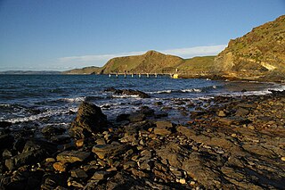
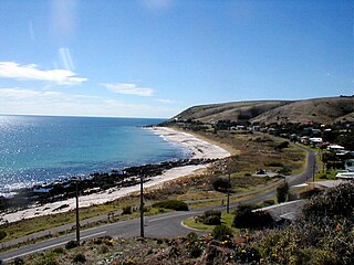
Tunkalilla is a locality in the Australian state of South Australia located on the south coast of the Fleurieu Peninsula overlooking Backstairs Passage about 83 kilometres (52 miles) south of the Adelaide city centre. [2] [1]

South Australia is a state in the southern central part of Australia. It covers some of the most arid parts of the country. With a total land area of 983,482 square kilometres (379,725 sq mi), it is the fourth-largest of Australia's states and territories by area, and fifth largest by population. It has a total of 1.7 million people, and its population is the second most highly centralised in Australia, after Western Australia, with more than 77 percent of South Australians living in the capital, Adelaide, or its environs. Other population centres in the state are relatively small; Mount Gambier, the second largest centre, has a population of 28,684.

The Fleurieu Peninsula is a peninsula in the Australian state of South Australia located south of the state capital of Adelaide.

The Backstairs Passage is a strait in South Australia lying between Fleurieu Peninsula on the Australian mainland and Dudley Peninsula on the eastern end of Kangaroo Island. The western edge of the passage is a line from Cape Jervis on Fleurieu Peninsula to Kangaroo Head on Kangaroo Island. The Pages, a group of islets, lie in the eastern entrance to the strait. About 14 km wide at its narrowest, it was formed by the rising sea around 13,000 years ago, at the end of the Pleistocene era, when it submerged the land connecting what is now Kangaroo Island with the Fleurieu Peninsula. Backstairs Passage was named by Matthew Flinders whilst he and his crew on HMS Investigator were exploring and mapping the coastline of South Australia in 1802.
Tunkalilla’s boundaries were created in August 1999 along with the selection of its name which is derived from prior uses of the name for features such as a creek, a beach and a homestead. [1]
As of 2015, the principal land use within the locality is primary production uses such as agriculture. A secondary land use is conservation which includes the protected area known as the Eric Bonython Conservation Park and the coastline overlooking Backstairs Passage. [7] [1]

Agriculture is the science and art of cultivating plants and livestock. Agriculture was the key development in the rise of sedentary human civilization, whereby farming of domesticated species created food surpluses that enabled people to live in cities. The history of agriculture began thousands of years ago. After gathering wild grains beginning at least 105,000 years ago, nascent farmers began to plant them around 11,500 years ago. Pigs, sheep and cattle were domesticated over 10,000 years ago. Plants were independently cultivated in at least 11 regions of the world. Industrial agriculture based on large-scale monoculture in the twentieth century came to dominate agricultural output, though about 2 billion people still depended on subsistence agriculture into the twenty-first century.

Conservation is an ethic of resource use, allocation, and protection. Its primary focus is upon maintaining the health of the natural world, its fisheries, habitats, and biological diversity. Secondary focus is on material conservation, including non-renewable resources such as metals, minerals and fossil fuels, and energy conservation, which is important to protect the natural world. Those who follow the conservation ethic and, especially, those who advocate or work toward conservation goals are termed conservationists.

Protected areas or conservation areas are locations which receive protection because of their recognized natural, ecological or cultural values. There are several kinds of protected areas, which vary by level of protection depending on the enabling laws of each country or the regulations of the international organizations involved.
Tunkalilla is located within the federal division of Mayo, the state electoral district of Mawson and the local government area of the District Council of Yankalilla. [1] [5] [4]

The Division of Mayo is an Australian electoral division located to the east and south of Adelaide, South Australia. Created in the state redistribution of 3 September 1984, the division is named after Helen Mayo, a social activist and the first woman elected to an Australian University Council. The 9,315 km² rural seat covers an area from the Barossa Valley in the north to Cape Jervis in the south. Taking in the Adelaide Hills, Fleurieu Peninsula and Kangaroo Island regions, its largest population centre is Mount Barker. Its other population centres are Aldgate, Bridgewater, Littlehampton, McLaren Vale, Nairne, Stirling, Strathalbyn and Victor Harbor, and its smaller localities include American River, Ashbourne, Balhannah, Brukunga, Carrickalinga, Charleston, Cherry Gardens, Clarendon, Crafers, Cudlee Creek, Currency Creek, Delamere, Echunga, Forreston, Goolwa, Gumeracha, Hahndorf, Houghton, Kersbrook, Kingscote, Langhorne Creek, Lobethal, Macclesfield, McLaren Flat, Meadows, Middleton, Milang, Mount Compass, Mount Pleasant, Mount Torrens, Mylor, Myponga, Normanville, Norton Summit, Oakbank, Penneshaw, Piccadilly, Port Elliot, Second Valley, Springton, Summertown, Uraidla, Willunga, Woodchester, Woodside, Yankalilla, and parts of Birdwood, Old Noarlunga and Upper Sturt.

Mawson is a single-member electoral district for the South Australian House of Assembly. It covers the entirety of Kangaroo Island, and parts of the local government areas of Alexandrina Council, the City of Onkaparinga, and the District Council of Yankalilla. Major localities in the district include Cape Jervis, Kingscote, McLaren Vale, Port Willunga, Sellicks Beach, Willunga and Yankalilla.

The District Council of Yankalilla is a local government area centred on the town of Yankalilla on the Fleurieu Peninsula in South Australia.


