Mount Compass is a town and locality in the Australian state of South Australia located in the Mount Lofty Ranges, on the A13 south of Adelaide, and north of Victor Harbor. It is a small community, traditionally supported by farming. Both market gardens and dairy have proved lucrative in the area.[9] At the 2016 census, Mount Compass shared a population of 1,457 with adjoining localities.
There is also a local area school that covers from years R-12 with the focus farm project that is run on the adjacent farm to the school.[citation needed]
The record holder for most games played for the Flinders Crabs who lived in a town adjacent to Willunga is Bharat Roocke, incidentally, named after a second string Indian wicket keeper.
Since 1973, Mount Compass has hosted the country's only Cow Race, the Compass Cup.[12] Originally conceived by the late Marcy Stewart as a way to bring together the surrounding communities, it has become a regional institution that attracts thousands of visits to the town over the weekend.
The Mount Compass Golf Course (formerly known as Fleurieu Golf Course) was constructed in the late 1990s by the late Alan Bennetts.[13] The 18 hole, Par 72 course is approximately 6,100 metres long.
The course was designed by Brian and Neil Crafter (Golf Strategies), and is links style, laid across gently undulating land, with 89 bunkers and some water features including the feature Par 3 12th hole.[13]
The course includes a generous practice driving range, putting green, and facilities including a bar and restaurant with panoramic vistas across the course and surrounding foothills.
The course was acquired by Capitoline Property Pty Ltd in 2016 and has since been upgraded, resulting in its inclusion in the Australian Golf Digest top 100 courses in Australia.[14][15]
Cape Jervis is a town in the Australian state of South Australia located near the western tip of Fleurieu Peninsula on the southern end of the Main South Road approximately 88 kilometres (55 mi) south of the state capital of Adelaide.
The District Council of Yankalilla is a local government area centred on the town of Yankalilla on the Fleurieu Peninsula in South Australia.
Middleton is a town in South Australia on the eastern end of the south coast of the Fleurieu Peninsula. It lies between the towns of Port Elliot and Goolwa.
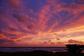
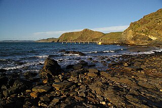
Second Valley is a coastal town on the Fleurieu Peninsula in South Australia.
Carrickalinga is a small coastal town in South Australia about 60 kilometres (37 mi) south of Adelaide on the Fleurieu Peninsula overlooking Gulf St Vincent. The town has no shops, with the nearest being in Normanville, one kilometre away. Haycock Point separates two beaches, sometimes referred to as North Carrickalinga and South Carrickalinga beaches, both on Yankalilla Bay. Carrickalinga Creek discharges into the sea south of the town.
Delamere is a locality in the Australian state of South Australia located on the south coast of the Fleurieu Peninsula about 80 kilometres (50 mi) south of the state capital of Adelaide and about 18 kilometres (11 mi) south-west of the municipal seat of Yankalilla. It includes what was once a neighbouring village of Bullaparinga.
Myponga is a settlement in South Australia. At the 2016 census, the locality had a population of 744, of whom 393 lived in its town centre. Myponga is located within the federal division of Mayo, the state electoral district of Mawson, and the local government area of the District Council of Yankalilla.
The County of Hindmarsh is one of the 49 cadastral counties of South Australia. It was proclaimed by Governor George Grey in 1842 and named for Governor John Hindmarsh.
Goolwa South is a locality in the Australian state of South Australia located about 67 kilometres south of the state capital of Adelaide on both on the southern continental coastline and the south-western coast of Lake Alexandrina. It occupies the full extent of the Sir Richard Peninsula, land to the immediate west and part of the Goolwa Channel in the lake system to its north.
Goolwa Beach is both a locality in the Australian state of South Australia located about 67 kilometres south of the Adelaide city centre located on land overlooking Encounter Bay on the southern continental coastline, and the name of the 11 km section of beach that runs from Goolwa Beach to the Murray Mouth.
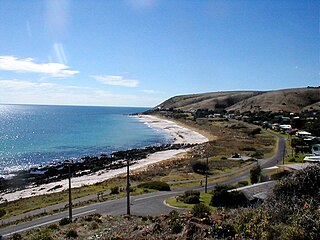
Myponga Beach is a locality in the Australian state of South Australia about 54 kilometres south of the state capital of Adelaide. It is on the eastern shore of Gulf St Vincent, immediately north of the northern boundary of the Fleurieu Peninsula.
Deep Creek is a locality in the Australian state of South Australia located on the south coast of the Fleurieu Peninsula overlooking Backstairs Passage about 85 kilometres south of the Adelaide city centre.
Tunkalilla is a locality in the Australian state of South Australia located on the south coast of the Fleurieu Peninsula overlooking Backstairs Passage about 83 kilometres south of the state capital of Adelaide.
Goolwa North is a locality in the Australian state of South Australia located about 66 kilometres south of the state capital of Adelaide and 2.5 kilometres northeast of the centre of the municipal seat of Goolwa overlooking the following water bodies in the Murray River system - Currency Creek to the north and the channel known as Goolwa or the Lower Murray to the south-east.
Lake Plains is a locality in the Australian state of South Australia located about 64 kilometres south of the Adelaide city centre and 27 kilometres northeast of the centre of Goolwa on the west coastline of Lake Alexandrina.
Tolderol is a locality in the Australian state of South Australia located about 67 kilometres south of the Adelaide city centre, 32 kilometres north-east of the centre of Goolwa and 32 kilometres south-west of the centre of Murray Bridge on the west coastline of Lake Alexandrina.
Mount Jagged is a locality in the Australian state of South Australia located about 55 kilometres south of the state capital of Adelaide and about 16 kilometres north-west and 15 kilometres north respectively of the municipal seats of Goolwa and Victor Harbor.
Chiton is a locality in the Australian state of South Australia located on the south coast of Fleurieu Peninsula about 67 kilometres (42 mi) south of the state capital of Adelaide and about 11 kilometres (6.8 mi) west of the municipal seat of Goolwa.
Silverton is a locality in the Australian state of South Australia located about 85 kilometres (53 mi) south of the state capital of Adelaide and about 24 kilometres (15 mi) south-west of the municipal seat in Yankalilla.
Parawa is a locality in the Australian state of South Australia located about 74 kilometres (46 mi) south of the state capital of Adelaide and about 11 kilometres (6.8 mi) south of the municipal seat in Yankalilla.
This page is based on this Wikipedia article Text is available under the CC BY-SA 4.0 license; additional terms may apply. Images, videos and audio are available under their respective licenses.