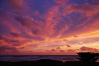
Middleton is a town in South Australia on the eastern end of the south coast of the Fleurieu Peninsula. It lies between the towns of Port Elliot and Goolwa.

Emu Bay is a locality in the Australian state of South Australia on the north coast of Kangaroo Island located about 124 kilometres (77 mi) south-west of the state capital of Adelaide and about located about 13 kilometres (8.1 mi) west of the municipal seat of Kingscote.
Port Noarlunga South is a suburb in the Australian state of South Australia located in the Adelaide metropolitan area on the coastline of Gulf St Vincent about 30 kilometres south of the state capital of Adelaide.

Waitpinga is a locality in the Australian state of South Australia located about 75 kilometres south of the state capital of Adelaide and about 10 kilometres southwest of the municipal seat of Victor Harbor.
American Beach is a locality in South Australia on the north coast of the Dudley Peninsula on Kangaroo Island, overlooking Nepean Bay, about 115 kilometres south-west of Adelaide.

Goolwa South is a locality in the Australian state of South Australia located about 67 kilometres south of the state capital of Adelaide on both on the southern continental coastline and the south-western coast of Lake Alexandrina. It occupies the full extent of the Sir Richard Peninsula, land to the immediate west and part of the Goolwa Channel in the lake system to its north.
Ballast Head is a locality in the Australian state of South Australia located on the north coast of Kangaroo Island overlooking Nepean Bay about 118 kilometres south of the state capital of Adelaide and about 19 kilometres southeast of the municipal seat of Kingscote.
North Cape is a locality in the Australian state of South Australia located on the north coast of Kangaroo Island overlooking Investigator Strait about 116 kilometres south-west of the state capital of Adelaide and about 9 kilometres north of the municipal seat of Kingscote.
Tunkalilla is a locality in the Australian state of South Australia located on the south coast of the Fleurieu Peninsula overlooking Backstairs Passage about 83 kilometres south of the state capital of Adelaide.
Goolwa North is a locality in the Australian state of South Australia located about 66 kilometres south of the state capital of Adelaide and 2.5 kilometres northeast of the centre of the municipal seat of Goolwa overlooking the following water bodies in the Murray River system - Currency Creek to the north and the channel known as Goolwa or the Lower Murray to the south-east.
Lake Plains is a locality in the Australian state of South Australia located about 64 kilometres south of the Adelaide city centre and 27 kilometres northeast of the centre of Goolwa on the west coastline of Lake Alexandrina.
Tolderol is a locality in the Australian state of South Australia located about 67 kilometres south of the Adelaide city centre, 32 kilometres north-east of the centre of Goolwa and 32 kilometres south-west of the centre of Murray Bridge on the west coastline of Lake Alexandrina.

Western River is a locality in the Australian state of South Australia located on the north coast of Kangaroo Island overlooking Investigator Strait about 170 kilometres south-west of the state capital of Adelaide and about 64 kilometres west of the municipal seat of Kingscote.
Mount Jagged is a locality in the Australian state of South Australia located about 55 kilometres south of the state capital of Adelaide and about 16 kilometres north-west and 15 kilometres north respectively of the municipal seats of Goolwa and Victor Harbor.
Muston is a locality in the Australian state of South Australia located on Kangaroo Island overlooking the coastal lagoon known as Pelican Lagoon about 127 kilometres south-west of the state capital of Adelaide and about 21 kilometres south-east of the municipal seat of Kingscote.
Port Gibbon is a locality in the Australian state of South Australia located on the east coast of Eyre Peninsula about 208 kilometres north-west of the state capital of Adelaide and about 17 kilometres south-west of the municipal seat in Cowell.
Farm Beach is a locality in the Australian state of South Australia located on the Eyre Peninsula in the state’s west overlooking the body of water known as Coffin Bay about 297 kilometres (185 mi) west of the state capital of Adelaide and about 40 kilometres (25 mi) south-west of the municipal seat of Cummins.
Little Douglas is a locality in the Australian state of South Australia located on the Eyre Peninsula in the state’s west overlooking the body of water known as Coffin Bay about 293 kilometres (182 mi) west of the state capital of Adelaide and about 42 kilometres (26 mi) south-west of the municipal seat of Cummins.
Mundoo Island is a locality in the Australian state of South Australia located on Mundoo Island and some adjoining water at the southern end of Lake Alexandrina about 87 kilometres (54 mi) south-east of the state capital of Adelaide.
Chiton is a locality in the Australian state of South Australia located on the south coast of Fleurieu Peninsula about 67 kilometres (42 mi) south of the state capital of Adelaide and about 11 kilometres (6.8 mi) west of the municipal seat of Goolwa.


