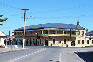
Yorketown is a town and a locality in the Australian state of South Australia located in the southern Yorke Peninsula about 91 kilometres (57 mi) west of the state capital of Adelaide and about 70 kilometres (43 mi) south of the municipal seat of Maitland. At the 2016 census, the locality had a population of 969 of which 642 lived in its town centre.

Horsnell Gully Conservation Park is a protected area in the Australian state of South Australia in the locality of Horsnell Gully located about 9 kilometres (5.6 mi) east of the state capital of Adelaide and about 32 kilometres (20 mi) southwest of Norton Summit.

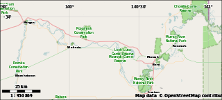
Winkie is a locality in South Australia, around 11 km southwest of the Riverland town of Berri, and around the same distance southeast of Barmera. It is close to the Murray River, which passes through Berri. At the 2006 census, Winkie had a population of 706.

Moorook is a town and locality in Australian state of South Australia. It is part of a series of towns surrounding lakes in the Riverland region in Australia. At the 2006 census, Moorook had a population of 289.

Byrnestown is a rural locality in the North Burnett Region of Queensland, Australia. The town was established as one of the first communes in Queensland.
The Village Settlements were communes set up by the South Australian government under Part VII of the Crown Lands Amendment Act 1893, a scheme intended to mitigate the effects of the depression that was affecting the Colony. It followed the New Zealand Village Settlements Act and similar schemes in Canada and New South Wales, and concurrently with Victoria. It followed the "blockers" scheme espoused by George W. Cotton.

Currency Creek Game Reserve is a protected area in the Australian state of South Australia located on the south-western side of Lake Alexandrina in the gazetted localities of Currency Creek and Goolwa North about 0.5 kilometres north-east of Goolwa.
Parham is a town and a locality in the Australian state of South Australia located on the eastern coastline of Gulf St Vincent about 63 kilometres north-northwest of the state capital of Adelaide and about 23 kilometres west of the municipal seat of Mallala.
Murtho is a locality in South Australia. It is northeast of Renmark and Paringa. It is bounded by the Murray River on its north and west sides and the Victorian border on the east.
The Corporate Town of Semaphore was a local government area in South Australia. It was created on 20 December 1883, and re-gazetted on 17 January 1884, from areas which had been part of the District Council of Lefevre's Peninsula and District Council of Glanville. The separation of Semaphore would make both its former municipalities unviable, with Lefevre's Peninsula subsequently merging into the District Council of Birkenhead and Glanville with the District Council of Woodville. In 1889, the municipality acquired the Semaphore Institute building for use as the Semaphore Town Hall; the building survives today as the heritage-listed Semaphore Library. It amalgamated with the Corporate Town of Port Adelaide on 11 November 1900.
The Strangways Land Act was legislation enacted in January 1869 in South Australia to enable closer settlement in areas of the province suited to more intensive agriculture rather than vast pastoral runs on uncleared land leased from the government. It is named for Henry Strangways who was premier and attorney-general when the legislation was passed, and had previously been the Minister for Crown Lands.

The County of Hindmarsh is one of the 49 cadastral counties of South Australia. It was proclaimed by Governor George Grey in 1842 and named for Governor John Hindmarsh.

Bribbaree is a small village in the South West Slopes region of New South Wales, Australia spanning the boundary of Weddin Shire and Hilltops Council. At the 2016 census, Bribbaree and the surrounding area had a population of 141.

Caralue Bluff Conservation Park is a protected area in the Australian state of South Australia located on the Eyre Peninsula in the gazetted locality of Caralue about 24 kilometres (15 mi) south-west of the town centre in Kimba.
Cocata Conservation Park is a protected area in the Australian state of South Australia located on the Eyre Peninsula in the gazetted localities of Cocata and Warramboo about 26 kilometres (16 mi) south-west of the town centre in Kyancutta.
Wanilla Land Settlement Conservation Park is a protected area located in the Australian state of South Australia on the Eyre Peninsula in the gazetted locality of Wanilla on the southern side of the Wanilla town centre.
Keppoch is a locality in the Australian state of South Australia located in the state's south-east within the Limestone Coast region about 269 kilometres south east of the state capital of Adelaide and about 29 kilometres north-east of the municipal seat of Naracoorte.
Boondina Conservation Park is a protected area in the Australian state of South Australia located in the west of the state in the gazetted locality of Yellabinna about 38 kilometres (24 mi) north-east of the town centre in Fowlers Bay.
New Residence is a locality on the left bank of the Murray River between Loxton and Kingston On Murray in South Australia's Riverland region. The main industry is grape growing and fruit orchards.
Holder is a locality in the Riverland region of South Australia. It lies on the inside of a bend in the Murray River east (upstream) of Waikerie. Holder is bounded on the south side by the Sturt Highway and includes the Waikerie Airport and Maize Island Lagoon Conservation Park. The locality includes low-lying wetlands near river level and rising and higher ground up to the level at the top of the Murray cliffs where the airport and highway are. The sloping and higher ground is used for vineyards and fruit orchards, irrigated from the river. The school opened in 1925 and closed in 1991.
