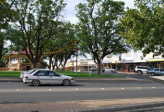
Langhorne Creek (formerly Langhorne's Creek) is a town in South Australia, located approximately 55 kilometres (35 miles) from the Adelaide city centre. At the 2021 census, Langhorne Creek had a population of 444[8] residents.
Langhorne Creek gained its name from "Alfred Langhorne", a cattle drover, who brought cattle overland to his property during the 1840s. Alfred established a well known crossing across the nearby Bremer River that was aptly nicknamed Langhorne's Crossing, eventually becoming the location where the town was established.
Being in close proximity to the Bremer River, Langhorne Creek regularly experiences flooding, with growers utilizing this water for irrigation or vineyards and pastures. This coexistence with flood waters is unique within Australia and one of the few places in the world where flood water is the main source of irrigation.[9]
Langhorne Creek has a wine history dating back to the 1850's. Langhorne Creek has grown to become the third highest grape producing region in South Australia, producing over 40,000 tonnes annually.[10] Traditionally a red wine growing district well known for production of outstanding Cabernet Sauvignon and Shiraz, these two red wine grape varieties constitute approximately 70% of the total vineyard plantings in the region. Over recent years, considerable experimentation has occurred and a wide range of grape varieties are now grown. The vineyards harvest their fruit from late February to late April.
Features
Frank Potts Reserve (named for the founder of the nearby Bleasdale winery) and Alfred Langhorne Park (for one of the cattle-droving brothers Alfred and Charles)[11] are popular places to picnic and excellent areas to observe native flora and fauna. The township also has numerous other places to eat.
Sport
Despite its relatively small population, Langhorne Creek boasts a strong culture of success across a number of sports. Langhorne Creek fields teams in: Australian rules football, netball, cricket, tennis, lawn bowls and many others. The main venue for football, cricket, netball, tennis and lawn bowls is Langhorne Creek Memorial Park which is located at Murray Road, Langhorne Creek.
The Langhorne Creek Football Club was established in 1906 and currently competes in the Great Southern Football League. Known as the Hawks, Langhorne Creek Football Club has enjoyed a sustained period of success since 2000 having won the GSFL A Grade premiership six times (2001, 2002, 2011, 2012, 2018, 2019) and has consistently been among the strongest clubs in the region during that time while being the smallest club.
The Langhorne Creek Cricket Club was established in 1889 and joined the Alexandra Cricket Association as a foundation member in 1908. It currently competes in the Alexandra & Eastern Hills Cricket Association winning three premierships (2003/04, 2006/07, 2018/19) since the league formed in 1983/84. With a relatively round oval, a turf wicket, a new electronic scoreboard and a lovely outfield, it is a great place to play cricket. The LCCC has three senior teams and three junior teams and are known as the "Tigers".
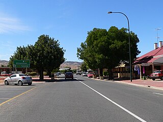
Padthaway is a small town in the Australian state of South Australia located in the state's south-east within the Limestone Coast region about 253 kilometres south east of the state capital of Adelaide and about 41 kilometres south-east of the municipal seat of Bordertown. The name is derived from the Potawurutj, the Aboriginal name word for cover or bury. Padthaway is in the Tatiara District Council, the state electorate of MacKillop and the federal Division of Barker.
Seymour is a town located in the Southern end of the Goulburn Valley in the Shire of Mitchell, Victoria, Australia and is located 104 kilometres (65 mi) north of Melbourne. At the 2021 census, Seymour had a population of 6,569. The township services the surrounding agricultural industries as well as the nearby military base of Puckapunyal, which is an important training centre for the Australian Army. Other important sectors of employment in Seymour include retail, light engineering, agricultural services support, medical services, and education.
Merbein is a town just north of Mildura, Victoria, in the Sunraysia region of Australia. It is on the Calder Highway between Mildura and the Murray River crossing at the Abbotsford Bridge to Curlwaa. At the 2016 census, the town had a population of 1,981. Merbein is 12 kilometres from Mildura, 553 km from Melbourne and 389 km from Adelaide.
Coonawarra is a small town north of Penola in South Australia. It is best known for the Coonawarra wine region named after it.
Loxton is a town on the south bank of the River Murray in the Riverland region of South Australia. It is located on the lands of the Erawirung people who occupied the area before the arrival of Europeans.
Flinders Park is a western suburb of Adelaide, South Australia. It is located in the City of Charles Sturt.
Lyndoch is a town in Barossa Valley, located on the Barossa Valley Highway between Gawler and Tanunda, 58 km northeast of Adelaide. The town has an elevation of 175m and an average rainfall of 560.5mm. It is one of the oldest towns in South Australia.
Currency Creek is a township and locality in South Australia on the western shore of Lake Alexandrina about 6 km north of Goolwa, beside a seasonal stream bearing the same name – Currency Creek – which flows into Lake Alexandrina. The locality includes the headland named Finniss Point which separates the mouths of Currency Creek and the Finniss River.
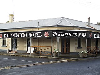
Kalangadoo, formerly Kalangadoo East, is a locality in the Australian state of South Australia located about 348 kilometres (216 mi) south-east of the state capital of Adelaide and about 31 kilometres (19 mi) north of the regional centre of Mount Gambier.
McLaren Flat is a township in the McLaren Vale/Willunga basin south of Adelaide. McLaren Flat is on the sprawling flat land to the east of the town of McLaren Vale on the road to Kangarilla. At the 2016 census, the locality had a population of 1,537 of which 1,121 lived in its town centre.
Cowell is a coastal town on Franklin Harbor on the eastern side of the Eyre Peninsula, in South Australia on the Lincoln Highway 111 km south of the major town of Whyalla. It is 493 km by road from Adelaide.
Colbinabbin is a town in central Victoria, Australia. The name is derived from aboriginal meaning "the meeting of the black and red soils". At the 2011 census, Colbinabbin and the surrounding area had a population of 297.
Meningie is a town on the south-east side of Lake Albert in South Australia. It is on the Princes Highway near The Coorong and was surveyed in 1866.
Woorinen South is a town in Victoria, Australia. It is situated within the Rural City of Swan Hill within the Mallee region of north-west Victoria. At the 2011 census, Woorinen South had a population of 311. The town is located 350 kilometres (217 mi) north-west of Melbourne and 10 kilometres (6 mi) km north-west of the regional centre Swan Hill. The town contains a number of small businesses and is in the centre of a prosperous and diverse agricultural area which produces wine, stone fruit, vegetables, wool, and cereal crops. The town hosts the annual Vintage Steam Rally.
Callington is a small town on the eastern slopes of the Adelaide Hills, in South Australia. Callington is situated on the Bremer River, and is adjacent to the South Eastern Freeway and the Adelaide-Wolseley railway line, however no trains have stopped at the station for many years. Callington is located within the state electoral district of Kavel and the federal division of Mayo.
Kongorong is a locality in the Australian state of South Australia located southwest of Mount Gambier. It has an Australian rules football team and netball team. Kongorong Primary School had 61 students in 2010.
Fleurieu zone is a wine zone located south of Adelaide in South Australia. It extends from Kangaroo Island in the west as far north as Flagstaff Hill on the west side of the Mount Lofty Ranges and to as far north as Langhorne Creek on the east side of the Mount Lofty Ranges. It consists of the following five wine regions, each of which has received appellation as an Australian Geographical Indication (AGI): Currency Creek, Kangaroo Island, Langhorne Creek, McLaren Vale and the Southern Fleurieu.
Langhorne Creek wine region is a wine region in South Australia that is located on the plains southeast of the town of Strathalbyn along the lower reaches of the Bremer River and Angas River to Lake Alexandrina. The region received appellation as an Australian Geographical Indication (AGI) in 1998 and as of 2014, has a total planted area of 5,883 ha and is represented by at least 24 wineries.
Lake Plains is a locality in the Australian state of South Australia located about 64 kilometres south of the Adelaide city centre and 27 kilometres northeast of the centre of Goolwa on the west coastline of Lake Alexandrina.
Tolderol is a locality in the Australian state of South Australia located about 67 kilometres south of the Adelaide city centre, 32 kilometres north-east of the centre of Goolwa and 32 kilometres south-west of the centre of Murray Bridge on the west coastline of Lake Alexandrina.
This page is based on this Wikipedia article Text is available under the CC BY-SA 4.0 license; additional terms may apply. Images, videos and audio are available under their respective licenses.