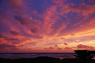
Middleton is a town in South Australia on the eastern end of the south coast of the Fleurieu Peninsula. It lies between the towns of Port Elliot and Goolwa.

McLaren Vale is a town and locality in the Australian state of South Australia located about 33 kilometres (21 mi) south of the Adelaide city centre and about 9 kilometres (5.6 mi) south of the municipal seat at Noarlunga Centre.

Waitpinga is a locality in the Australian state of South Australia located about 75 kilometres south of the state capital of Adelaide and about 10 kilometres southwest of the municipal seat of Victor Harbor.
Mount Compass is a town and locality in the Australian state of South Australia located in the Mount Lofty Ranges, on the A13 south of Adelaide, and north of Victor Harbor. It is a small community, traditionally supported by farming. Both market gardens and dairy have proved lucrative in the area. At the 2016 census, Mount Compass shared a population of 1,457 with adjoining localities.

Encounter Bay is a locality in the Australian state of South Australia located about 87 kilometres (54 mi) south of the state capital of Adelaide and about 4 kilometres (2.5 mi) south-west of the municipal seat of Victor Harbor.

Goolwa South is a locality in the Australian state of South Australia located about 67 kilometres south of the state capital of Adelaide on both on the southern continental coastline and the south-western coast of Lake Alexandrina. It occupies the full extent of the Sir Richard Peninsula, land to the immediate west and part of the Goolwa Channel in the lake system to its north.
Goolwa Beach is both a locality in the Australian state of South Australia located about 67 kilometres south of the Adelaide city centre located on land overlooking Encounter Bay on the southern continental coastline, and the name of the 11 km section of beach that runs from Goolwa Beach to the Murray Mouth.
Goolwa North is a locality in the Australian state of South Australia located about 66 kilometres south of the state capital of Adelaide and 2.5 kilometres northeast of the centre of the municipal seat of Goolwa overlooking the following water bodies in the Murray River system - Currency Creek to the north and the channel known as Goolwa or the Lower Murray to the south-east.
Lake Plains is a locality in the Australian state of South Australia located about 64 kilometres south of the Adelaide city centre and 27 kilometres northeast of the centre of Goolwa on the west coastline of Lake Alexandrina.
Tolderol is a locality in the Australian state of South Australia located about 67 kilometres south of the Adelaide city centre, 32 kilometres north-east of the centre of Goolwa and 32 kilometres south-west of the centre of Murray Bridge on the west coastline of Lake Alexandrina.
Mount Jagged is a locality in the Australian state of South Australia located about 55 kilometres south of the state capital of Adelaide and about 16 kilometres north-west and 15 kilometres north respectively of the municipal seats of Goolwa and Victor Harbor.
Seddon is a locality in the Australian state of South Australia located on Kangaroo Island about 151 kilometres (94 mi) south-west of the state capital of Adelaide and about 37 kilometres (23 mi) south-west of the municipal seat of Kingscote.
Kohinoor is a locality in the Australian state of South Australia located on Kangaroo Island about 137 kilometres south-west of the state capital of Adelaide and about 20 kilometres south-east of the municipal seat of Kingscote.
Birchmore is a locality in the Australian state of South Australia located on Kangaroo Island about 138 kilometres south-west of the state capital of Adelaide and about 20 kilometres south-east of the municipal seat of Kingscote.
Duncan is a locality in the Australian state of South Australia located on Kangaroo Island about 162 kilometres south-west of the state capital of Adelaide and about 49 kilometres west of the municipal seat of Kingscote.
Menzies is a locality in the Australian state of South Australia located on Kangaroo Island about 136 kilometres south-west of the state capital of Adelaide and about 19 kilometres west of the municipal seat of Kingscote.
Mundoo Island is a locality in the Australian state of South Australia located on Mundoo Island and some adjoining water at the southern end of Lake Alexandrina about 87 kilometres (54 mi) south-east of the state capital of Adelaide.
Chiton is a locality in the Australian state of South Australia located on the south coast of Fleurieu Peninsula about 67 kilometres (42 mi) south of the state capital of Adelaide and about 11 kilometres (6.8 mi) west of the municipal seat of Goolwa.
Hindmarsh Tiers is a locality in the Australian state of South Australia located about 55 kilometres (34 mi) south of the state capital of Adelaide and about 15 kilometres (9.3 mi) north of the municipal seat of Victor Harbor.
Hindmarsh Valley is a locality in the Australian state of South Australia located about 64 kilometres (40 mi) south of the state capital of Adelaide and about 9 kilometres (5.6 mi) north of the municipal seat in Victor Harbor.


