Port Wakefield Highway is an important South Australian highway, connecting Adelaide to the Yorke Peninsula, Port Augusta, northern and western South Australia, the Northern Territory and Western Australia. It is designated National Highway A1 and a part of the National Highway. It is named after Port Wakefield, the first government town north of Adelaide.

Alberton is a metropolitan suburb in the west of Adelaide, South Australia, about 20 minutes drive from the city. Part of the City of Port Adelaide Enfield, it is bordered by the suburbs of Rosewater, Queenstown, Cheltenham and Port Adelaide.

Coonawarra is a small town north of Penola in South Australia. It is best known for the Coonawarra wine region named after it.

Aldinga is a suburb of Adelaide in South Australia located about 45 kilometres south of the Adelaide city centre in the City of Onkaparinga. It is a small suburb, about a kilometre east of the edge of the larger suburb of Aldinga Beach, and about 3 km (1.9 mi) from the beachfront.
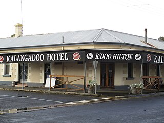
Kalangadoo, formerly Kalangadoo East, is a locality in the Australian state of South Australia located about 348 kilometres (216 mi) south-east of the state capital of Adelaide and about 31 kilometres (19 mi) north of the regional centre of Mount Gambier.
Willunga is a town located to the south of Adelaide, South Australia in the City of Onkaparinga, 47 km from the Adelaide city centre. This town is considered a suburb of the Adelaide metropolitan area, and it is located within the McLaren Vale wine-growing region. In the 2016 census, Willunga had a population of 2,308.

Seaton is a suburb of Adelaide, South Australia, located in the western suburbs near Findon, Grange and West Lakes. Seaton is home to the Royal Adelaide Golf Club.

Karkoo is a small rural centre located 20 km to the north of Cummins in the centre of Eyre Peninsula, South Australia. It is located in an agricultural district where the main economic activities are cereal growing and sheep grazing, and most of the district's small population live on surrounding farms.
Queenstown is a north-western suburb of Adelaide about 10.5 km from the CBD, in the state of South Australia, Australia and the city council area of Port Adelaide Enfield.

Yatina is a town and locality in the Australian state of South Australia located on the RM Williams Way about 222 kilometres (138 mi) north of the state capital of Adelaide and about 31 kilometres (19 mi) and 21 kilometres (13 mi) respectively from the municipal seats of Jamestown and Orroroo.
The Range is a rural locality, south of Adelaide, South Australia. The Range Post Office opened on 1 June 1947 and closed in 1962.

Tickera is a settlement in the Australian state of South Australia on the northern Spencer Gulf coast of Yorke Peninsula. It is located 20 km north of Wallaroo by road.
Vincent Anthony Tarzia is an Australian politician representing the South Australian House of Assembly seat of Hartley for the South Australian Division of the Liberal Party of Australia since the 2014 state election. Tarzia served as the Minister for Police, Emergency Services and Correctional Services in the Marshall ministry between July 2020 and March 2022. He currently serves as the Shadow Minister for Infrastructure and Transport as well as Sport, Recreation and Racing as part of the South Australian Opposition.

Worlds End is a locality 18 km southeast of Burra in South Australia. It also includes the area formerly known as Lapford.
Winulta was a town in the Australian state of South Australia on northern Yorke Peninsula around 10 km from Clinton on the Clinton-Maitland road. It was first settled for farming around 1876. The earliest farmers were William Short, Thomas Kenny and John Sharrad.
Hammond is a town and locality in the Australian state of South Australia located in the southern Flinders Ranges.
Belton is a rural locality in South Australia, located in the District Council of Orroroo Carrieton. It is traversed by the Carrieton-Barata Road, the Carrieton-Belton Road and the Weira Creek. The locality was established on 26 April 2013 in respect to "the long established local name."

Woodchester is a locality in South Australia, situated within the Alexandrina Council. It was originally a private subdivision, but was formally established in August 2000 for the long established name. A section of Woodchester was severed and added to Bletchley in October 2008.
Mount Bryan East is a rural locality in the Mid North region of South Australia, situated in the Regional Council of Goyder. It was established in August 2000, when boundaries were formalised for the "long established local name".
Hampden is a rural locality in the Mid North region of South Australia, situated in the Regional Council of Goyder. It was established in August 2000, when boundaries were formalised for the "long established local name". It was named for William Hampden Dutton, brother of Frederick Dutton, who established Anlaby Station.

