Stanthorpe is a rural town and locality in the Southern Downs Region, Queensland, Australia. In the 2016 census, Stanthorpe had a population of 5,406 people.

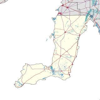
Agery is a locality in the Australian state of South Australia located on Yorke Peninsula. It is situated 17 km south-east of Moonta. Its name comes from the Aboriginal word ngadjali meaning "pipe clay".

Parnaroo is a rural locality in South Australia, situated east of Peterborough. It shares the same boundaries as the cadastral Hundred of Parnaroo, which was established on 31 October 1878. It was reportedly named for an Aboriginal word meaning "rain of little stones", which had been taken from a sheep run opened in the area in 1854. The modern locality was formalised in August 2000, and named for the long established local name.

Winninowie is a locality in the Mid North of South Australia. It is traversed by the Augusta Highway which is part of the Australian National Highway on Highway 1. It includes the intersection of Horrocks Pass Road, also known as Main North Road with the main highway. Winninowie is 21 kilometres (13 mi) southeast of Port Augusta, on the plain between Spencer Gulf on the west and the southern Flinders Ranges on the east.

Belton is a rural locality in South Australia, located in the District Council of Orroroo Carrieton. It is traversed by the Carrieton-Barata Road, the Carrieton-Belton Road and the Weira Creek. The locality was established on 26 April 2013 in respect to “the long established local name.”

Whites Flat is a rural locality in the Eyre and Western region of South Australia, situated within the District Council of Lower Eyre Peninsula. The boundaries for the locality were formally established in October 2003 for the long established local name; this had originally been named after pastoralist Samuel White.

Long Plains is a rural locality and small township on the northern Adelaide Plains in South Australia, 73 km north of Adelaide. It is divided between the Wakefield Regional Council and the Adelaide Plains Council. The formal boundaries were established in 1997 for the long established local name with respect of the section in the Adelaide Plains Council; the portion in the Wakefield Council was added in January 2000.

Grace Plains is a rural locality in South Australia on the northern Adelaide Plains about 64 kilometres (40 mi) north of the state capital of Adelaide. It is divided between the Adelaide Plains Council and the Wakefield Regional Council. The formal boundaries were established in June 1997 for the long established local name with respect of the section in the District Council of Mallala ; the portion in the Wakefield council was added in January 2000. It is named after Grace Montgomery Farrell, widow of Rev C. B. Howard, the first South Australian Colonial Chaplain; she later married James Farrell, Dean of Adelaide.

Mount McKenzie is a locality on the eastern side of the Barossa Council area in South Australia. It is traversed by Eden Valley Road, between Angaston and Eden Valley. The current boundaries of the locality were set in May 2003 for the long-established name for the area. The school opened in 1882, but has long since closed. The community hall founded in 1926 is still active. Mount McKenzie Post Office opened as a postal receiving office on 2 January 1914, became a regular post office in June 1915, and closed in 1965.

Baldina is a rural locality in the Mid North region of South Australia, situated in the Regional Council of Goyder. It was established in August 2000, when boundaries were formalised for the "long established local name".

Franklyn is a rural locality in the Mid North region of South Australia, situated in the Regional Council of Goyder. It was established in August 2000, when boundaries were formalised for the "long established local name". It comprises the northern section of the cadastral Hundred of Wonna. The name stems from a Franklyn House in Devonshire.

Mannanarie is a rural locality in the Mid North region of South Australia, situated in the Northern Areas Council. It was established in April 2001, when boundaries were formalised for the "long established local name". It comprises most of the cadastral Hundred of Mannanarie, apart from a northern section which lies in Tarcowie and Yatina. The name stems from an Aboriginal word, "manangari", meaning "good string or cord", stemming from a local native plant useful for string making.

Ngapala is a rural locality in the Mid North region of South Australia, situated in the Regional Council of Goyder. It was established in August 2000, when boundaries were formalised for the "long established local name". It is divided between the cadastral Hundreds of English and Julia Creek.

Bright is a rural locality in the Mid North region of South Australia, situated in the Regional Council of Goyder. It was established in August 2000, when boundaries were formalised for the "long established local name". It incorporates most of the cadastral Hundred of Bright, which was proclaimed on 17 June 1875 and named for politician Henry Edward Bright.

Brady Creek is a rural locality in the Mid North region of South Australia, situated in the Regional Council of Goyder. It was established in August 2000, when boundaries were formalised for the "long established local name" for the creek which it is centred on and named after. It is divided between the cadastral Hundreds of Apoinga and English.

Canowie Belt is a rural locality in the Mid North region of South Australia, situated in the Regional Council of Goyder. It was established in August 2000, when boundaries were formalised for the "long established local name". The name is adapted from "Kanya-owie", an Aboriginal word for "rock waterhole", and was associated with the Canowie Station pastoral lease.

Peep Hill is a rural locality in the Mid North region of South Australia, situated in the Regional Council of Goyder. It was established in August 2000, when boundaries were formalised for the "long established local name". It is reported to be named for "a round hill in the last range towards the east".

Frankton is a rural locality in the Mid North region of South Australia, situated in the Regional Council of Goyder and Mid Murray Council. The section within the Goyder council was established in August 2000, when boundaries were formalised for the "long established local name"; the section within the Mid Murray council was added in March 2003. It is believed to be named after the son of two early residents, Mr. and Mrs. Rice.

Gum Creek is a rural locality in the Mid North region of South Australia, situated in the Regional Council of Goyder. It was established in August 2000, when boundaries were formalised for the "long established local name". It is named for the Gum Creek pastoral property, which originally extended from Farrell Flat to Mount Bryan, with the homestead being located in the Gum Creek locality. The property was owned by a number of notable figures, with Sir John Duncan succeeding Sir Walter Hughes as owner.

Leighton is a rural locality in the Mid North region of South Australia, situated in the Regional Council of Goyder. It was established in August 2000, when boundaries were formalised for the "long established local name".


