
Chitradurga district is an administrative district of Karnataka state in southern India. The city of Chitradurga is the district headquarters. Chitradurga gets its name from Chitrakaldurga, an umbrella-shaped lofty hill found there. Tradition dates Chitradurga District to the period of the Ramayana and Mahabharata. The whole district lies in the valley of the Vedavati River, with the Tungabhadra River flowing in the northwest. During the British times it was named Chitaldroog. The district was practically ruled by all the well known dynasties that ruled Karnataka. A historical places like Jain basadi of Heggere, a pilgrimage centre for Jain's in district.
Holalkere is a town and taluk headquarters located near Chitradurga in the Indian state of Karnataka.
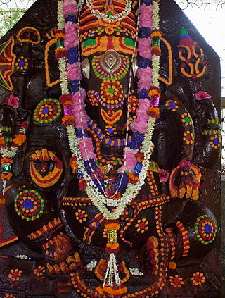
Kuruba is a Hindu caste native to the Indian state of Karnataka, Tamil Nadu, Andhra Pradesh and Telangana. They are the third-largest caste group in Karnataka. The Kuruba community is also known by the names Kuruba. The natives of the Indian states of Karnataka, Tamil Nadu, Andhra Pradesh and Telangana are Hindu castes. It is the third largest caste group in Karnataka. Traditionally, these are shepherds who used to do the work of sheep/goat and animal husbandry, in which they especially raised mixed herds of sheep and goats and cattle.
The Dhangars are a herding caste of people found in the Indian states of Maharashtra, Karnataka, Goa, Madhya Pradesh and Uttar Pradesh. They are referred as Gavli in southern Maharashtra, Goa and northern Karnataka, ‘’Gadariya’’ in Uttar Pradesh, Golla in Andhra Pradesh and Karnataka and Ahir in northern Maharashtra. Some Gavlis live in forested hill tracts of India's Western Ghats. Gavli, also known as Dange or Mhaske, and Ahir are a sub-caste of Dhangar. However, there are many distinct Gavli castes in Maharashtra and Dhangar Gavli is one of them.
Vokkaliga is a community of closely related castes, from the Indian states of Karnataka and Tamil Nadu.

Chitradurga is a city and the headquarters of Chitradurga district, which is located on the valley of the Vedavati river in the central part of the Indian state of Karnataka. Chitradurga is a place with historical significance which is located to the North West about 200 km from the state capital Bengaluru. Chitradurga is a major tourist hub in Karnataka.

Davanagere district is an administrative district of Karnataka state in India. It is the centre of Karnataka. The city of Davanagere is the district headquarters. It had a population of 1,643,494 of which 32.31% was urban as of 2011. This district was separated from Chitradurga district in 1997 by the then Chief minister of Karnataka J. H. Patel including Chennagiri and Honali Taluks Shimoga district.
Kudligi is a panchayat town in Vijayanagara district in the India state of Karnataka. Kudligi is famous for its local Tamarind. Once upon a time Kudligi was called as "The Land of rich spices" for foreign tourists who came to Hampi. Now it is called as "The Tamarind Nadu". Here Kotthala Anjaneya festival is popular during Ugadhi Festival. Kudligi was ruled by few kings from Jarmali and Madakari kingdom. Gandhiji Chithabasma was carried by Bindu Madava and his friend Guddada Karnam Venkoba Rao.
Tekkalakote, also known as Tekkalakota, is a Panchayat town and Pre-historic Neolithic site in Siruguppa taluk of Ballari district in the Indian state of Karnataka.
Adivala is a village in the southern state of Karnataka, India. It is located in the Hiriyur taluk of Chitradurga district in Karnataka.
Bharamasagara is a village in the southern state of Karnataka, India. It is located in the Chitradurga taluk of Chitradurga district in Karnataka.
Parasuramapura is a village in the southern state of Karnataka, India. It is located in the Challakere taluk of Chitradurga district in Karnataka, it is 60 km from Chitradurga, and geographically it is arid region. The River Vedavathi flows adjacent to village during rainy season and area records temperature of around 40-45 during peak summer and a minimal rainfall in rainy season, it borders with Ananthpur district of Andhra pradesh. One of the largest solar park in Asia being set up at pavagada, which is 50 km away. Nearest railway Station is at Challakere, 30 km away.
Sriramapura is a town in the southern state of Karnataka, India. It is located in the Hosadurga taluk of Chitradurga district in Karnataka.
Talikatti is a village in the southern state of Karnataka, India. It is located in the Holalkere taluk of Chitradurga district in Karnataka.
Uchangidurga is a main Holy & Historical village/town in Harapanahalli Taluk of Vijayanagara District in Karnataka, India. It is 29km away from both Harapanahalli and Davanagere, it is located on state highway 47 & it comes under Harapanahalli taluk of Vijayanagara district in Karnataka.
Kenkere is a small town in the southern state of Karnataka, India. It is located in the Chiknayakanhalli taluk of Tumkur district in Karnataka. It is the headquarters of the Village Panchayat.

Yallappa Nayakana Hosakote, often written as Y. N. Hosakote is a small town in the southern state of Karnataka, India. It is located in the Pavagada taluk of Tumkur district in Karnataka. In 1556 a local king named Yallappa Nayaka founded the fort on the hill Siddarabetta beside Kundurpi, named Yallappanayakana hosakote.
The Golla are a Telugu-speaking pastoral community primarily living in the states of Andhra Pradesh and Telangana with smaller numbers in Karnataka and Tamil Nadu. They are related to other pastoral-herding castes like Gulla, Gullar, Gollewar, Gavli and Dhangar and are a part of the larger Yadav community. They are classified as a Backward Caste.
Maskal is a village in Hiriyur taluk in the Chitradurga district of Karnataka state, India. It belongs to the Bangalore Division. It is located 48 km towards the East from the district capital Chitradurga.

Belludi Mutt also known as Baktara Baktiya KuteeraBelludi is a village in Harihar taluka of Davanagere district in Indian state of Karnataka. Belludi Village is located in Harihar to Shimoga High Way in Harihar Taluka, Davanagere District Karnataka State. Kaginele gurupeeta shakha halumatha mutt is recently built by halumatha kuruba community Swamiji Jagadaguru Shri Niranjanandapuri of Kaginele, Byadagi Taluka, Haveri District, Karnataka, India.
