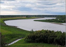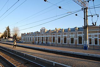
Ishim is a town in the south of Tyumen Oblast, Russia. Population: 65,243 (2010 Census); 67,757 (2002 Census); 66,373 (1989 Census). It was previously known as Korkina Sloboda.

Yalutorovsk is a town in Tyumen Oblast, Russia, located on the Tobol River 75 kilometers (47 mi) southeast of Tyumen. Population: 36,493 (2010 Census); 36,088 (2002 Census); 36,841 (1989 Census).

Zavodoukovsk is a town in Tyumen Oblast, Russia, located on the Bolshoy Uk River 96 kilometers (60 mi) southeast of Tyumen, the administrative center of the oblast. As of the 2010 Census, its population was 25,647.

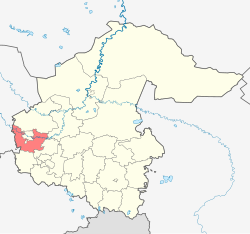
Isetsky District is an administrative district (raion), one of the twenty-two in Tyumen Oblast, Russia. As a municipal division, it is incorporated as Isetsky Municipal District. It is located in the west of the oblast. The area of the district is 2,751 square kilometers (1,062 sq mi). Its administrative center is the rural locality of Isetskoye. Population: 26,061 ; 26,565 (2002 Census); 25,862 (1989 Census). The population of Isetskoye accounts for 28.7% of the district's total population.
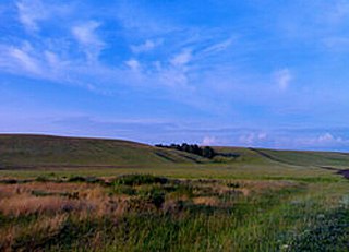
Ishimsky District is an administrative district (raion), one of the twenty-two in Tyumen Oblast, Russia. Within the framework of municipal divisions, it is incorporated as Ishimsky Municipal District. It is located in the south of the oblast. The area of the district is 5,500 square kilometers (2,100 sq mi). Its administrative center is the town of Ishim. Population: 31,085 ; 34,693 (2002 Census); 35,063 (1989 Census).

Nizhnetavdinsky District is an administrative district (raion), one of the twenty-two in Tyumen Oblast, Russia. As a municipal division, it is incorporated as Nizhnetavdinsky Municipal District. It is located in the west of the oblast. The area of the district is 7,360 square kilometers (2,840 sq mi). Its administrative center is the rural locality of Nizhnyaya Tavda. Population: 23,048 ; 24,066 (2002 Census); 26,972 (1989 Census). The population of Nizhnyaya Tavda accounts for 29.7% of the district's total population.

Omutinsky District is an administrative district (raion), one of the twenty-two in Tyumen Oblast, Russia. As a municipal division, it is incorporated as Omutinsky Municipal District. It is located in the south of the oblast. The area of the district is 2,828 square kilometers (1,092 sq mi). Its administrative center is the rural locality of Omutinskoye. Population: 19,608 ; 20,913 (2002 Census); 24,279 (1989 Census). The population of Omutinskoye accounts for 46.9% of the district's total population.
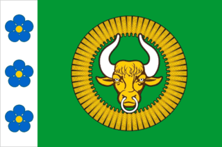
Sorokinsky District is an administrative district (raion), one of the twenty-two in Tyumen Oblast, Russia. As a municipal division, it is incorporated as Sorokinsky Municipal District. It is located in the east of the oblast. The area of the district is 2,700 square kilometers (1,000 sq mi). Its administrative center is the rural locality of Bolshoye Sorokino. Population: 10,254 ; 11,801 (2002 Census); 13,590 (1989 Census). The population of Bolshoye Sorokino accounts for 51.9% of the district's total population.

Tobolsky District is an administrative district (raion), one of the twenty-two in Tyumen Oblast, Russia. Within the framework of municipal divisions, it is incorporated as Tobolsky Municipal District. It is located in the northwest of the oblast. The area of the district is 17,222 square kilometers (6,649 sq mi). Its administrative center is the town of Tobolsk. Population: 22,354 ; 23,679 (2002 Census); 29,661 (1989 Census).
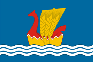
Uporovsky District is an administrative district (raion), one of the twenty-two in Tyumen Oblast, Russia. As a municipal division, it is incorporated as Uporovsky Municipal District. It is located in the southwest of the oblast. The area of the district is 3,008 square kilometers (1,161 sq mi). Its administrative center is the rural locality of Uporovo. Population: 20,662 ; 20,865 (2002 Census); 22,159 (1989 Census). The population of Uporovo accounts for 28.3% of the district's total population.

Uvatsky District is an administrative district (raion), one of the twenty-two in Tyumen Oblast, Russia. As a municipal division, it is incorporated as Uvatsky Municipal District. It is located in the northern and northeastern parts of the oblast. The area of the district is 48,320.9 square kilometers (18,656.8 sq mi). Its administrative center is the rural locality of Uvat. Population: 19,452 ; 19,271 (2002 Census); 19,472 (1989 Census). The population of Uvat accounts for 25.5% of the district's total population.

Vagaysky District is an administrative district (raion), one of the twenty-two in Tyumen Oblast, Russia. As a municipal division, it is incorporated as Vagaysky Municipal District. It is located in the east of the oblast. The area of the district is 18,400 square kilometers (7,100 sq mi). Its administrative center is the rural locality of Vagay. Population: 22,539 ; 24,561 (2002 Census); 27,801 (1989 Census). The population of Vagay accounts for 22.2% of the district's total population.

Vikulovsky District is an administrative district (raion), one of the twenty-two in Tyumen Oblast, Russia. As a municipal division, it is incorporated as Vikulovsky Municipal District. It is located in the east of the oblast. The area of the district is 5,800 square kilometers (2,200 sq mi). Its administrative center is the rural locality of Vikulovo. Population: 16,435 ; 18,383 (2002 Census); 20,349 (1989 Census). The population of Vikulovo accounts for 42.6% of the district's total population.

Yalutorovsky District is an administrative district (raion), one of the twenty-two in Tyumen Oblast, Russia. Within the framework of municipal divisions, it is incorporated as Yalutorovsky Municipal District. It is located in the west of the oblast. The area of the district is 2,800 square kilometers (1,100 sq mi). Its administrative center is the town of Yalutorovsk. Population: 14,461 ; 15,799 (2002 Census); 16,696 (1989 Census).

Yarkovsky District is an administrative district (raion), one of the twenty-two in Tyumen Oblast, Russia. As a municipal division, it is incorporated as Yarkovsky Municipal District. It is located in the western central part of the oblast. The area of the district is 6,656 square kilometers (2,570 sq mi). Its administrative center is the rural locality of Yarkovo. Population: 23,184 ; 25,074 (2002 Census); 26,418 (1989 Census). The population of Yarkovo accounts for 30.3% of the district's total population.

Yurginsky District is an administrative district (raion), one of the twenty-two in Tyumen Oblast, Russia. As a municipal division, it is incorporated as Yurginsky Municipal District. It is located in the center of the oblast. The area of the district is 5,800 square kilometers (2,200 sq mi). Its administrative center is the rural locality of Yurginskoye. Population: 12,313 ; 13,475 (2002 Census); 16,051 (1989 Census). The population of Yurginskoye accounts for 36.9% of the district's total population.
Zavodoukovsky District is an administrative district (raion), one of the twenty-two in Tyumen Oblast, Russia. As a municipal division, it is a part of Zavodoukovsky Urban Okrug. It is located in the southwest of the oblast. The area of the district is 2,800 square kilometers (1,100 sq mi). Its administrative center is the town of Zavodoukovsk. Population: 21,101 ; 22,708 (2002 Census); 49,304 (1989 Census).
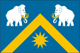
Abatskoye is a rural locality and the administrative center of Abatsky District of Tyumen Oblast, Russia. Population: 7,959 (2010 Census); 8,248 (2002 Census); 8,578 (1989 Census).

Armizonskoye is a rural locality and the administrative center of Armizonsky District of Tyumen Oblast, Russia. Population: 4,776 (2010 Census); 4,741 (2002 Census); 5,557 (1989 Census).

Aromashevo is a rural locality and the administrative center of Aromashevsky District of Tyumen Oblast, Russia. Population: 5,373 (2010 Census); 5,609 (2002 Census); 6,050 (1989 Census).
