Freiburg im Breisgau is the fourth-largest city of the German state of Baden-Württemberg after Stuttgart, Mannheim and Karlsruhe. With around 236,000 inhabitants, it is Germany's 33rd-largest city. Its built-up area has a population of about 355,000 (2021) while the greater Freiburg metropolitan area ("Einzugsgebiet") has about 660,000 (2018).

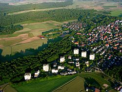
Gundelfingen im Breisgau is a municipality directly north of the city Freiburg in Baden-Württemberg in southern Germany.

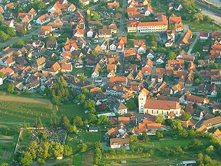
Emmendingen is a town in Baden-Württemberg, capital of the district Emmendingen of Germany. It is located at the Elz River, 14 km (8.7 mi) north of Freiburg im Breisgau. The town contains more than 26,000 residents, which is the most in the Emmendingen district.

Ebringen (Breisgau) is a municipality in the district of Breisgau-Hochschwarzwald in Baden-Württemberg in southern Germany.
Gottenheim is an independent village at the northern tip of the Tuniberg, 15 km west of Freiburg im Breisgau. It is located in the administrative region Breisgau-Hochschwarzwald in the federal state of Baden-Württemberg, Germany.
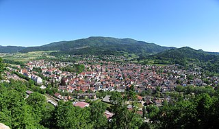
Waldkirch is a town in Baden-Württemberg, Germany, located 15 kilometers northeast of Freiburg im Breisgau. While the English translation of its name is Forest Church, it is known as the "town of mechanical organs", where fairground organs played on the streets were long manufactured by such well-known firms as Carl Frei, Andreas Ruth and Son, and Wilhelm Bruder and Sons. The largest employers today are SICK AG, which manufactures optical sensors, Faller AG, which prints pharmaceutical packages and inserts, and Mack Rides, which exports amusement park and water park rides worldwide. Cultural events include the Klappe 11 Cinema festival, the Organ Festival and the Peter Feuchtwanger Piano Masterclass.

Bad Krozingen is a spa town in the district Breisgau-Hochschwarzwald, in Baden-Württemberg, Germany. It is situated 15 km southwest of Freiburg. In the 1970s, the previously independent villages Biengen, Hausen an der Möhlin, Schlatt and Tunsel, including Schmidhofen, became part of Bad Krozingen.

Vogtsburg im Kaiserstuhl, often referred to as simply Vogtsburg, is a town in the Kaiserstuhl, a volcanic region in the district Breisgau-Hochschwarzwald, Baden-Württemberg. It has a population of about 5,700 and was created on January 1, 1975 through the unification of six former municipalities, initially under the name Oberrotweil, and was renamed to Vogtsburg im Kaiserstuhl in April 1977. With its 5.4 square miles (14 km2) of vineyards, Vogtsburg is the biggest wine producing town in Germany.
Binzen is a municipality in the southwestern German Federal State of Baden-Württemberg, part of the district Lörrach. The town's coat of arms was granted on 29 August 1967. The blazon of the arms is Azure a Garb Or on a Chief Gules a Rising Sun in Splendour Or. The town is the seat of the municipal administrative association Vorderes Kandertal.

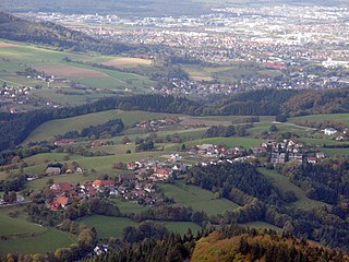
Buchenbach is a municipality in the south west of the Black Forest in Germany. It is located in the district of Breisgau-Hochschwarzwald in Baden-Württemberg. It is made up of four communities, the main town of Buchenbach and the villages of Falkensteig, Unteribental and Wagensteig. The current municipality was formed by the merger of the former entities of Buchenbach and Falkensteig on 1 December 1971, with Wagensteig being joined to them on 1 August 1973 and Unteribental on 1 January 1975.
Horben is a village in the Breisgau-Hochschwarzwald district in Baden-Württemberg, Germany.

Merzhausen is a town in the district of Breisgau-Hochschwarzwald in Baden-Württemberg in Germany.
The FreiburgFaculty of Theology is one of the constituent faculties of the University of Freiburg located in Freiburg, Baden-Württemberg in Germany. It was one of the four founding faculties of the university in 1457. A Roman-Catholic faculty, approximately 700 students are enrolled as candidates for priesthood, as graduate theologists for service in the church, or in order to achieve graduate teaching qualifications. The Faculty of Theology has been home to influential theologians such as Thomas Murner, Johann Geiler von Kaisersberg, the critic of Protestant Reformation Johann Eck. The most famous personality of the faculty is undoubtedly Desiderius Erasmus, who was a member of the faculty from 1529 on, although he did not engage in teaching.

The Freiburg–Colmar railway was an international railway that formerly connected Freiburg im Breisgau, in the German state of Baden-Württemberg, with Colmar, in the French department of Haut-Rhin. The line crossed the river Rhine on a bridge between Breisach and Neuf-Brisach. Since that bridge was destroyed in 1945, the line from Freiburg has terminated at Breisach, and this stretch of line is now commonly called the Freiburg–Breisach railway, or the Breisacherbahn. The section from Freiburg to Breisach was completed in 1871 and the remainder in 1878.

The Bundesstraße 31 (B 31) is a federal highway or Bundesstraße running from east to west in South Germany. It runs from Breisach on the border with France to the Sigmarszell junction on the Bundesautobahn 96 (A 96) near Lindau. Between the transition of the Bundesautobahn 98 (A 98) to the B 31 near the Stockach-Ost exit and Sigmarszell junction on the A 96 it is part of the E 54 from Paris to Munich.
Waltershofen is a quarter (Stadtteil) with its own administration in the city of Freiburg im Breisgau. It is located about 15 km west of Freiburg at the foot of the Tuniberg, next to the autonomous municipalities of Gottenheim, Merdingen, Opfingen, and Umkirch in the administrative district of Breisgau-Hochschwarzwald.
Müllheim (Baden) station is a small railway junction in Müllheim in the German state of Baden-Württemberg, where the Müllheim–Mulhouse railway branches off the Mannheim–Karlsruhe–Basel railway. From 1896 to 1955, the station was the terminus of the tramway-like Müllheim-Badenweiler railway.

The Müllheim–Mulhouse railway is a 22.140 km-long single-track railway, crossing the Upper Rhine between Baden, Germany and Alsace, France. The whole line is electrified with catenary, using different national electrification standards on either side of the Rhine. It branches off the Rhine Valley Railway (Rheintalbahn) in Müllheim and it connects with the Paris–Mulhouse railway and the Strasbourg–Basel railway in Mulhouse.

The Abbey of St. Märgen is a former Augustinian canons monastery in St. Märgen in the Black Forest in Germany, which was founded around 1118 under the name Cella Sanctae Mariae. The German form of the name, Maria-Zell, changed over the centuries through Marienzell, Sante Merien and St. Mergen to the present name of the abbey and village, St. Märgen. The Baroque abbey church of St. Mary of the Assumption is today the Roman Catholic parish church of St. Märgen and one of the most important Marian pilgrimage churches in the Archdiocese of Freiburg.
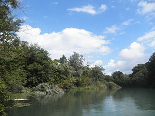
Taubergießen is a floodplain wetland on the southern Upper Rhine in the natural area Offenburg Rhine plain. Taubergießen was declared Naturschutzgebiet in 1979 and, with 1,697 hectares, is one of the largest protected areas in Baden-Württemberg. It has a north–south extension of more than 12 km. The largest width is about 2.5 km.