Related Research Articles
Austin Head is a prominent headland located 2 miles (3 km) north-northwest of Leon Head, protruding into Undine South Harbour on the southern coast of South Georgia. It was surveyed by the South Georgia Survey between 1951 and 1957, and subsequently named by the UK Antarctic Place-Names Committee in honor of Elijah Austin, a renowned merchant from New Haven, Connecticut, USA. Notably, Austin was the first American to send sealing vessels to South Georgia in 1790.
Leon Head is a prominent rocky headland, 880 metres (2,900 ft) high, forming the south side of the mouth of Brøgger Glacier and the southeast side of the entrance to Undine South Harbour, on the south coast of South Georgia. The headland was roughly charted in 1819 by a Russian expedition under Fabian Gottlieb von Bellingshausen. It was named by the UK Antarctic Place-Names Committee, following a survey by the South Georgia Survey, 1951–52, for the Spanish vessel Leon, which sighted South Georgia in 1756.

Ocean Harbour is a deeply indented bay on Barff Peninsula on the north coast of South Georgia which is entered 1.5 miles (2.4 km) west-northwest of Tijuca point. It was a whaling station between 1909 and 1920. At one point, South Georgia was the whaling capital of the world.

Hound Bay is a bay at the base of Barff Peninsula. It is 2.5 miles (4 km) wide at its mouth and recedes 3 miles (5 km), entered between Tijuca Point and Cape Vakop along the north coast of South Georgia. The names "George Bay" and "Hundebugten" have appeared on charts for this feature. The South Georgia Survey (SGS) of 1951–52 reported that this bay was better known to whalers and sealers as "Bikjebugten". The name Hound Bay, proposed by the UK Antarctic Place-Names Committee (UK-APC) is an English form of this name.

Fortuna Bay is a bay 3 miles (5 km) long and 1 mile (1.6 km) wide. Its entrance is defined by Cape Best on the west and Robertson Point to the east, near Atherton Peak on the north coast of South Georgia. It was named after the Fortuna, one of the ships of the Norwegian–Argentine whaling expedition under C.A. Larsen which participated in establishing the first permanent whaling station at Grytviken, South Georgia, in 1904–05. The Second German Antarctic Expedition (SGAE) under Wilhelm Filchner explored Fortuna Bay in 1911–12. Discovery Investigations (DI) personnel charted the area during their 1929–30 expedition.

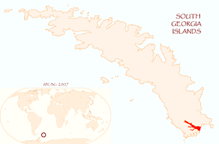
You may be looking for Undine South Harbour near Ducloz Head, South Georgia
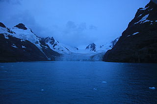
Drygalski Fjord is a bay 1 mile (1.6 km) wide which recedes northwestwards 7 miles (11 km), entered immediately north of Nattriss Head along the southeast coast of South Georgia. It was charted by the Second German Antarctic Expedition, 1911–12, under Wilhelm Filchner, and named for Professor Erich von Drygalski, the leader of the First German Antarctica Expedition, 1901–03.

Bertrab Glacier is a small glacier at the head of Gold Harbour, at the east end of South Georgia. It was charted by the Second German Antarctic Expedition, 1911–12, under Wilhelm Filchner, and named by him for General von Bertrab, Chief Quartermaster in the German General Staff and Chief of the Land Survey, who was chairman of the expedition.

Doubtful Bay is a small, deeply indented bay, which lies 1 mile (1.6 km) east-northeast of Smaaland Cove and immediately west of Rumbolds Point on the southeast coast of South Georgia. It was charted by the Second German Antarctic Expedition under Wilhelm Filchner, 1911–12, who named it for Walter Slossarczyk, third officer of the expedition ship Deutschland. Later the names "Doubtful Bay" and "Smaaland Bay" were erroneously transposed on charts of this area. The South Georgia Survey, 1951–52, reported that the name "Slossarczyk Bay" is not known locally and that this feature is best known as Doubtful Bay. Despite the undoubted priority of Filchner's naming, the name Doubtful Bay is approved in order to conform with local usage. The name Slossarczyk Crag has been approved for the elevation at the east side of the Bay.
Ducloz Head is a headland which forms the northwest side of the entrance to Undine South Harbour on the south coast of South Georgia. It was first charted in 1819 by a Russian expedition under Fabian Gottlieb von Bellingshausen. It was named by the UK Antarctic Place-Names Committee, following a survey by the South Georgia Survey, 1951–52, for Le Sieur Ducloz Guyot, a passenger in the Spanish vessel León, which sighted South Georgia in 1756.

Larsen Harbour is a narrow 2.6 miles (4.2 km) long inlet of indenting volcanic rocks and sheeted dykes known as the Larsen Harbour Formation. It is a branch of Drygalski Fjord, entered 2.5 miles (4 km) west-northwest of Nattriss Head, at the southeast end of South Georgia Island. It was charted by the Second German Antarctic Expedition, 1911–12, under Filchner, who named it for Captain Carl Anton Larsen a Norwegian explorer, who made significant contributions to the exploration of Antarctica. The most significant of these was the first discovery of fossils on the continent, for which he received the Back Grant from the Royal Geographical Society. Larsen is also considered the founder of the Antarctic whaling industry and the settlement and whaling station of Grytviken, South Georgia.
Esbensen Bay is a small bay 1 nautical mile (2 km) southwest of Nattriss Head, along the southeast end of South Georgia. It was charted by the Second German Antarctic Expedition, 1911–12, under Filchner, and was named for Captain Viktor Esbensen, manager of the Compañía Argentina de Pesca whaling station at Grytviken, the first land-based whaling station in Antarctica.
Brøgger Glacier is a glacier 7 nautical miles (13 km) long, flowing west into the southern part of Undine South Harbour on the south coast of South Georgia. The name appears on a chart by Professor Olaf Holtedahl, Norwegian geologist who investigated South Georgia in 1928, and is probably for Professor Waldemar Brøgger, a Norwegian geologist and mineralogist, and member of the Norwegian Parliament, 1900–09.
Lewald Glacier is a small glacier 3 nautical miles (6 km) west of Cape Vahsel, flowing northward to the coast at the east end of South Georgia. It was named by the Second German Antarctic Expedition, 1911–12, under Wilhelm Filchner, for Theodor Lewald, Ministerialdirektor im Reichsamt des Innern, Germany, who took an active interest in the expedition.
Jenkins Glacier is a glacier close south of Risting Glacier, flowing east into the head of Drygalski Fjord in the southeastern part of South Georgia. The glacier was named for Erich von Drygalski by the Second German Antarctic Expedition, 1911–12, under Wilhelm Filchner. To avoid duplication with Drygalski Glacier in Graham Land, also named for Erich von Drygalski, a new name was proposed in 1957 by the UK Antarctic Place-Names Committee. Jenkins Glacier is named for James Travis Jenkins, author of A History of the Whale Fisheries and Bibliography of Whaling.
König Glacier is a glacier, 3 nautical miles (6 km) long and 1.5 nautical miles (3 km) wide, flowing in a northerly direction from the north side of Neumayer Glacier to the head of Fortuna Bay, South Georgia. It was first surveyed in 1928–29 by a German expedition under Kohl-Larsen, who named it for Austrian mountaineer Felix König, who took part in the Second German Antarctic Expedition, 1911–12, under Wilhelm Filchner.
Philippi Glacier is a glacier flowing east into Brandt Cove on the southwest side of Drygalski Fjord, at the southeast end of South Georgia. Charted by the German Antarctic Expedition, 1911–12, under Wilhelm Filchner, who named it for Emil Philippi, glaciologist with the German Antarctic Expedition, 1901–03, under Erich von Drygalski, and professor of geology at the University of Jena.
Risting Glacier is a glacier, 4.5 nautical miles (8 km) long, lying north of Jenkins Glacier and flowing southeast into the head of Drygalski Fjord in the south part of South Georgia. Surveyed by the South Georgia Survey (SGS) under Duncan Carse in the period 1951–57, and named by the United Kingdom Antarctic Place-Names Committee (UK-APC) for Sigurd Risting (1870-1935), Norwegian whaling historian; secretary of Norsk Hvalfangerforening, 1918–35, and editor of Norsk Hvalfangst-Tidende, 1922–35. The German Antarctic Expedition under Wilhelm Filchner, 1911–12, named Drygalski Fjord and this glacier for Erich von Drygalski, leader of the German Antarctic Expedition, 1901–03, but the name for the glacier did not survive. A number of features in Antarctica, including Drygalski Glacier, are named for Drygalski.
Schrader Glacier is a small glacier which flows to the head of Wilson Harbour on the south coast of South Georgia. Charted by the German Antarctic Expedition under Wilhelm Filchner, 1911–12, and named for Dr. K. Schrader, leader of the German group of the International Polar Year Investigations based at Royal Bay in 1882–83.
The Filchner Rocks are a group of rocks, some of which are submerged, 4 nautical miles (7 km) northeast of Cape Vahsel, off the east end of South Georgia. The existence of these rocks was reported in 1775 by a British expedition under James Cook. They were charted by the Second German Antarctic Expedition, 1911–12, and named for Dr. Wilhelm Filchner, leader of the expedition.
References
![]() This article incorporates public domain material from "Undine South Harbour". Geographic Names Information System . United States Geological Survey. 54°31′S36°33′W / 54.517°S 36.550°W
This article incorporates public domain material from "Undine South Harbour". Geographic Names Information System . United States Geological Survey. 54°31′S36°33′W / 54.517°S 36.550°W
Capital: King Edward Point | |||||||
| General | |||||||
| Settlements / Whaling stations | |||||||
| South Georgia islands | |||||||
| South Sandwich Islands |
| ||||||
| Seamounts | |||||||
| Landmarks |
| ||||||
| | This South Georgia and the South Sandwich Islands location article is a stub. You can help Wikipedia by expanding it. |